Valley oasis
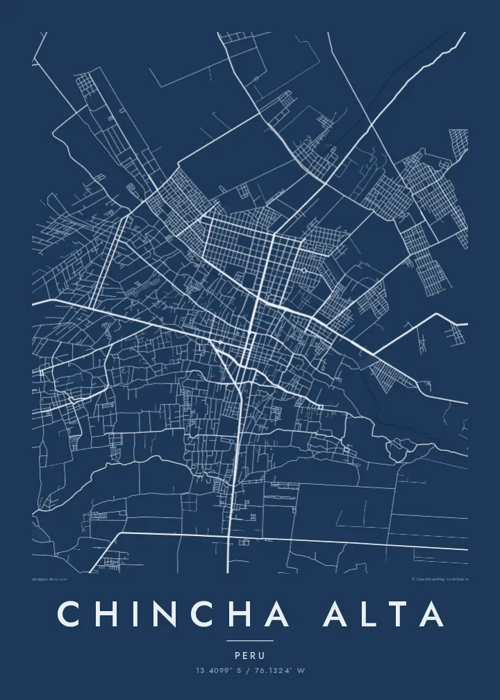
The city sits in an irrigated valley between desert hills and the ocean. The contrast between the dense urban blocks and the surrounding farmland shapes the whole composition.
ቀላል ንድፍ ያለው የካርታ ፖስተር · ፔሩ
13.4099° S / 76.1324° W
A dense valley town on Peru's desert coast, ringed by irrigated fields and vineyards a short distance from the Pacific.



አንድ ከተማ፣ አምስት ስሜቶች
ዘይቤ በመንካት በግድግዳ ላይ ይመልከቱት። ሁሉም ዘይቤዎች ተመሳሳይ ዋጋ አላቸው — የታተመ፣ በፍሬም የተደረገ ወይም እንደ HD ፋይል።
 ትክክለኛ ፒክሰሎች · 24 × 36″ የህትመት ፋይል
ለህትመት ጥርት ያለ
ይህ ከትክክለኛው የህትመት ፋይል 100% የተቆረጠ ክፍል ነው። እያንዳንዱ ፖስተር — የታተመ፣ በፍሬም የተደረገ ወይም የወረደ — በእኛ አገልጋዮች ላይ በ300 DPI፣ እስከ 7,200 × 10,800 ፒክሰሎች ይሠራል፣ ስለዚህ በ24 × 36″ ህትመት ላይ እንኳን ትንንሾቹ መንገዶች ግልጽ ሆነው ይቆያሉ።
በግድግዳ ላይ


ካርታው
Chincha Alta is the main city of Chincha Province in the Ica Region, on the southern coast of Peru. It sits a few kilometres inland from the Pacific, in a river valley that stands out as a green oasis against the surrounding desert. From above, the urban area is compact, with streets packed densely around the centre and the Pan-American Highway running nearby, linking it to Lima in the north and Ica in the south.
Chincha is widely regarded as the heartland of Afro-Peruvian culture, with music and dance traditions centred on the nearby district of El Carmen. The valley is also known for grape growing and pisco. Before the Spanish arrived, the area was home to the Chincha, a seafaring and trading society later absorbed into the Inca empire.
The Chincha Alta map poster captures the city as a dense island of streets inside a patchwork of fields. Farm roads and irrigation channels create a soft, lined texture around the urban core, and the highway draws a strong stroke across the composition. At a wider scale, the map shows the whole valley reaching toward the coast.
The city sits in an irrigated valley between desert hills and the ocean. The contrast between the dense urban blocks and the surrounding farmland shapes the whole composition.
The main north–south road of the Peruvian coast passes the city, drawing a long straight line through the map and connecting Chincha with Lima and the rest of the coast.
El Carmen, southeast of the city, is known for festivals and music traditions that draw visitors every year. On wider maps it appears as a small settlement among the fields.
የራስዎ ያድርጉት
ቀን፣ ስም ወይም የራስዎን ጽሑፍ ያክሉ፤ ስታይልን፣ መጠንን ወይም አቅጣጫን ይቀይሩ።
ነፃው ቅድመ-እይታ ዝቅተኛ ጥራት ያለው እና የውሃ ምልክት ያለበት ነው። ህትመቶች እና HD ፋይሎች በ300 DPI፣ እስከ 7,200 × 10,800 px፣ ያለ ውሃ ምልክት ይሠራሉ።
ለምን Chincha Alta
Chincha Alta speaks to people with family in the valley, to those who travelled south for the music and the pisco, and to Peruvians abroad who want the shape of their town on the wall. The compact centre looks especially good in the larger print sizes.
Personalise the title and subtitle, perhaps with a surname or a festival year, and edit the coordinates line. Choose among five styles, from Noir to Sand. Digital files include six sizes, and printed posters arrive on matte paper with an optional wooden frame.
የChincha Alta ፖስተር ይዘዙ| የህትመት መጠን | ጥራት | ፋይሎች |
|---|---|---|
| 30 × 40 cm11.8 × 15.7″ | 3,543 × 4,724 px | PNG · PDF |
| 29.7 × 42 cm (A3)11.7 × 16.5″ | 3,508 × 4,961 px | PNG · PDF |
| 42 × 59.4 cm (A2)16.5 × 23.4″ | 4,961 × 7,016 px | PNG · PDF |
| 45.7 × 61 cm18 × 24″ | 5,400 × 7,200 px | PNG · PDF |
| 50 × 70 cm19.7 × 27.6″ | 5,906 × 8,268 px | PNG · PDF |
| 61 × 91.4 cm24 × 36″ | 7,200 × 10,800 px | PNG · PDF |
ለማነጻጸር፣ ነፃው ቅድመ እይታ 900 px ስፋት ያለው፣ የውሃ ምልክት ያለበት እና ለስክሪን የታሰበ ነው። HD ፋይሎቹ በእያንዳንዱ አቅጣጫ እስከ 8 እጥፍ ጥራት አላቸው፤ በሙሉ የፖስተር መጠንም በንጽህና ይታተማሉ።
በገጹ የላይኛው ክፍል ላይ ዘይቤ ይምረጡ፣ ከዚያም የታተመ ፖስተር — መጠን እና ካስፈለገ ፍሬም — ወይም ዲጂታል HD ፋይሎችን ይምረጡ። ክፍያው በአንድ ደረጃ ይጠናቀቃል፣ ክፍያው እንደተጠናቀቀ የትዕዛዝ ገጽዎ ወዲያውኑ ይዘምናል።
በስድስት መጠኖች ውስጥ በአንዱ፣ ከ30 × 40 ሴ.ሜ እስከ 24 × 36″ ባለ ከፍተኛ ጥራት 200 gsm ማት ወረቀት ላይ ይታተማል። የታተሙ ፖስተሮች ከ$39 ጀምሮ ናቸው፣ ማጓጓዣን ጨምሮ።
አዎ። ጠንካራ የእንጨት ፍሬም በጥቁር፣ በነጭ፣ በተፈጥሯዊ ኦክ ወይም በጥቁር እንጨት ይምረጡ። የማይሰበር መስታወት ያለው ሲሆን ወዲያውኑ ለመስቀል ዝግጁ ነው። በፍሬም የተደረጉ ፖስተሮች ከ$99 ጀምሮ ናቸው፣ ማጓጓዣን ጨምሮ።
ወደ 60+ አገሮች መላኪያ ነፃ ነው። እያንዳንዱ ፖስተር በ30+ አገሮች ካሉ የህትመት አጋሮቻችን በአቅራቢያዎ ባለው ይታተማል፤ አብዛኛውን ጊዜ በ3–7 የሥራ ቀናት ውስጥ ይደርሳል። ሁኔታውንና መከታተያውን በ«የእኔ ትዕዛዞች» ውስጥ ማየት ይችላሉ። ጥቂት አገሮች ከ2–5 ሳምንታት ይወስዳሉ፤ እስካሁን በማንልክበት አገር ደግሞ ከመክፈልዎ በፊት ድረ-ገጹ ያሳውቅዎታል።
በደረሰ በ14 ቀናት ውስጥ ፎቶ ይላኩልን፣ በነፃ እንደግመዋለን ወይም ገንዘብዎን እንመልሳለን።
አዎ። በዚህ ገጽ ላይ ባለው አርታኢ ውስጥ፣ ርዕሱን፣ ንዑስ ርዕሱን እና የመጋጠሚያ መስመሩን እንደፈለጉት ይቀይሩ፣ ዘይቤ እና መጠን ይምረጡ። የታተሙ፣ በፍሬም የተደረጉ እና ዲጂታል ትዕዛዞች ሁሉም የእርስዎን ንድፍ በትክክል ይጠቀማሉ።
በ$9 በ300 DPI PNG እና ለህትመት ዝግጁ የሆኑ PDF ፋይሎችን በሁሉም ስድስት መጠኖች፣ ያለ ውሃ ምልክት፣ በየትኛውም ቦታ ለማተም ያገኛሉ። እርግጠኛ ካልሆኑ? መጀመሪያ ነፃ የውሃ ምልክት ያለበት ቅድመ-እይታ ያውርዱ።
