Medan Merdeka
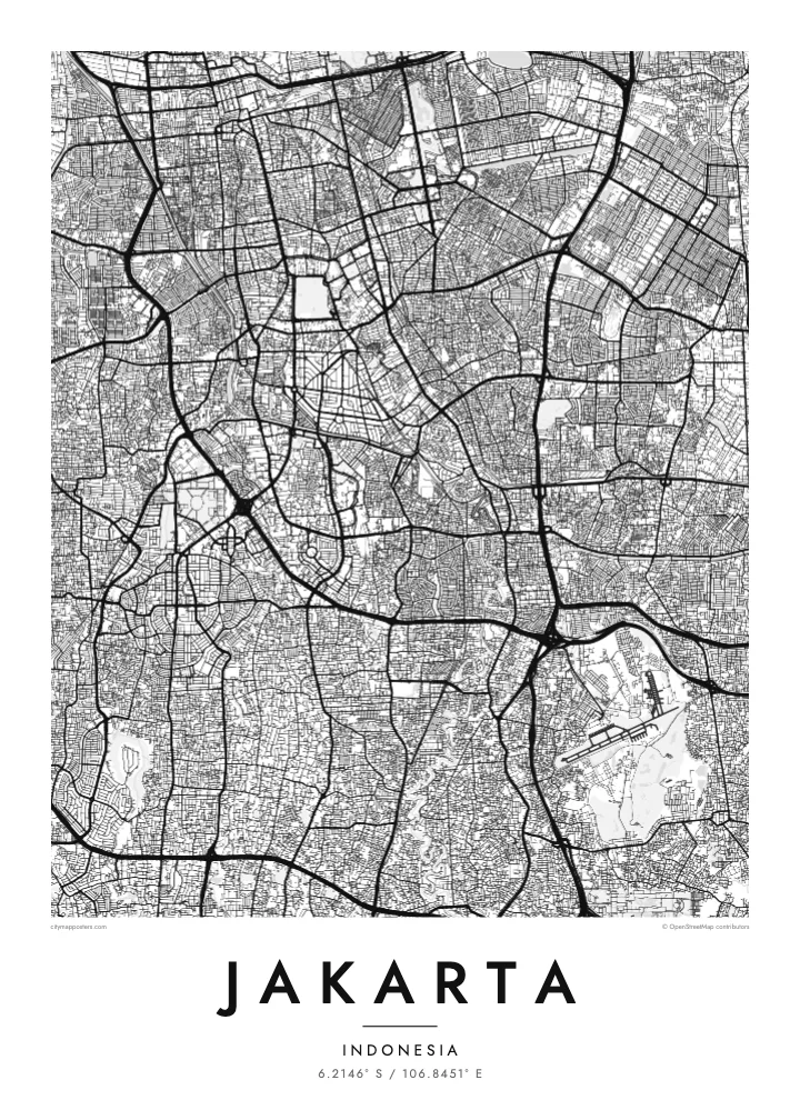
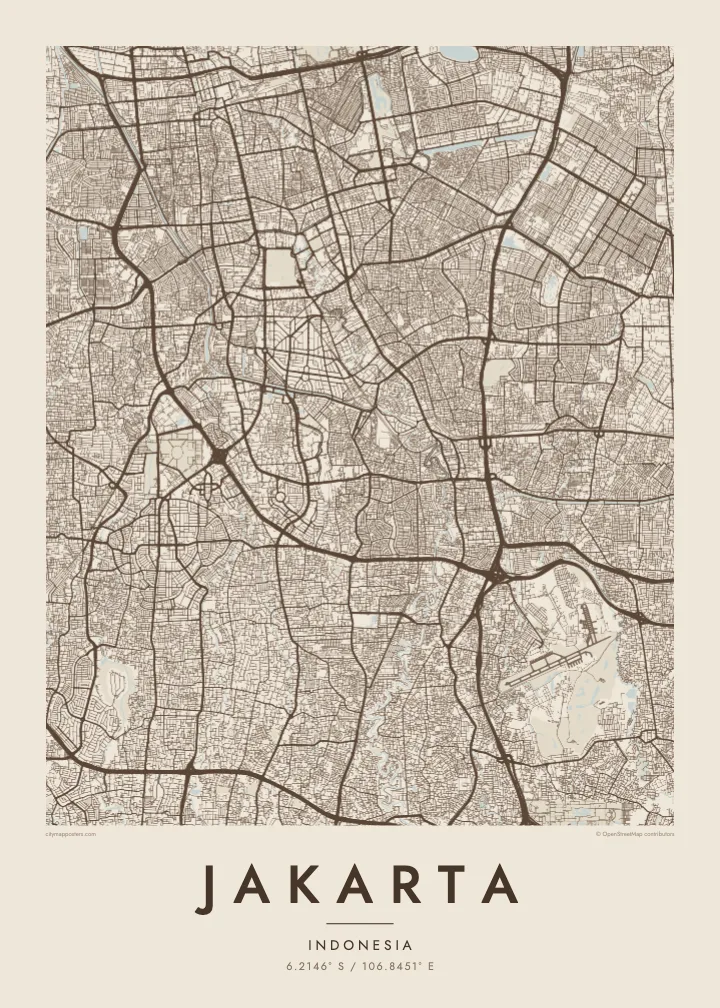
One of the largest city squares in the world, a near-square open field with the National Monument at its centre. On the map it forms a strong, blank anchor in the middle of the city.
ቀላል ንድፍ ያለው የካርታ ፖስተር · ኢንዶኔዢያ
6.2146° S / 106.8451° E
A flat coastal capital on Java's north shore, crossed by rivers and flood canals, with the old Batavia harbour at its edge.


አንድ ከተማ፣ አምስት ስሜቶች
ዘይቤ በመንካት በግድግዳ ላይ ይመልከቱት። ሁሉም ዘይቤዎች ተመሳሳይ ዋጋ አላቸው — የታተመ፣ በፍሬም የተደረገ ወይም እንደ HD ፋይል።
 ትክክለኛ ፒክሰሎች · 24 × 36″ የህትመት ፋይል
ለህትመት ጥርት ያለ
ይህ ከትክክለኛው የህትመት ፋይል 100% የተቆረጠ ክፍል ነው። እያንዳንዱ ፖስተር — የታተመ፣ በፍሬም የተደረገ ወይም የወረደ — በእኛ አገልጋዮች ላይ በ300 DPI፣ እስከ 7,200 × 10,800 ፒክሰሎች ይሠራል፣ ስለዚህ በ24 × 36″ ህትመት ላይ እንኳን ትንንሾቹ መንገዶች ግልጽ ሆነው ይቆያሉ።
በግድግዳ ላይ


ካርታው
Jakarta spreads across a low, flat plain on the northern coast of Java, facing Jakarta Bay. Because the land is so level, water shapes much of the map. The Ciliwung and several other rivers flow north through the city to the sea, and two large flood canals, the West and East Banjir Kanal, cut across it to carry water past the centre.
The oldest part of the city is Kota Tua in the north, once the Dutch colonial settlement of Batavia. Its canals and warehouses sit beside Sunda Kelapa, the old harbour where wooden schooners still load cargo. To the south, the planned centre spreads around Medan Merdeka, a vast square with the National Monument at its middle, surrounded by ministries and wide avenues.
Beyond the centre, Jakarta becomes an enormous metropolitan region of toll roads and suburban grids. Parts of the north coast are subsiding, one reason the government decided to develop a new capital, Nusantara, in East Kalimantan. A Jakarta map poster records the city as it is now, from the bay and old port to the long avenues of Thamrin and Sudirman.
One of the largest city squares in the world, a near-square open field with the National Monument at its centre. On the map it forms a strong, blank anchor in the middle of the city.
Two long flood canals that bend around the core, the western one dating from the Dutch period and the eastern completed much later. Their clean curves stand apart from the winding natural rivers.
The old port at the mouth of the Ciliwung, with narrow basins and quays beside Kota Tua. It marks the point where the city began, on the shore of Jakarta Bay.
የራስዎ ያድርጉት
ቀን፣ ስም ወይም የራስዎን ጽሑፍ ያክሉ፤ ስታይልን፣ መጠንን ወይም አቅጣጫን ይቀይሩ።
ነፃው ቅድመ-እይታ ዝቅተኛ ጥራት ያለው እና የውሃ ምልክት ያለበት ነው። ህትመቶች እና HD ፋይሎች በ300 DPI፣ እስከ 7,200 × 10,800 px፣ ያለ ውሃ ምልክት ይሠራሉ።
ለምን Jakarta
Jakarta is a city many people pass through for work and many more call home, often in one particular kampung or district. A map shows how that corner connects to the bay, the canals and the centre, which is rarely obvious from street level.
Write a title, add a date or subtitle, and adjust the coordinates line, then choose one of five styles. Classic black & white keeps the dense grid legible; Blueprint suits the canals. The $9 download includes a 300 DPI PNG and a print-ready PDF for each size.
የJakarta ፖስተር ይዘዙ| የህትመት መጠን | ጥራት | ፋይሎች |
|---|---|---|
| 30 × 40 cm11.8 × 15.7″ | 3,543 × 4,724 px | PNG · PDF |
| 29.7 × 42 cm (A3)11.7 × 16.5″ | 3,508 × 4,961 px | PNG · PDF |
| 42 × 59.4 cm (A2)16.5 × 23.4″ | 4,961 × 7,016 px | PNG · PDF |
| 45.7 × 61 cm18 × 24″ | 5,400 × 7,200 px | PNG · PDF |
| 50 × 70 cm19.7 × 27.6″ | 5,906 × 8,268 px | PNG · PDF |
| 61 × 91.4 cm24 × 36″ | 7,200 × 10,800 px | PNG · PDF |
ለማነጻጸር፣ ነፃው ቅድመ እይታ 900 px ስፋት ያለው፣ የውሃ ምልክት ያለበት እና ለስክሪን የታሰበ ነው። HD ፋይሎቹ በእያንዳንዱ አቅጣጫ እስከ 8 እጥፍ ጥራት አላቸው፤ በሙሉ የፖስተር መጠንም በንጽህና ይታተማሉ።
በገጹ የላይኛው ክፍል ላይ ዘይቤ ይምረጡ፣ ከዚያም የታተመ ፖስተር — መጠን እና ካስፈለገ ፍሬም — ወይም ዲጂታል HD ፋይሎችን ይምረጡ። ክፍያው በአንድ ደረጃ ይጠናቀቃል፣ ክፍያው እንደተጠናቀቀ የትዕዛዝ ገጽዎ ወዲያውኑ ይዘምናል።
በስድስት መጠኖች ውስጥ በአንዱ፣ ከ30 × 40 ሴ.ሜ እስከ 24 × 36″ ባለ ከፍተኛ ጥራት 200 gsm ማት ወረቀት ላይ ይታተማል። የታተሙ ፖስተሮች ከ$39 ጀምሮ ናቸው፣ ማጓጓዣን ጨምሮ።
አዎ። ጠንካራ የእንጨት ፍሬም በጥቁር፣ በነጭ፣ በተፈጥሯዊ ኦክ ወይም በጥቁር እንጨት ይምረጡ። የማይሰበር መስታወት ያለው ሲሆን ወዲያውኑ ለመስቀል ዝግጁ ነው። በፍሬም የተደረጉ ፖስተሮች ከ$99 ጀምሮ ናቸው፣ ማጓጓዣን ጨምሮ።
ወደ 60+ አገሮች መላኪያ ነፃ ነው። እያንዳንዱ ፖስተር በ30+ አገሮች ካሉ የህትመት አጋሮቻችን በአቅራቢያዎ ባለው ይታተማል፤ አብዛኛውን ጊዜ በ3–7 የሥራ ቀናት ውስጥ ይደርሳል። ሁኔታውንና መከታተያውን በ«የእኔ ትዕዛዞች» ውስጥ ማየት ይችላሉ። ጥቂት አገሮች ከ2–5 ሳምንታት ይወስዳሉ፤ እስካሁን በማንልክበት አገር ደግሞ ከመክፈልዎ በፊት ድረ-ገጹ ያሳውቅዎታል።
በደረሰ በ14 ቀናት ውስጥ ፎቶ ይላኩልን፣ በነፃ እንደግመዋለን ወይም ገንዘብዎን እንመልሳለን።
አዎ። በዚህ ገጽ ላይ ባለው አርታኢ ውስጥ፣ ርዕሱን፣ ንዑስ ርዕሱን እና የመጋጠሚያ መስመሩን እንደፈለጉት ይቀይሩ፣ ዘይቤ እና መጠን ይምረጡ። የታተሙ፣ በፍሬም የተደረጉ እና ዲጂታል ትዕዛዞች ሁሉም የእርስዎን ንድፍ በትክክል ይጠቀማሉ።
በ$9 በ300 DPI PNG እና ለህትመት ዝግጁ የሆኑ PDF ፋይሎችን በሁሉም ስድስት መጠኖች፣ ያለ ውሃ ምልክት፣ በየትኛውም ቦታ ለማተም ያገኛሉ። እርግጠኛ ካልሆኑ? መጀመሪያ ነፃ የውሃ ምልክት ያለበት ቅድመ-እይታ ያውርዱ።
