Balcón de Europa
The promontory at the heart of town projects into the Mediterranean like a small pier of rock, a sharp point on the coastline that gives the map its focal centre.
ቀላል ንድፍ ያለው የካርታ ፖስተር · ስፔን
36.7528° N / 3.8744° W
A cliff-top town on a scalloped coastline, cut by ravines and anchored by the Balcón de Europa promontory


አንድ ከተማ፣ አምስት ስሜቶች
ዘይቤ በመንካት በግድግዳ ላይ ይመልከቱት። ሁሉም ዘይቤዎች ተመሳሳይ ዋጋ አላቸው — የታተመ፣ በፍሬም የተደረገ ወይም እንደ HD ፋይል።
 ትክክለኛ ፒክሰሎች · 24 × 36″ የህትመት ፋይል
ለህትመት ጥርት ያለ
ይህ ከትክክለኛው የህትመት ፋይል 100% የተቆረጠ ክፍል ነው። እያንዳንዱ ፖስተር — የታተመ፣ በፍሬም የተደረገ ወይም የወረደ — በእኛ አገልጋዮች ላይ በ300 DPI፣ እስከ 7,200 × 10,800 ፒክሰሎች ይሠራል፣ ስለዚህ በ24 × 36″ ህትመት ላይ እንኳን ትንንሾቹ መንገዶች ግልጽ ሆነው ይቆያሉ።
በግድግዳ ላይ


ካርታው
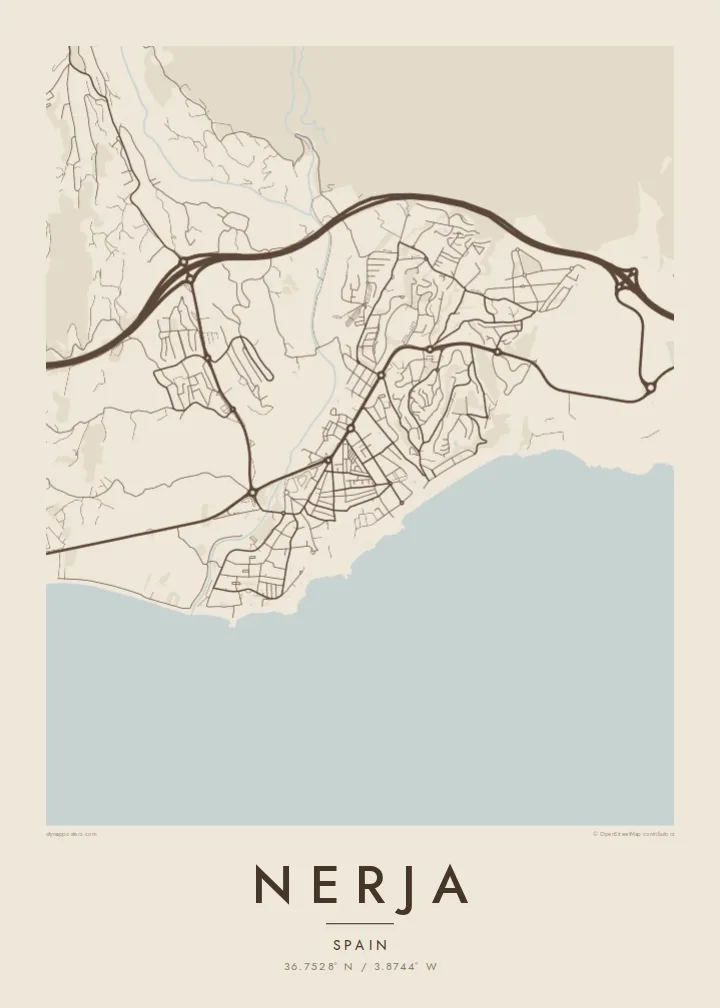
Nerja sits at the eastern end of the Málaga coast, where the Sierra Almijara drops steeply toward the Mediterranean. The town occupies a low plateau above the sea, and on a map its edge is anything but straight: small coves, rocky points and beaches alternate along the shore, each tucked between cliffs. Behind the town the mountains close in, leaving a narrow strip for streets and terraces.
At the centre of that coastline is the Balcón de Europa, a promontory that juts into the sea from the old town and forms the most recognisable point on any map of Nerja. Around it the historic streets are short and irregular. East of the centre, Burriana beach traces a long curve, and beyond it the river Chíllar cuts its valley down from the sierra.
Nerja is widely known for its caves, a vast cavern system discovered in 1959 just east of town near the village of Maro, now among the most visited sites in Andalusia. A Nerja map poster brings together the elements that make the place distinct from above: the jagged shore, the promontory, the ravines running to the sea and the mountain wall that frames it all.
The promontory at the heart of town projects into the Mediterranean like a small pier of rock, a sharp point on the coastline that gives the map its focal centre.
Between cliffs, a series of beaches and small coves gives the shoreline a scalloped outline, with Burriana forming the longest and most open curve east of the old town.
The Chíllar descends from the Sierra Almijara along the eastern side of town, its narrow valley tracing a line from the mountains down to the sea.
የራስዎ ያድርጉት
ቀን፣ ስም ወይም የራስዎን ጽሑፍ ያክሉ፤ ስታይልን፣ መጠንን ወይም አቅጣጫን ይቀይሩ።
ነፃው ቅድመ-እይታ ዝቅተኛ ጥራት ያለው እና የውሃ ምልክት ያለበት ነው። ህትመቶች እና HD ፋይሎች በ300 DPI፣ እስከ 7,200 × 10,800 px፣ ያለ ውሃ ምልክት ይሠራሉ።
ለምን Nerja
Nerja is a place people return to year after year, and many Spaniards first saw it in the television series Verano azul, filmed here in the early 1980s. A map of the town is a way to keep those summers at home, from the promontory to the beach where you always swam.
Add a title and subtitle, perhaps the year you first came or the name of your street, and choose Classic black & white, Noir, Paper, Blueprint or Sand. Sand suits the coastline especially well. Get HD files for $9 or a matte printed poster, framed if you prefer.
የNerja ፖስተር ይዘዙ| የህትመት መጠን | ጥራት | ፋይሎች |
|---|---|---|
| 30 × 40 cm (11.8 × 15.7″) | 3,543 × 4,724 px | PNG · PDF |
| 29.7 × 42 cm (A3, 11.7 × 16.5″) | 3,508 × 4,961 px | PNG · PDF |
| 42 × 59.4 cm (A2, 16.5 × 23.4″) | 4,961 × 7,016 px | PNG · PDF |
| 45.7 × 61 cm (18 × 24″) | 5,400 × 7,200 px | PNG · PDF |
| 50 × 70 cm (19.7 × 27.6″) | 5,906 × 8,268 px | PNG · PDF |
| 61 × 91.4 cm (24 × 36″) | 7,200 × 10,800 px | PNG · PDF |
ለማነጻጸር፣ ነፃው ቅድመ እይታ 900 px ስፋት ያለው፣ የውሃ ምልክት ያለበት እና ለስክሪን የታሰበ ነው። HD ፋይሎቹ በእያንዳንዱ አቅጣጫ እስከ 8 እጥፍ ጥራት አላቸው፤ በሙሉ የፖስተር መጠንም በንጽህና ይታተማሉ።
በገጹ የላይኛው ክፍል ላይ ዘይቤ ይምረጡ፣ ከዚያም የታተመ ፖስተር — መጠን እና ካስፈለገ ፍሬም — ወይም ዲጂታል HD ፋይሎችን ይምረጡ። ክፍያው በአንድ ደረጃ ይጠናቀቃል፣ ክፍያው እንደተጠናቀቀ የትዕዛዝ ገጽዎ ወዲያውኑ ይዘምናል።
በስድስት መጠኖች ውስጥ በአንዱ፣ ከ30 × 40 ሴ.ሜ እስከ 24 × 36″ ባለ ከፍተኛ ጥራት 200 gsm ማት ወረቀት ላይ ይታተማል። የታተሙ ፖስተሮች ከ{printFrom} ጀምሮ ናቸው፣ ማጓጓዣን ጨምሮ።
አዎ። ጠንካራ የእንጨት ፍሬም በጥቁር፣ በነጭ፣ በተፈጥሯዊ ኦክ ወይም በጥቁር እንጨት ይምረጡ። የማይሰበር መስታወት ያለው ሲሆን ወዲያውኑ ለመስቀል ዝግጁ ነው። በፍሬም የተደረጉ ፖስተሮች ከ{framedFrom} ጀምሮ ናቸው፣ ማጓጓዣን ጨምሮ።
ማጓጓዣ በዓለም ዙሪያ ነፃ ነው። እያንዳንዱ ፖስተር ከ30+ ሀገራት በሚገኙ የህትመት አጋሮቻችን መካከል ቅርብ በሆነው ይታተምና በተለምዶ በ3–7 የስራ ቀናት ውስጥ ይደርሳል። ሁኔታውን እና ክትትሉን ከ«የእኔ ትዕዛዞች» ስር መከታተል ይችላሉ።
በደረሰ በ14 ቀናት ውስጥ ፎቶ ይላኩልን፣ በነፃ እንደግመዋለን ወይም ገንዘብዎን እንመልሳለን።
አዎ። በዚህ ገጽ ላይ ባለው አርታኢ ውስጥ፣ ርዕሱን፣ ንዑስ ርዕሱን እና የመጋጠሚያ መስመሩን እንደፈለጉት ይቀይሩ፣ ዘይቤ እና መጠን ይምረጡ። የታተሙ፣ በፍሬም የተደረጉ እና ዲጂታል ትዕዛዞች ሁሉም የእርስዎን ንድፍ በትክክል ይጠቀማሉ።
በ$9 በ300 DPI PNG እና ለህትመት ዝግጁ የሆኑ PDF ፋይሎችን በሁሉም ስድስት መጠኖች፣ ያለ ውሃ ምልክት፣ በየትኛውም ቦታ ለማተም ያገኛሉ። እርግጠኛ ካልሆኑ? መጀመሪያ ነፃ የውሃ ምልክት ያለበት ቅድመ-እይታ ያውርዱ።
