Central grid
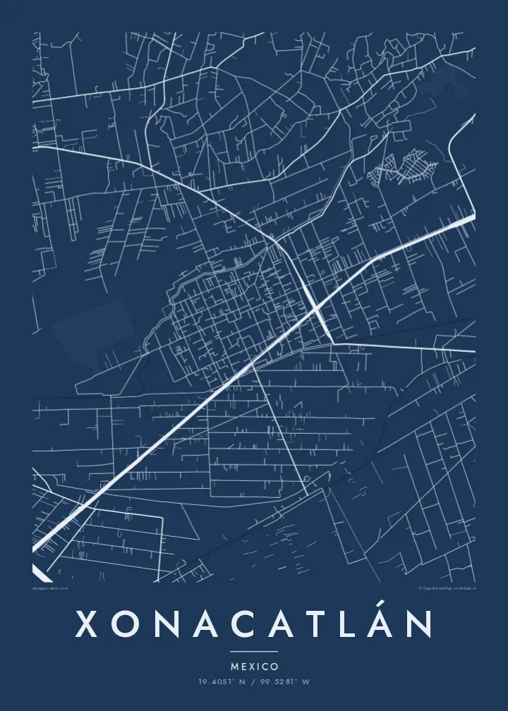
The historic core follows a regular block pattern, a familiar arrangement in central Mexican towns that anchors the middle of the map.
ቀላል ንድፍ ያለው የካርታ ፖስተር · ሜክሲኮ
19.4051° N / 99.5281° W
A highland town in the State of Mexico, between the Toluca valley and the mountains that separate it from the capital



አንድ ከተማ፣ አምስት ስሜቶች
ዘይቤ በመንካት በግድግዳ ላይ ይመልከቱት። ሁሉም ዘይቤዎች ተመሳሳይ ዋጋ አላቸው — የታተመ፣ በፍሬም የተደረገ ወይም እንደ HD ፋይል።
 ትክክለኛ ፒክሰሎች · 24 × 36″ የህትመት ፋይል
ለህትመት ጥርት ያለ
ይህ ከትክክለኛው የህትመት ፋይል 100% የተቆረጠ ክፍል ነው። እያንዳንዱ ፖስተር — የታተመ፣ በፍሬም የተደረገ ወይም የወረደ — በእኛ አገልጋዮች ላይ በ300 DPI፣ እስከ 7,200 × 10,800 ፒክሰሎች ይሠራል፣ ስለዚህ በ24 × 36″ ህትመት ላይ እንኳን ትንንሾቹ መንገዶች ግልጽ ሆነው ይቆያሉ።
በግድግዳ ላይ


ካርታው
Xonacatlán lies in the State of Mexico, west of Mexico City, on the high ground near the Toluca valley. The altitude is well over two thousand metres, and the town sits in a landscape of cultivated land and rising hills. On a map it has a traditional centre of regular blocks, with newer neighbourhoods and roads spreading outward.
The municipality lies between two large urban areas, and highways toward Toluca and toward the capital pass nearby. That position shows in the drawing: strong routes crossing the region, a compact town between them, and farmland filling the gaps. The name comes from Nahuatl, like many place names in central Mexico.
A Xonacatlán map poster gives the grid of the centre, the looser outer streets and the highway lines equal clarity. The result is balanced and orderly, a portrait of a highland town that is still distinct despite the growing cities on either side.
The historic core follows a regular block pattern, a familiar arrangement in central Mexican towns that anchors the middle of the map.
Major roads toward Toluca and Mexico City pass through the area, forming the strongest lines in the composition.
Fields and rural lanes surround the town, giving the edges of the map a lighter, more open texture.
የራስዎ ያድርጉት
ቀን፣ ስም ወይም የራስዎን ጽሑፍ ያክሉ፤ ስታይልን፣ መጠንን ወይም አቅጣጫን ይቀይሩ።
ነፃው ቅድመ-እይታ ዝቅተኛ ጥራት ያለው እና የውሃ ምልክት ያለበት ነው። ህትመቶች እና HD ፋይሎች በ300 DPI፣ እስከ 7,200 × 10,800 px፣ ያለ ውሃ ምልክት ይሠራሉ።
ለምን Xonacatlán
Xonacatlán is home to many families who commute to Toluca or the capital while keeping their roots in town. A map of it marks where they belong in a simple, modern way.
Write your own title and subtitle, add a date to the coordinates line, and choose from Classic black & white, Noir, Paper, Blueprint and Sand to fit your room.
የXonacatlán ፖስተር ይዘዙ| የህትመት መጠን | ጥራት | ፋይሎች |
|---|---|---|
| 30 × 40 cm (11.8 × 15.7″) | 3,543 × 4,724 px | PNG · PDF |
| 29.7 × 42 cm (A3, 11.7 × 16.5″) | 3,508 × 4,961 px | PNG · PDF |
| 42 × 59.4 cm (A2, 16.5 × 23.4″) | 4,961 × 7,016 px | PNG · PDF |
| 45.7 × 61 cm (18 × 24″) | 5,400 × 7,200 px | PNG · PDF |
| 50 × 70 cm (19.7 × 27.6″) | 5,906 × 8,268 px | PNG · PDF |
| 61 × 91.4 cm (24 × 36″) | 7,200 × 10,800 px | PNG · PDF |
ለማነጻጸር፣ ነፃው ቅድመ እይታ 900 px ስፋት ያለው፣ የውሃ ምልክት ያለበት እና ለስክሪን የታሰበ ነው። HD ፋይሎቹ በእያንዳንዱ አቅጣጫ እስከ 8 እጥፍ ጥራት አላቸው፤ በሙሉ የፖስተር መጠንም በንጽህና ይታተማሉ።
በገጹ የላይኛው ክፍል ላይ ዘይቤ ይምረጡ፣ ከዚያም የታተመ ፖስተር — መጠን እና ካስፈለገ ፍሬም — ወይም ዲጂታል HD ፋይሎችን ይምረጡ። ክፍያው በአንድ ደረጃ ይጠናቀቃል፣ ክፍያው እንደተጠናቀቀ የትዕዛዝ ገጽዎ ወዲያውኑ ይዘምናል።
በስድስት መጠኖች ውስጥ በአንዱ፣ ከ30 × 40 ሴ.ሜ እስከ 24 × 36″ ባለ ከፍተኛ ጥራት 200 gsm ማት ወረቀት ላይ ይታተማል። የታተሙ ፖስተሮች ከ$39 ጀምሮ ናቸው፣ ማጓጓዣን ጨምሮ።
አዎ። ጠንካራ የእንጨት ፍሬም በጥቁር፣ በነጭ፣ በተፈጥሯዊ ኦክ ወይም በጥቁር እንጨት ይምረጡ። የማይሰበር መስታወት ያለው ሲሆን ወዲያውኑ ለመስቀል ዝግጁ ነው። በፍሬም የተደረጉ ፖስተሮች ከ$99 ጀምሮ ናቸው፣ ማጓጓዣን ጨምሮ።
ማጓጓዣ በመላው ዓለም ነፃ ነው። እያንዳንዱ ፖስተር ከ30+ አገሮች ውስጥ በሚገኙ የሕትመት አጋሮቻችን መካከል ለእርስዎ በጣም ቅርብ በሆነው ይታተማል፤ አብዛኛውን ጊዜ በ3–7 የሥራ ቀናት ውስጥ ይደርሳል። ሁኔታውንና የመከታተያ መረጃውን በ«ትዕዛዞቼ» ውስጥ ማየት ይችላሉ። ጥቂት አገሮች ከ2–5 ሳምንታት ይወስዳሉ፤ እስካሁን በማንልክባቸው አገሮች ደግሞ ከመክፈልዎ በፊት ድረ ገጹ ያሳውቅዎታል።
በደረሰ በ14 ቀናት ውስጥ ፎቶ ይላኩልን፣ በነፃ እንደግመዋለን ወይም ገንዘብዎን እንመልሳለን።
አዎ። በዚህ ገጽ ላይ ባለው አርታኢ ውስጥ፣ ርዕሱን፣ ንዑስ ርዕሱን እና የመጋጠሚያ መስመሩን እንደፈለጉት ይቀይሩ፣ ዘይቤ እና መጠን ይምረጡ። የታተሙ፣ በፍሬም የተደረጉ እና ዲጂታል ትዕዛዞች ሁሉም የእርስዎን ንድፍ በትክክል ይጠቀማሉ።
በ$9 በ300 DPI PNG እና ለህትመት ዝግጁ የሆኑ PDF ፋይሎችን በሁሉም ስድስት መጠኖች፣ ያለ ውሃ ምልክት፣ በየትኛውም ቦታ ለማተም ያገኛሉ። እርግጠኛ ካልሆኑ? መጀመሪያ ነፃ የውሃ ምልክት ያለበት ቅድመ-እይታ ያውርዱ።
በአቅራቢያ
