Mays Island
A narrow island in the Cedar River holding civic buildings, linked to both banks by bridges. On the poster it appears as a small block of streets floating in the middle of the water.
Minimalist xəritə posteri · Amerika Birləşmiş Ştatları
42.0083° N / 91.6441° W
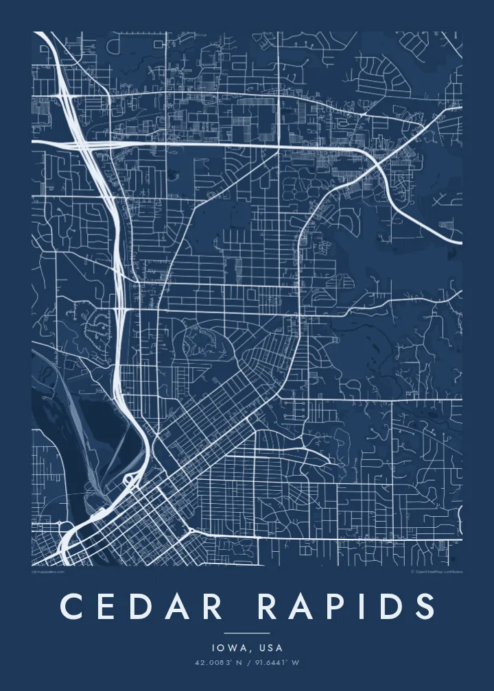
A river city split diagonally by the Cedar, with an island at its centre and four quadrants of numbered streets.



Bir şəhər, beş əhval
Divarda necə görünəcəyinə baxmaq üçün üzərinə toxunun. Bütün üslublar eyni qiymətə başa gəlir — çap, çərçivəli və ya HD fayl formasında.
 Əsl piksellər · 24 × 36″ çap faylı
Çapda kəskin
Bu, əsl çap faylının 100% böyüdülmüş hissəsidir. Hər poster — çap olunmuş, çərçivəli və ya endirilmiş — serverlərimizdə 300 DPI, 7,200 × 10,800 pikselə qədər keyfiyyətlə hazırlanır, ona görə 24 × 36″ çapda ən nazik yollar belə aydın qalır.
Divarda


Xəritə
From above, Cedar Rapids is organised around the Cedar River, which cuts through the city from northwest to southeast. Streets and avenues are numbered and labelled by quadrant (NE, NW, SE and SW), so the map reads as four grids meeting at the water. Downtown sits on the east bank, and a series of bridges connects it to the west side and to Mays Island in the middle of the channel.
Mays Island is the detail most people remember. Civic buildings stand on it, which makes Cedar Rapids one of very few American cities with its seat of government on a river island. A short walk upstream, the large Quaker Oats plant reflects the city's long connection to grain processing, and on some days the smell of toasted oats drifts across downtown.
A Cedar Rapids map poster shows the whole arrangement at once: the river, the island, Interstate 380 curving through the centre and residential blocks spreading toward the farmland of eastern Iowa. The painter Grant Wood lived and worked here, and his ordered, clean-lined view of the Midwest suits the calm geometry of a black-and-white street map.
A narrow island in the Cedar River holding civic buildings, linked to both banks by bridges. On the poster it appears as a small block of streets floating in the middle of the water.
Numbered streets and avenues divide into NE, NW, SE and SW sections. The result is four slightly offset grids that meet along the river and give the map its structure.
The interstate runs north to south through the city and crosses the river close to downtown. Its long, smooth curves stand out against the square blocks on either side.
Özünüzə uyğunlaşdırın
Tarix, ad və ya öz sözlərinizi əlavə edin, üslubu, ölçünü və ya istiqaməti dəyişin.
Pulsuz önizləmə aşağı keyfiyyətli və filiqranlıdır. Çap və HD fayllar filiqransız, 300 DPI, 7,200 × 10,800 px-ə qədər keyfiyyətlə hazırlanır.
Niyə Cedar Rapids
Cedar Rapids maps tend to go to people with a long attachment to the city: those who grew up in its quadrants, worked in its plants and offices, or helped rebuild after the 2008 flood. The river and the island make the layout recognisable even without labels.
The title, subtitle and coordinates line can all be personalised, for example with a family name or a date that matters, and the map comes in five styles: Classic black & white, Noir, Paper, Blueprint and Sand. Choose the $9 digital HD files or a printed poster with an optional wooden frame.
Cedar Rapids posterini sifariş et| Çap ölçüsü | Ölçülülük | Fayllar |
|---|---|---|
| 30 × 40 cm (11.8 × 15.7″) | 3,543 × 4,724 px | PNG · PDF |
| 29.7 × 42 cm (A3, 11.7 × 16.5″) | 3,508 × 4,961 px | PNG · PDF |
| 42 × 59.4 cm (A2, 16.5 × 23.4″) | 4,961 × 7,016 px | PNG · PDF |
| 45.7 × 61 cm (18 × 24″) | 5,400 × 7,200 px | PNG · PDF |
| 50 × 70 cm (19.7 × 27.6″) | 5,906 × 8,268 px | PNG · PDF |
| 61 × 91.4 cm (24 × 36″) | 7,200 × 10,800 px | PNG · PDF |
Müqayisə üçün: pulsuz önizləmə 900 px enindədir, su nişanlıdır və ekranlar üçün nəzərdə tutulub. HD faylların ölçülülüyü hər istiqamətdə 8 dəfəyədək yüksəkdir və tam poster ölçüsündə təmiz çap olunur.
Səhifənin yuxarısından bir üslub seçin, sonra Çap Olunmuş Poster — ölçü və istəyə görə çərçivə — və ya Rəqəmsal HD Fayllar arasından seçim edin. Ödəniş bir addımdan ibarətdir, ödəniş keçən kimi sifariş səhifəniz yenilənir.
O, 200 qram mat kağız üzərində, 30 × 40 sm-dən 24 × 36″-ə qədər altı ölçüdən birində çap olunur. Çap posterlərin qiyməti $39-dan başlayır, çatdırılma daxildir.
Bəli. Qara, ağ, təbii palıd və ya tünd rəngli taxta çərçivə seçə bilərsiniz. Sındırılmaz şüşə ilə gəlir və asmağa hazırdır. Çərçivəli posterlərin qiyməti $99-dan başlayır, çatdırılma daxildir.
Çatdırılma bütün dünyada pulsuzdur. Hər poster 30-dan çox ölkədəki çap tərəfdaşlarımızdan ən yaxınında çap olunur və adətən 3–7 iş günü ərzində çatır. Statusu və izləmə nömrəsini «Sifarişlərim» bölməsində izləyə bilərsiniz. Bəzi ölkələrə çatdırılma 2–5 həftə çəkir, hələ çatdırmadığımız ölkələr barədə isə sayt ödənişdən əvvəl xəbər verir.
Çatdırılmadan sonra 14 gün ərzində bizə şəkil göndərin, pulsuz yenidən çap edərik və ya pulunuzu geri qaytararıq.
Bəli. Bu səhifədəki redaktorda başlığı, alt başlığı və koordinat sətrini istədiyiniz kimi dəyişin, üslub və ölçü seçin. Çap, çərçivəli və rəqəmsal sifarişlərin hamısı məhz sizin dizaynınızla hazırlanır.
$9 qarşılığında, filiqransız, 300 DPI PNG və çapa hazır PDF fayllarını bütün altı ölçüdə, hər yerdə çap edə biləcəyiniz formada əldə edirsiniz. Hələ qərarsızsınız? Əvvəlcə pulsuz filiqranlı önizləməni endirin.
Yaxınlıqda
