Central street grid
The core follows a regular grid of rectangular blocks, a layout common to Guatemalan towns. On paper it forms a steady, even texture at the centre of the composition.
Minimalist xəritə posteri · Qvatemala
14.3010° N / 90.7882° W
A lowland grid on Guatemala's Pacific slope, strung along the highway that runs from the volcanoes down to the coast



Bir şəhər, beş əhval
Divarda necə görünəcəyinə baxmaq üçün üzərinə toxunun. Bütün üslublar eyni qiymətə başa gəlir — çap, çərçivəli və ya HD fayl formasında.
 Əsl piksellər · 24 × 36″ çap faylı
Çapda kəskin
Bu, əsl çap faylının 100% böyüdülmüş hissəsidir. Hər poster — çap olunmuş, çərçivəli və ya endirilmiş — serverlərimizdə 300 DPI, 7,200 × 10,800 pikselə qədər keyfiyyətlə hazırlanır, ona görə 24 × 36″ çapda ən nazik yollar belə aydın qalır.
Divarda


Xəritə
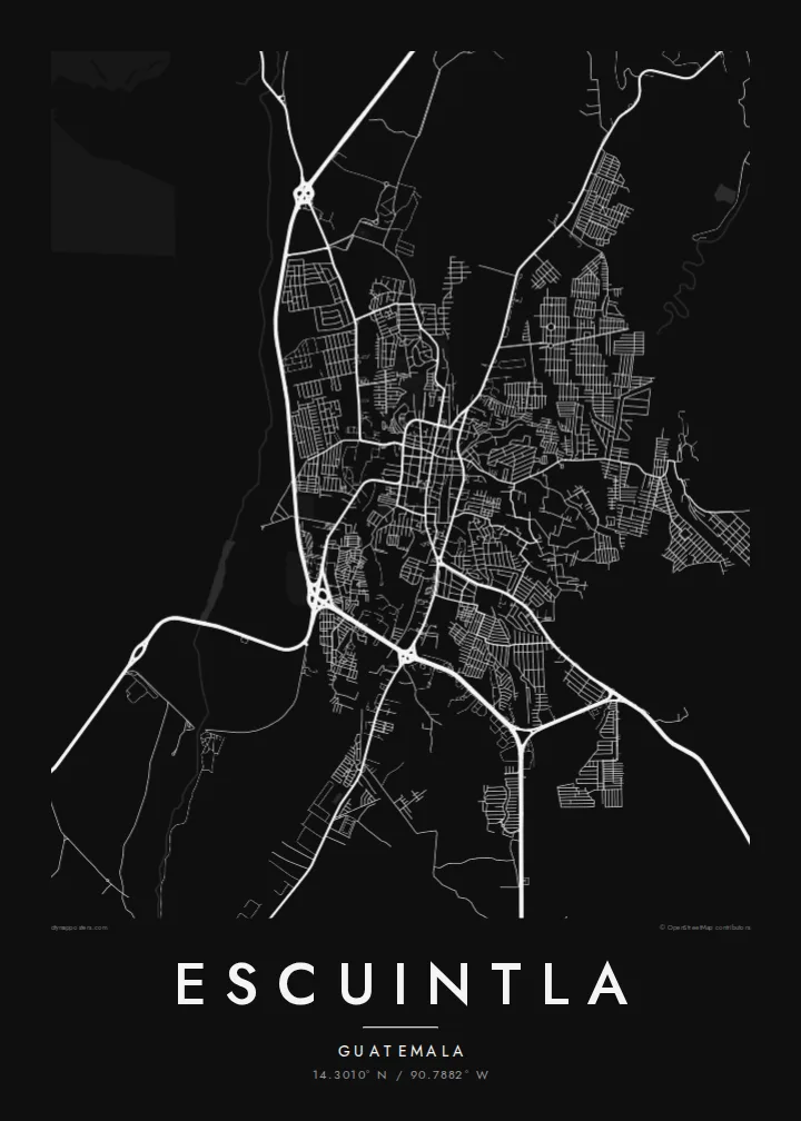
Escuintla lies south of Guatemala City, where the highlands drop into the hot Pacific coastal plain. The city is the capital of the department of the same name. From above it is a fairly regular grid of blocks, cut through by the main highway that links the capital with the Pacific ports. Beyond the edges, the grid gives way to large agricultural estates.
The surrounding lowlands are among the country's most productive farmland, with sugar cane covering much of the plain. To the north the land rises towards the volcanic chain that includes Agua, Fuego and Pacaya. The city sits at the transition between the steep volcanic slopes and the flat coast.
An Escuintla map poster captures this crossroads position. Straight blocks make an even pattern at the centre, while arterial roads leave the grid at angles, heading towards the mountains and the sea. In monochrome, the density of streets and the openness of the surrounding plain are both easy to read.
The core follows a regular grid of rectangular blocks, a layout common to Guatemalan towns. On paper it forms a steady, even texture at the centre of the composition.
The main route between Guatemala City and the Pacific coast runs past the city. It makes a long, confident line that shows Escuintla's role as a stop between highlands and sea.
Beyond the last streets the map opens into broad, sparsely drawn farmland. This gives the dense urban grid a clear outline and plenty of breathing space.
Özünüzə uyğunlaşdırın
Tarix, ad və ya öz sözlərinizi əlavə edin, üslubu, ölçünü və ya istiqaməti dəyişin.
Pulsuz önizləmə aşağı keyfiyyətli və filiqranlıdır. Çap və HD fayllar filiqransız, 300 DPI, 7,200 × 10,800 px-ə qədər keyfiyyətlə hazırlanır.
Niyə Escuintla
For anyone with roots in the Pacific lowlands, or who has passed through on the road to the coast, Escuintla's grid is a familiar shape. The poster turns that everyday geography into a quiet piece for a wall.
Add a personal title, a subtitle such as a date or a family name, and your own coordinates line. Then pick Classic black & white, Noir, Paper, Blueprint or Sand to set the mood.
Escuintla posterini sifariş et| Çap ölçüsü | Ölçülülük | Fayllar |
|---|---|---|
| 30 × 40 cm (11.8 × 15.7″) | 3,543 × 4,724 px | PNG · PDF |
| 29.7 × 42 cm (A3, 11.7 × 16.5″) | 3,508 × 4,961 px | PNG · PDF |
| 42 × 59.4 cm (A2, 16.5 × 23.4″) | 4,961 × 7,016 px | PNG · PDF |
| 45.7 × 61 cm (18 × 24″) | 5,400 × 7,200 px | PNG · PDF |
| 50 × 70 cm (19.7 × 27.6″) | 5,906 × 8,268 px | PNG · PDF |
| 61 × 91.4 cm (24 × 36″) | 7,200 × 10,800 px | PNG · PDF |
Müqayisə üçün: pulsuz önizləmə 900 px enindədir, su nişanlıdır və ekranlar üçün nəzərdə tutulub. HD faylların ölçülülüyü hər istiqamətdə 8 dəfəyədək yüksəkdir və tam poster ölçüsündə təmiz çap olunur.
Səhifənin yuxarısından bir üslub seçin, sonra Çap Olunmuş Poster — ölçü və istəyə görə çərçivə — və ya Rəqəmsal HD Fayllar arasından seçim edin. Ödəniş bir addımdan ibarətdir, ödəniş keçən kimi sifariş səhifəniz yenilənir.
O, 200 qram mat kağız üzərində, 30 × 40 sm-dən 24 × 36″-ə qədər altı ölçüdən birində çap olunur. Çap posterlərin qiyməti {printFrom}-dan başlayır, çatdırılma daxildir.
Bəli. Qara, ağ, təbii palıd və ya tünd rəngli taxta çərçivə seçə bilərsiniz. Sındırılmaz şüşə ilə gəlir və asmağa hazırdır. Çərçivəli posterlərin qiyməti {framedFrom}-dan başlayır, çatdırılma daxildir.
Çatdırılma bütün dünyada pulsuzdur. Hər poster 30-dan çox ölkədə olan tərəfdaşlarımızdan ən yaxınında çap olunur və adətən 3–7 iş günü ərzində çatır. Statusu və izləmə nömrəsini Sifarişlərim bölməsində görə bilərsiniz.
Çatdırılmadan sonra 14 gün ərzində bizə şəkil göndərin, pulsuz yenidən çap edərik və ya pulunuzu geri qaytararıq.
Bəli. Bu səhifədəki redaktorda başlığı, alt başlığı və koordinat sətrini istədiyiniz kimi dəyişin, üslub və ölçü seçin. Çap, çərçivəli və rəqəmsal sifarişlərin hamısı məhz sizin dizaynınızla hazırlanır.
$9 qarşılığında, filiqransız, 300 DPI PNG və çapa hazır PDF fayllarını bütün altı ölçüdə, hər yerdə çap edə biləcəyiniz formada əldə edirsiniz. Hələ qərarsızsınız? Əvvəlcə pulsuz filiqranlı önizləməni endirin.
Yaxınlıqda
