Route Napoléon
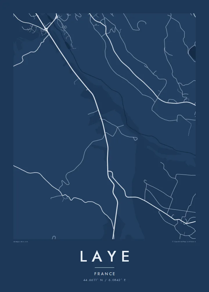
The historic road north from Gap runs through the commune toward the Col Bayard, giving the map a strong line that the smaller lanes branch away from.
Minimalist xəritə posteri · Fransa
44.6611° N / 6.0842° E
A small commune on the approach to the Col Bayard, where the Route Napoléon climbs north out of the Gap basin.



Bir şəhər, beş əhval
Divarda necə görünəcəyinə baxmaq üçün üzərinə toxunun. Bütün üslublar eyni qiymətə başa gəlir — çap, çərçivəli və ya HD fayl formasında.
 Əsl piksellər · 24 × 36″ çap faylı
Çapda kəskin
Bu, əsl çap faylının 100% böyüdülmüş hissəsidir. Hər poster — çap olunmuş, çərçivəli və ya endirilmiş — serverlərimizdə 300 DPI, 7,200 × 10,800 pikselə qədər keyfiyyətlə hazırlanır, ona görə 24 × 36″ çapda ən nazik yollar belə aydın qalır.
Divarda


Xəritə
Laye sits in the Hautes-Alpes a short distance north of Gap, on the slopes leading up to the Col Bayard. The historic Route Napoléon passes through on its way over the pass toward the Champsaur and Grenoble, and on the map it appears as the main line crossing the commune, with smaller lanes branching off toward farms and hamlets.
The village is home to a small ski station, one of the closest to Gap, used mostly by local families and beginners. Its short runs and modest lifts make only a small mark on the landscape, surrounded by meadow, forest and the open ground around the pass. The whole commune covers about eleven square kilometres, so the map stays close and readable.
A Laye map poster is less about grandeur than about a familiar route: the road winding up from the city, a village on the slope, a few ski runs cut into the hillside. For people from Gap and the Champsaur who learned to ski here, or who cross the pass often, it is a very personal piece of geography.
The historic road north from Gap runs through the commune toward the Col Bayard, giving the map a strong line that the smaller lanes branch away from.
The small ski area sits close to the village, its short runs and lifts drawn as a few light strokes against the surrounding meadow and woodland.
Northward the terrain rises toward the Col Bayard, where the road crosses between the Gap basin and the Champsaur valley that opens out beyond it.
Özünüzə uyğunlaşdırın
Tarix, ad və ya öz sözlərinizi əlavə edin, üslubu, ölçünü və ya istiqaməti dəyişin.
Pulsuz önizləmə aşağı keyfiyyətli və filiqranlıdır. Çap və HD fayllar filiqransız, 300 DPI, 7,200 × 10,800 px-ə qədər keyfiyyətlə hazırlanır.
Niyə Laye
Laye is the kind of place people know from childhood rather than from brochures: the nearby slope for a Sunday afternoon, the pass on the way to family. A clean map of it makes a quietly meaningful gift for anyone rooted in the southern Alps.
Change the title, subtitle and coordinates line to suit, perhaps with a name and a year, and choose one of five styles. Start with a free 900 px preview, then take the high-resolution files for $9 or a printed poster with an optional wooden frame.
Laye posterini sifariş et| Çap ölçüsü | Ölçülülük | Fayllar |
|---|---|---|
| 30 × 40 cm (11.8 × 15.7″) | 3,543 × 4,724 px | PNG · PDF |
| 29.7 × 42 cm (A3, 11.7 × 16.5″) | 3,508 × 4,961 px | PNG · PDF |
| 42 × 59.4 cm (A2, 16.5 × 23.4″) | 4,961 × 7,016 px | PNG · PDF |
| 45.7 × 61 cm (18 × 24″) | 5,400 × 7,200 px | PNG · PDF |
| 50 × 70 cm (19.7 × 27.6″) | 5,906 × 8,268 px | PNG · PDF |
| 61 × 91.4 cm (24 × 36″) | 7,200 × 10,800 px | PNG · PDF |
Müqayisə üçün: pulsuz önizləmə 900 px enindədir, su nişanlıdır və ekranlar üçün nəzərdə tutulub. HD faylların ölçülülüyü hər istiqamətdə 8 dəfəyədək yüksəkdir və tam poster ölçüsündə təmiz çap olunur.
Səhifənin yuxarısından bir üslub seçin, sonra Çap Olunmuş Poster — ölçü və istəyə görə çərçivə — və ya Rəqəmsal HD Fayllar arasından seçim edin. Ödəniş bir addımdan ibarətdir, ödəniş keçən kimi sifariş səhifəniz yenilənir.
O, 200 qram mat kağız üzərində, 30 × 40 sm-dən 24 × 36″-ə qədər altı ölçüdən birində çap olunur. Çap posterlərin qiyməti {printFrom}-dan başlayır, çatdırılma daxildir.
Bəli. Qara, ağ, təbii palıd və ya tünd rəngli taxta çərçivə seçə bilərsiniz. Sındırılmaz şüşə ilə gəlir və asmağa hazırdır. Çərçivəli posterlərin qiyməti {framedFrom}-dan başlayır, çatdırılma daxildir.
Çatdırılma bütün dünyada pulsuzdur. Hər poster 30-dan çox ölkədə olan tərəfdaşlarımızdan ən yaxınında çap olunur və adətən 3–7 iş günü ərzində çatır. Statusu və izləmə nömrəsini Sifarişlərim bölməsində görə bilərsiniz.
Çatdırılmadan sonra 14 gün ərzində bizə şəkil göndərin, pulsuz yenidən çap edərik və ya pulunuzu geri qaytararıq.
Bəli. Bu səhifədəki redaktorda başlığı, alt başlığı və koordinat sətrini istədiyiniz kimi dəyişin, üslub və ölçü seçin. Çap, çərçivəli və rəqəmsal sifarişlərin hamısı məhz sizin dizaynınızla hazırlanır.
$9 qarşılığında, filiqransız, 300 DPI PNG və çapa hazır PDF fayllarını bütün altı ölçüdə, hər yerdə çap edə biləcəyiniz formada əldə edirsiniz. Hələ qərarsızsınız? Əvvəlcə pulsuz filiqranlı önizləməni endirin.
Yaxınlıqda
