Colonial grid
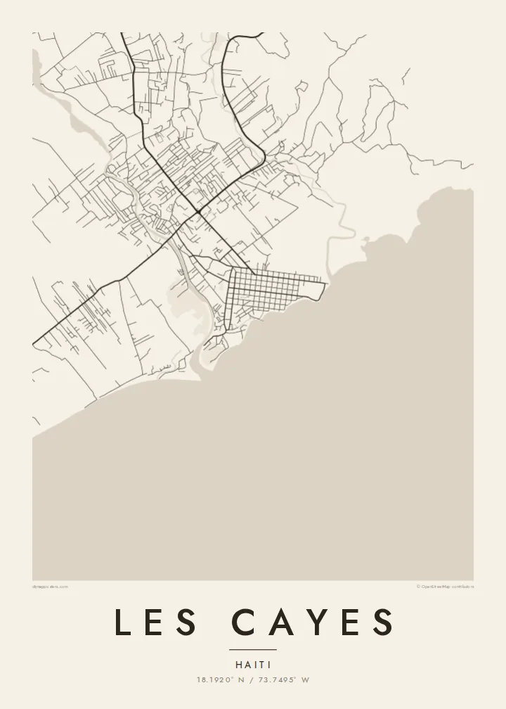
The historic centre is a regular grid of streets, laid out when the port was founded. It is the most recognisable feature of the town from above.
Minimalist xəritə posteri · Haiti
18.1920° N / 73.7495° W
A Caribbean port on Haiti's southern coast, its grid of streets opening onto a sheltered bay



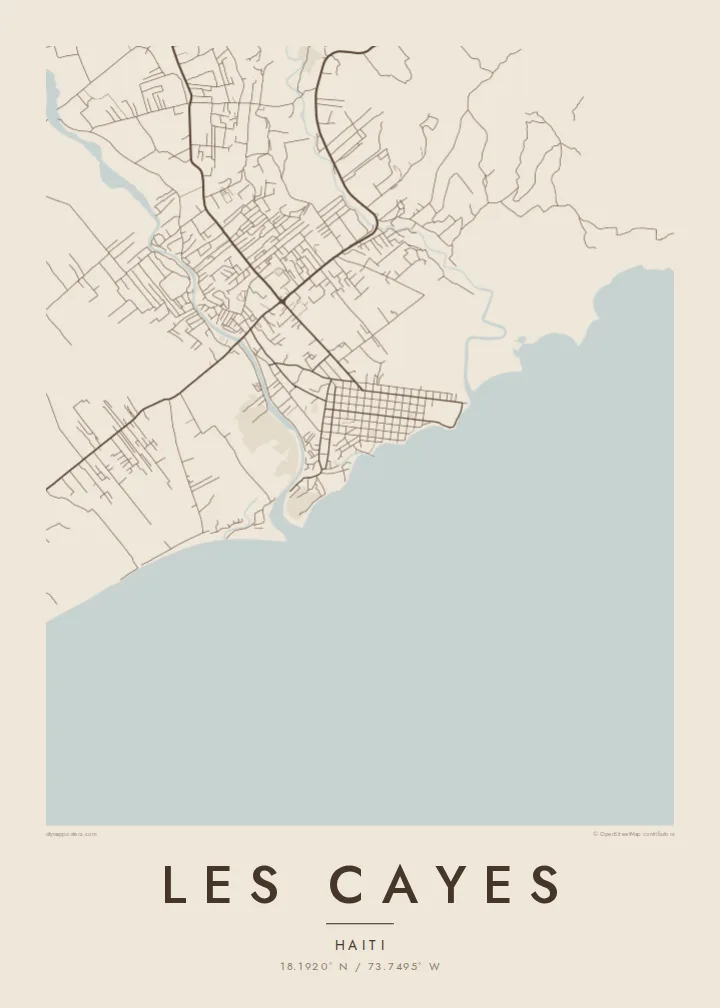
Bir şəhər, beş əhval
Divarda necə görünəcəyinə baxmaq üçün üzərinə toxunun. Bütün üslublar eyni qiymətə başa gəlir — çap, çərçivəli və ya HD fayl formasında.
 Əsl piksellər · 24 × 36″ çap faylı
Çapda kəskin
Bu, əsl çap faylının 100% böyüdülmüş hissəsidir. Hər poster — çap olunmuş, çərçivəli və ya endirilmiş — serverlərimizdə 300 DPI, 7,200 × 10,800 pikselə qədər keyfiyyətlə hazırlanır, ona görə 24 × 36″ çapda ən nazik yollar belə aydın qalır.
Divarda


Xəritə
Les Cayes sits on the southern coast of Haiti's Tiburon Peninsula, facing the Caribbean. From above, the centre is a clear colonial-era grid of straight streets that ends at the waterfront. Rivers reach the sea on either side of the town, and the low coastal plain behind it is crossed by roads and field boundaries heading towards the mountains inland.
It is one of the main towns of the south and the capital of the Sud department. The town was founded in the eighteenth century as a port. Offshore lies Île-à-Vache, an island visible across the bay. The region has been hit hard by hurricanes and earthquakes, and the town's layout has been rebuilt many times while keeping its old street plan.
A Les Cayes map poster contrasts the neat grid with the curving coastline and river mouths. The bay forms a large, calm space along the bottom of the map. Streets meet the water at right angles. For the Haitian diaspora in Miami, Montreal, New York or Paris, it is a precise and personal map of a home port.
The historic centre is a regular grid of streets, laid out when the port was founded. It is the most recognisable feature of the town from above.
Les Cayes faces a wide bay of the Caribbean Sea. The shoreline forms the southern edge of the map and the town's open side.
Rivers reach the sea near the town, cutting across the coastal plain. Their winding courses frame the straight streets of the centre.
Özünüzə uyğunlaşdırın
Tarix, ad və ya öz sözlərinizi əlavə edin, üslubu, ölçünü və ya istiqaməti dəyişin.
Pulsuz önizləmə aşağı keyfiyyətli və filiqranlıdır. Çap və HD fayllar filiqransız, 300 DPI, 7,200 × 10,800 px-ə qədər keyfiyyətlə hazırlanır.
Niyə Les Cayes
Many people with family in the south of Haiti want a map of Les Cayes as a lasting link to the town, its streets and its bay. It also makes a meaningful gift across generations.
Personalise the title, subtitle and coordinates line, for example with a family name or a parish. Choose Classic black & white, Noir, Paper, Blueprint or Sand. The HD files are $9, and printed posters ship from partners in more than 30 countries.
Les Cayes posterini sifariş et| Çap ölçüsü | Ölçülülük | Fayllar |
|---|---|---|
| 30 × 40 cm11.8 × 15.7″ | 3,543 × 4,724 px | PNG · PDF |
| 29.7 × 42 cm (A3)11.7 × 16.5″ | 3,508 × 4,961 px | PNG · PDF |
| 42 × 59.4 cm (A2)16.5 × 23.4″ | 4,961 × 7,016 px | PNG · PDF |
| 45.7 × 61 cm18 × 24″ | 5,400 × 7,200 px | PNG · PDF |
| 50 × 70 cm19.7 × 27.6″ | 5,906 × 8,268 px | PNG · PDF |
| 61 × 91.4 cm24 × 36″ | 7,200 × 10,800 px | PNG · PDF |
Müqayisə üçün: pulsuz önizləmə 900 px enindədir, su nişanlıdır və ekranlar üçün nəzərdə tutulub. HD faylların ölçülülüyü hər istiqamətdə 8 dəfəyədək yüksəkdir və tam poster ölçüsündə təmiz çap olunur.
Səhifənin yuxarısından bir üslub seçin, sonra Çap Olunmuş Poster — ölçü və istəyə görə çərçivə — və ya Rəqəmsal HD Fayllar arasından seçim edin. Ödəniş bir addımdan ibarətdir, ödəniş keçən kimi sifariş səhifəniz yenilənir.
O, 200 qram mat kağız üzərində, 30 × 40 sm-dən 24 × 36″-ə qədər altı ölçüdən birində çap olunur. Çap posterlərin qiyməti $39-dan başlayır, çatdırılma daxildir.
Bəli. Qara, ağ, təbii palıd və ya tünd rəngli taxta çərçivə seçə bilərsiniz. Sındırılmaz şüşə ilə gəlir və asmağa hazırdır. Çərçivəli posterlərin qiyməti $99-dan başlayır, çatdırılma daxildir.
Çatdırılma 60+ ölkəyə pulsuzdur. Hər poster 30+ ölkədəki çap tərəfdaşlarımızdan sizə ən yaxın olanda çap olunur və adətən 3–7 iş günü ərzində çatır. Statusu və izləmə məlumatını «Sifarişlərim» bölməsindən izləyə bilərsiniz. Bəzi ölkələrə çatdırılma 2–5 həftə çəkir, hələ çatdırılma etmədiyimiz ölkələrdə isə sayt ödənişdən əvvəl bu barədə xəbər verir.
Çatdırılmadan sonra 14 gün ərzində bizə şəkil göndərin, pulsuz yenidən çap edərik və ya pulunuzu geri qaytararıq.
Bəli. Bu səhifədəki redaktorda başlığı, alt başlığı və koordinat sətrini istədiyiniz kimi dəyişin, üslub və ölçü seçin. Çap, çərçivəli və rəqəmsal sifarişlərin hamısı məhz sizin dizaynınızla hazırlanır.
$9 qarşılığında, filiqransız, 300 DPI PNG və çapa hazır PDF fayllarını bütün altı ölçüdə, hər yerdə çap edə biləcəyiniz formada əldə edirsiniz. Hələ qərarsızsınız? Əvvəlcə pulsuz filiqranlı önizləməni endirin.
Yaxınlıqda
