Citadel hill
The walled citadel rises above Ulus, north-east of the centre. Its irregular ring of fortifications and tight inner lanes form the densest and oldest street pattern in the city.
Мінімалістычны постар з картай · Турцыя
39.9199° N / 32.8543° E
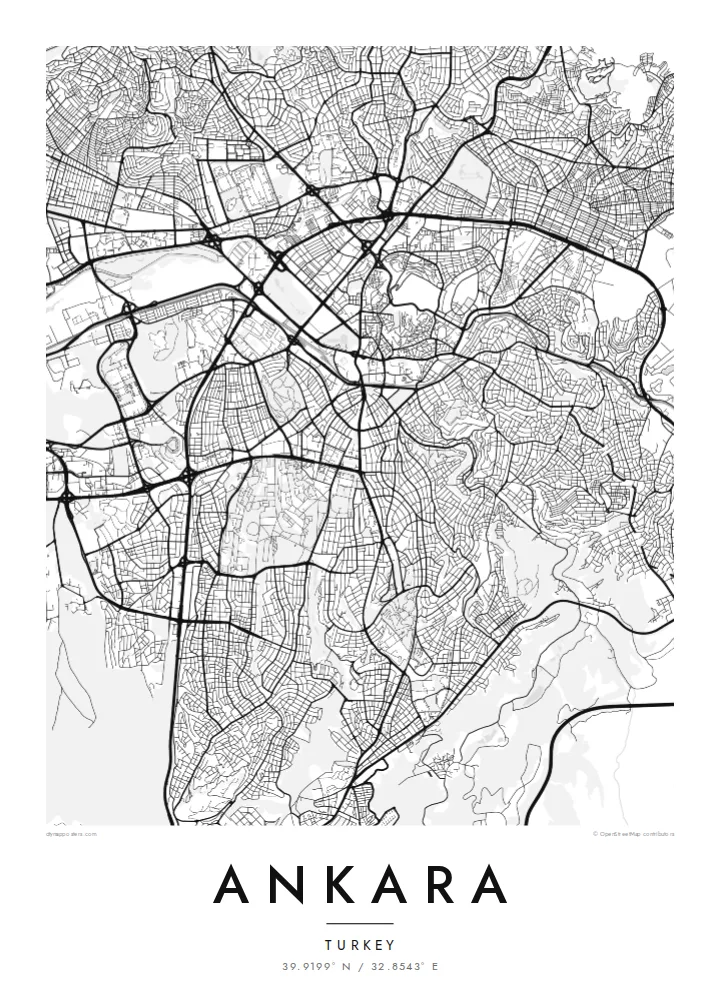
A plateau capital spreading from a citadel hill, cut through by a long boulevard running south toward the ministries and Çankaya.

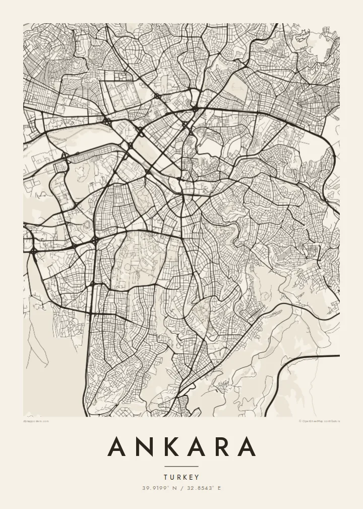


Адзін горад — пяць настрояў
Дакраніцеся да стылю, каб убачыць яго на сцяне. Усе стылі каштуюць аднолькава — друкаваны варыянт, у раме або HD-файлы.
 Рэальныя пікселі · файл для друку 24 × 36″
Выразна ў друку
Гэта 100% фрагмент сапраўднага файла для друку. Кожны постар — надрукаваны, у раме або спампаваны — рэндэрыцца на нашых серверах пры 300 DPI, да 7,200 × 10,800 пікселяў, таму нават самыя дробныя вулачкі застаюцца выразнымі пры друку 24 × 36″.
На сцяне


Карта
Ankara sits on the Anatolian plateau at more than 900 metres, and from above its oldest layer is easy to find: the citadel on its rocky hill north-east of the centre, wrapped in a tight knot of lanes that ignore any grid. Everything newer radiates away from that point. Over the twentieth century the city was pushed outward as a small provincial town became the seat of a republic.
Ankara became the capital in 1923, and the plan drawn up for it in the late 1920s by the German planner Hermann Jansen still shows in the map. Atatürk Boulevard runs as a long spine from Ulus through Kızılay to the government quarter. Gençlik Park is pressed against the old centre, and Anıtkabir, Atatürk's mausoleum, occupies its own hill to the west within a broad ceremonial park.
Further out, the city loses its early order and breaks into large residential districts, ring roads and campuses. The wooded grounds of the Middle East Technical University form one of the largest green shapes on the south-western edge, with the lakes of Eymir and Mogan beyond them. An Ankara map poster captures both the deliberately planned capital and the much larger city that grew around it.
The walled citadel rises above Ulus, north-east of the centre. Its irregular ring of fortifications and tight inner lanes form the densest and oldest street pattern in the city.
A straight north–south axis linking Ulus, Kızılay and Çankaya. On the map it reads as the city's backbone, with ministries, parks and embassies lined up along it.
Atatürk's mausoleum stands on a hilltop west of Kızılay, surrounded by a broad area of green and ceremonial ground that stands out clearly against the housing blocks around it.
Зрабіце яго сваім
Дадайце дату, імя ці свой радок, змяніце стыль, памер або арыентацыю.
Бясплатны прэв'ю — нізкай якасці і з вадзяным знакам. Друкаваныя постары і HD-файлы рэндэрацца пры 300 DPI, да 7,200 × 10,800 пікселяў, без вадзянога знака.
Чаму Ankara
Ankara tends to be personal for the people who hang it: students who spent years at one of its universities, diplomats posted to Çankaya, families who moved to the capital for work. The map holds the route from the citadel down the boulevard, a walk most of them made many times.
You can change the title and subtitle, add a date that matters and adjust the coordinates line. Choose Classic black & white, Noir, Paper, Blueprint or Sand, then download the $9 HD files to print at home, or order a matte print.
Замовіць постар Ankara| Памер друку | Раздзяляльнасць | Файлы |
|---|---|---|
| 30 × 40 cm (11.8 × 15.7″) | 3,543 × 4,724 px | PNG · PDF |
| 29.7 × 42 cm (A3, 11.7 × 16.5″) | 3,508 × 4,961 px | PNG · PDF |
| 42 × 59.4 cm (A2, 16.5 × 23.4″) | 4,961 × 7,016 px | PNG · PDF |
| 45.7 × 61 cm (18 × 24″) | 5,400 × 7,200 px | PNG · PDF |
| 50 × 70 cm (19.7 × 27.6″) | 5,906 × 8,268 px | PNG · PDF |
| 61 × 91.4 cm (24 × 36″) | 7,200 × 10,800 px | PNG · PDF |
Для параўнання: бясплатны прагляд мае шырыню 900 px, вадзяны знак і прызначаны для экранаў. HD-файлы маюць да 8× большую раздзяляльнасць па кожным баку і чыста друкуюцца ў поўным памеры постара.
Выберыце стыль уверсе старонкі, а потым — друкаваны постар (памер і, пры жаданні, раму) або лічбавыя HD-файлы. Афармленне заказу займае адзін крок, і старонка заказу абновіцца адразу пасля аплаты.
Ён друкуецца на прэміум матавай паперы 200 г/м² у адным з шасці памераў — ад 30 × 40 см да 24 × 36″. Друкаваныя постары каштуюць ад {printFrom}, дастаўка ўключана.
Так. Выберыце раму з масіву дрэва — чорную, белую, натуральны дуб або цёмнае дрэва. Яна пастаўляецца з ударамоцным шклом і гатовая да развешвання. Постары ў раме каштуюць ад {framedFrom}, дастаўка ўключана.
Дастаўка бясплатная па ўсім свеце. Кожны постар друкуецца найбліжэйшым з нашых друкарскіх партнёраў у больш чым 30 краінах і звычайна прыходзіць за 3–7 працоўных дзён. Статус і адсочванне можна праверыць у раздзеле «Мае заказы».
Дашліце нам фота на працягу 14 дзён пасля атрымання, і мы бясплатна надрукуем новы або вернем грошы.
Так. У рэдактары на гэтай старонцы зменіце загаловак, падзагаловак і радок з каардынатамі на што заўгодна, а таксама выберыце стыль і памер. Друкаваныя, у раме і лічбавыя заказы выкарыстоўваюць менавіта ваш дызайн.
За $9 вы атрымаеце PNG пры 300 DPI і гатовыя да друку PDF-файлы ва ўсіх шасці памерах, без вадзянога знака, для друку дзе заўгодна. Яшчэ не ўпэўненыя? Спачатку спампуйце бясплатны прэв'ю з вадзяным знакам.
Побач
