Suomenlinna sea fortress
Built in the eighteenth century across several linked islands at the harbour entrance, its angular bastions and irregular walls form one of the most distinctive outlines on the whole map.
Мінімалістычны постар з картай · Фінляндыя
60.1695° N / 24.9354° E
A granite peninsula that breaks into bays and islands, with a compact grid at its tip and sea on three sides


Адзін горад — пяць настрояў
Дакраніцеся да стылю, каб убачыць яго на сцяне. Усе стылі каштуюць аднолькава — друкаваны варыянт, у раме або HD-файлы.
 Рэальныя пікселі · файл для друку 24 × 36″
Выразна ў друку
Гэта 100% фрагмент сапраўднага файла для друку. Кожны постар — надрукаваны, у раме або спампаваны — рэндэрыцца на нашых серверах пры 300 DPI, да 7,200 × 10,800 пікселяў, таму нават самыя дробныя вулачкі застаюцца выразнымі пры друку 24 × 36″.
На сцяне


Карта
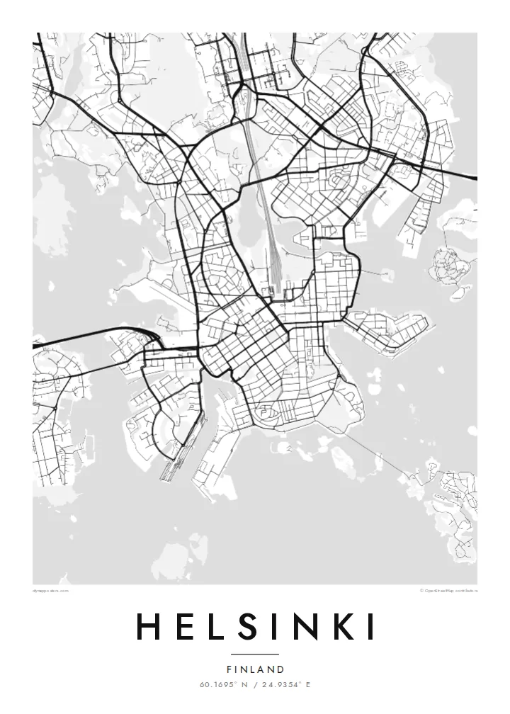
Helsinki sits on a peninsula that pushes into the Gulf of Finland, and from above its coastline matters most. The land breaks into coves, headlands and more than three hundred islands, so the city carries on past the point where the streets stop. Inland the pattern loosens into leafy districts and a long strip of forest, the Central Park, which runs north almost unbroken from Töölö Bay towards the city's edge.
The centre is orderly. After Helsinki was named capital in 1812, the architect Carl Ludvig Engel laid out a neoclassical core around Senate Square. The Esplanadi park strip still runs west from the market harbour as straight as a ruler. Around it, blocks of stone apartment buildings form a tight grid that reads cleanly in black and white. Rail yards and the long curve of the harbour break it up.
A Helsinki map poster shows this balance of order and irregularity: a precise centre, a coastline with almost no straight lines, and water in every gap. Offshore, the island fortress of Suomenlinna, a UNESCO World Heritage Site, spreads across a cluster of connected islets at the harbour mouth. Ferries, bridges and causeways join the rest together, and each one leaves a thin line on the page.
Built in the eighteenth century across several linked islands at the harbour entrance, its angular bastions and irregular walls form one of the most distinctive outlines on the whole map.
Senate Square and the Esplanadi park avenue sit just back from the South Harbour. They give the densest streets a clear, symmetrical anchor that stands out at every print size.
A band of forest about ten kilometres long runs north from the inner city. It leaves a wide, pale ribbon between the residential districts on either side.
Зрабіце яго сваім
Дадайце дату, імя ці свой радок, змяніце стыль, памер або арыентацыю.
Бясплатны прэв'ю — нізкай якасці і з вадзяным знакам. Друкаваныя постары і HD-файлы рэндэрацца пры 300 DPI, да 7,200 × 10,800 пікселяў, без вадзянога знака.
Чаму Helsinki
People hang Helsinki for a flat near Töölö, summers on the islands, or an exchange year that turned into something longer. The map holds all of it at once: the harbour, the grid and the sea. Add a title, a date or a line of coordinates to mark which chapter it belongs to.
The coastline works especially well in Noir, where the water turns dark and the islands look like scattered light, or in Blueprint for a cooler, technical look. Classic black & white, Paper and Sand are available too. Download the HD files for $9 or order a matte print, framed if you like.
Замовіць постар Helsinki| Памер друку | Раздзяляльнасць | Файлы |
|---|---|---|
| 30 × 40 cm (11.8 × 15.7″) | 3,543 × 4,724 px | PNG · PDF |
| 29.7 × 42 cm (A3, 11.7 × 16.5″) | 3,508 × 4,961 px | PNG · PDF |
| 42 × 59.4 cm (A2, 16.5 × 23.4″) | 4,961 × 7,016 px | PNG · PDF |
| 45.7 × 61 cm (18 × 24″) | 5,400 × 7,200 px | PNG · PDF |
| 50 × 70 cm (19.7 × 27.6″) | 5,906 × 8,268 px | PNG · PDF |
| 61 × 91.4 cm (24 × 36″) | 7,200 × 10,800 px | PNG · PDF |
Для параўнання: бясплатны прагляд мае шырыню 900 px, вадзяны знак і прызначаны для экранаў. HD-файлы маюць да 8× большую раздзяляльнасць па кожным баку і чыста друкуюцца ў поўным памеры постара.
Выберыце стыль уверсе старонкі, а потым — друкаваны постар (памер і, пры жаданні, раму) або лічбавыя HD-файлы. Афармленне заказу займае адзін крок, і старонка заказу абновіцца адразу пасля аплаты.
Ён друкуецца на прэміум матавай паперы 200 г/м² у адным з шасці памераў — ад 30 × 40 см да 24 × 36″. Друкаваныя постары каштуюць ад $39, дастаўка ўключана.
Так. Выберыце раму з масіву дрэва — чорную, белую, натуральны дуб або цёмнае дрэва. Яна пастаўляецца з ударамоцным шклом і гатовая да развешвання. Постары ў раме каштуюць ад $99, дастаўка ўключана.
Дастаўка бясплатная ва ўсім свеце. Кожны плакат друкуецца ў бліжэйшага з нашых партнёраў-друкарняў у 30+ краінах і звычайна прыходзіць за 3–7 працоўных дзён. Статус і трэкінг можна адсочваць у раздзеле «Мае заказы». У некаторыя краіны дастаўка займае 2–5 тыдняў, а калі мы туды яшчэ не дастаўляем, сайт папярэдзіць вас да аплаты.
Дашліце нам фота на працягу 14 дзён пасля атрымання, і мы бясплатна надрукуем новы або вернем грошы.
Так. У рэдактары на гэтай старонцы зменіце загаловак, падзагаловак і радок з каардынатамі на што заўгодна, а таксама выберыце стыль і памер. Друкаваныя, у раме і лічбавыя заказы выкарыстоўваюць менавіта ваш дызайн.
За $9 вы атрымаеце PNG пры 300 DPI і гатовыя да друку PDF-файлы ва ўсіх шасці памерах, без вадзянога знака, для друку дзе заўгодна. Яшчэ не ўпэўненыя? Спачатку спампуйце бясплатны прэв'ю з вадзяным знакам.
Побач
