Satpura ridges
Wooded hills surround the town, and roads curve to follow them. The irregular pattern contrasts with the flatter plains elsewhere in central India.
Simpol poster blong map · India
21.5533° N / 76.8897° E
A forest-edge town in the Satpura hills near the Tapi, where roads wind between rivers and wooded ridges



Wan taon, faef filing
Klikim wan style blong luk hem antap long wol. Evri style i sem prais nomo — sapos yu prinim, putum insaed frem, o daonlodem olsem HD file.
 Trufala pixel · 24 × 36″ prin file
Klia blong prent
Hemia i wan 100% haf blong trufala prin file. Evri poster — sapos prinim, putum insaed frem, o daonlodem — mifala i wokem long server blong mifala long 300 DPI, kasem 7,200 × 10,800 pixel, mekem se nomata ol smol rod tu oli klia gud long wan 24 × 36″ prin.
Long wol


Map
Dhārni lies in the Satpura range in central India, close to the border between Maharashtra and Madhya Pradesh. It is in the Melghat area, a hilly, heavily forested region crossed by rivers flowing to the Tapi. The town is a local centre for the surrounding villages, many of them home to the Korku and other Adivasi communities.
The Melghat Tiger Reserve lies nearby, one of India's early tiger reserves. The forests, hills and rivers of the area shape both daily life and the layout of the settlements. Roads and houses follow the valleys and gentler slopes, avoiding the steepest ground.
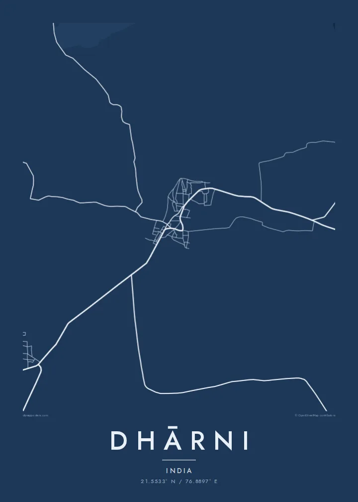
A Dhārni map poster shows a compact town in a much larger natural landscape. Streets cluster in the centre, roads wind through the hills in long curves, and rivers and streams cut across the frame. The irregular, organic pattern reflects a place where the terrain still decides where people can build.
Wooded hills surround the town, and roads curve to follow them. The irregular pattern contrasts with the flatter plains elsewhere in central India.
Rivers and streams from the hills flow towards the Tapi. They add winding lines across the map and define the valleys where settlements lie.
The town sits close to the forests of Melghat. Beyond the streets the map opens out into large areas with few roads, giving the print space.
Mekem i blong yu
Putum wan dei, wan nem o wan laen blong yu, jenisim stael, saes o saed.
Fri preview i lo-resolusen mo i gat watermak. Prin mo HD file oli wok long 300 DPI, kasem 7,200 × 10,800 px, i no gat watermak.
From wanem Dhārni
For people from Dhārni and the Melghat villages, as well as for those who have worked or travelled here, this map is a reminder of the town, its hills and the forest beyond.
Personalise the title, subtitle and coordinates with a village name, a family name or a special date. Choose from Classic black and white, Noir, Paper, Blueprint or Sand. Sand reflects the warm tones of the Satpura landscape.
Odarem poster blong Dhārni| Saes blong prent | Rezolusen | Ol fael |
|---|---|---|
| 30 × 40 cm11.8 × 15.7″ | 3,543 × 4,724 px | PNG · PDF |
| 29.7 × 42 cm (A3)11.7 × 16.5″ | 3,508 × 4,961 px | PNG · PDF |
| 42 × 59.4 cm (A2)16.5 × 23.4″ | 4,961 × 7,016 px | PNG · PDF |
| 45.7 × 61 cm18 × 24″ | 5,400 × 7,200 px | PNG · PDF |
| 50 × 70 cm19.7 × 27.6″ | 5,906 × 8,268 px | PNG · PDF |
| 61 × 91.4 cm24 × 36″ | 7,200 × 10,800 px | PNG · PDF |
Blong yu save komperem, fri priviu i 900 px long waed, i gat wotamak mo i blong skrin nomo. Ol HD fael oli gat kasem 8× moa rezolusen long evri saed mo oli prent klia long ful saes blong poster.
Jusum wan style antap long pej, biaen jusum Prinim Poster — wan saes mo, sapos yu wantem, wan frem — o Digital HD Files. Pemen i wan step nomo, mo pej blong oda blong yu i apdet stret taem pemen i pas.
Mifala i prinim long gudfala 200 gsm matte pepa, long wan long 6 saes, statem long 30 × 40 cm kasem 24 × 36″. Prin poster i statem long $39, sipin i insaed finis.
Yes. Jusum wan strong wud frem long kala blak, waet, natural oak, o tudak wud. I gat glas we i no save brok isi, mo i rere blong hangem stret. Poster wetem frem i statem long $99, sipin i insaed finis.
Shipping i fri i go long 60+ kantri. Evri poster i kam from wan long ol prin pATna blong mifala we i stap kolosap moa long 30+ kantri, mo i save kasem yu long 3–7 wokin dei. Yu save lukluk stetus mo tracking long My Orders. Sam kantri i tekem 2–5 wik, mo long ol ples we mifala i no sendem yet, saet i talem yu bifo yu pem.
Sendem wan foto long mifala insaed 14 dei afta i kasem yu, mo mifala bae i prinim wan niufala fri o givim bak mane blong yu.
Yes. Long editor long pej ya, jenisim taetol, sabtaetol, mo laen blong koordinet i go long wanem yu wantem, mo jusum wan style mo saes. Prin, frem, mo digital oda oli yusum stret design blong yu.
Long $9 yu kasem 300 DPI PNG mo PDF file we i rere blong prinim, long evri 6 saes, i no gat watermak, mo yu save prinim long enisave ples. Yu no sua yet? Daonlodem wan fri preview wetem watermak fastaem.
Klosap
