Transport corridor
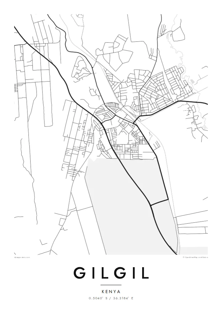
The highway and the railway run through the town in long, straight lines, giving the map its backbone and linking Gilgil to Naivasha and Nakuru.
Simpol poster blong map · Kenya
0.5040° S / 36.3184° E
A Rift Valley town strung along the highway and railway between Naivasha and Nakuru, near the shores of Lake Elmenteita



Wan taon, faef filing
Klikim wan style blong luk hem antap long wol. Evri style i sem prais nomo — sapos yu prinim, putum insaed frem, o daonlodem olsem HD file.
 Trufala pixel · 24 × 36″ prin file
Klia blong prent
Hemia i wan 100% haf blong trufala prin file. Evri poster — sapos prinim, putum insaed frem, o daonlodem — mifala i wokem long server blong mifala long 300 DPI, kasem 7,200 × 10,800 pixel, mekem se nomata ol smol rod tu oli klia gud long wan 24 × 36″ prin.
Long wol


Map
Gilgil is a town in Nakuru County, in Kenya's Great Rift Valley. On a map it follows the main transport corridor between Naivasha and Nakuru: the highway and the railway run through or beside the town, and streets branch off them into residential areas and farms. The valley floor around it is open, with hills rising in the distance.
The town is known in Kenya for its military presence, with barracks and training grounds nearby occupying large areas on the map. To the north-west lies Lake Elmenteita, one of the shallow soda lakes of the Rift Valley, whose outline adds a strong shape to any wider view of the area.
A Gilgil map poster works well at a scale that shows the corridor and the lake together. The straight lines of road and rail cross a gently rolling landscape, and the town gathers where they meet. It is a practical, grounded image of a place many Kenyans pass through, and some call home.
The highway and the railway run through the town in long, straight lines, giving the map its backbone and linking Gilgil to Naivasha and Nakuru.
This shallow Rift Valley lake lies to the north-west, and its outline forms the largest natural shape in a wider view of the area.
Barracks and training areas near the town occupy broad, open parcels, visible as large blocks between farms and residential streets.
Mekem i blong yu
Putum wan dei, wan nem o wan laen blong yu, jenisim stael, saes o saed.
Fri preview i lo-resolusen mo i gat watermak. Prin mo HD file oli wok long 300 DPI, kasem 7,200 × 10,800 px, i no gat watermak.
From wanem Gilgil
Gilgil means different things to different people: a childhood home, a posting, a stop on the road through the Rift Valley. A map with the highway, railway and lake captures all of those memories at once.
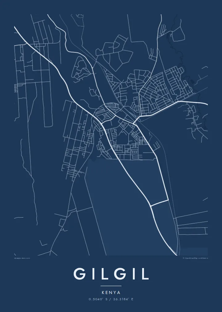
Personalise the title, subtitle and coordinates line, perhaps with a year of service or a family name, and choose Classic black & white, Noir, Paper, Blueprint or Sand. HD files cost $9, or order a printed poster with an optional wooden frame.
Odarem poster blong Gilgil| Saes blong prent | Rezolusen | Ol fael |
|---|---|---|
| 30 × 40 cm11.8 × 15.7″ | 3,543 × 4,724 px | PNG · PDF |
| 29.7 × 42 cm (A3)11.7 × 16.5″ | 3,508 × 4,961 px | PNG · PDF |
| 42 × 59.4 cm (A2)16.5 × 23.4″ | 4,961 × 7,016 px | PNG · PDF |
| 45.7 × 61 cm18 × 24″ | 5,400 × 7,200 px | PNG · PDF |
| 50 × 70 cm19.7 × 27.6″ | 5,906 × 8,268 px | PNG · PDF |
| 61 × 91.4 cm24 × 36″ | 7,200 × 10,800 px | PNG · PDF |
Blong yu save komperem, fri priviu i 900 px long waed, i gat wotamak mo i blong skrin nomo. Ol HD fael oli gat kasem 8× moa rezolusen long evri saed mo oli prent klia long ful saes blong poster.
Jusum wan style antap long pej, biaen jusum Prinim Poster — wan saes mo, sapos yu wantem, wan frem — o Digital HD Files. Pemen i wan step nomo, mo pej blong oda blong yu i apdet stret taem pemen i pas.
Mifala i prinim long gudfala 200 gsm matte pepa, long wan long 6 saes, statem long 30 × 40 cm kasem 24 × 36″. Prin poster i statem long $39, sipin i insaed finis.
Yes. Jusum wan strong wud frem long kala blak, waet, natural oak, o tudak wud. I gat glas we i no save brok isi, mo i rere blong hangem stret. Poster wetem frem i statem long $99, sipin i insaed finis.
Shipping i fri i go long 60+ kantri. Evri poster i kam from wan long ol prin pATna blong mifala we i stap kolosap moa long 30+ kantri, mo i save kasem yu long 3–7 wokin dei. Yu save lukluk stetus mo tracking long My Orders. Sam kantri i tekem 2–5 wik, mo long ol ples we mifala i no sendem yet, saet i talem yu bifo yu pem.
Sendem wan foto long mifala insaed 14 dei afta i kasem yu, mo mifala bae i prinim wan niufala fri o givim bak mane blong yu.
Yes. Long editor long pej ya, jenisim taetol, sabtaetol, mo laen blong koordinet i go long wanem yu wantem, mo jusum wan style mo saes. Prin, frem, mo digital oda oli yusum stret design blong yu.
Long $9 yu kasem 300 DPI PNG mo PDF file we i rere blong prinim, long evri 6 saes, i no gat watermak, mo yu save prinim long enisave ples. Yu no sua yet? Daonlodem wan fri preview wetem watermak fastaem.
Klosap
