Indented coastline
Countless small bays, headlands and islets surround the island, producing an intricate edge that looks especially striking against open water on the map.
Simpol poster blong map · Japan
33.7829° N / 129.7209° E
An island city in the strait between Kyushu and Tsushima, low hills and small harbours tucked into a ragged coastline.


Wan taon, faef filing
Klikim wan style blong luk hem antap long wol. Evri style i sem prais nomo — sapos yu prinim, putum insaed frem, o daonlodem olsem HD file.
 Trufala pixel · 24 × 36″ prin file
Klia blong prent
Hemia i wan 100% haf blong trufala prin file. Evri poster — sapos prinim, putum insaed frem, o daonlodem — mifala i wokem long server blong mifala long 300 DPI, kasem 7,200 × 10,800 pixel, mekem se nomata ol smol rod tu oli klia gud long wan 24 × 36″ prin.
Long wol


Map
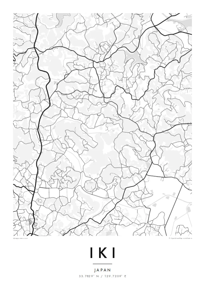
Iki is an island city in Nagasaki Prefecture, set in the strait between northern Kyushu and Tsushima. The whole island fits on a single map: a compact, roughly rounded landmass with a heavily indented coastline, small bays and offshore islets. Inland, low hills and a surprisingly broad central plain are covered in fields and scattered villages rather than steep mountains.
Towns cluster around the harbours. Gōnoura in the southwest is the main ferry port, while Ashibe and others sit on sheltered inlets elsewhere on the coast. Roads loop between them across the island, and the network of rural lanes connecting farms gives the interior a fine, branching texture.
Iki has a long history as a stepping stone between Japan and the Asian mainland. The Harunotsuji site on the island is thought to be the centre of Ikikoku, one of the states mentioned in ancient Chinese records. The island is also known for barley shochu. An Iki map poster frames an entire island in one clear, legible shape.
Countless small bays, headlands and islets surround the island, producing an intricate edge that looks especially striking against open water on the map.
The main port sits in a sheltered bay on the southwest coast, where the densest streets meet ferry terminals and fishing piers.
The interior is unusually flat for an island in the region, with fields, farm roads and small settlements spread evenly across it.
Mekem i blong yu
Putum wan dei, wan nem o wan laen blong yu, jenisim stael, saes o saed.
Fri preview i lo-resolusen mo i gat watermak. Prin mo HD file oli wok long 300 DPI, kasem 7,200 × 10,800 px, i no gat watermak.
From wanem Iki
Island maps have a completeness that city maps rarely do, and Iki is a fine example. It suits islanders who moved to the mainland, frequent visitors, and anyone drawn to Japan's quieter coastal places.
Add a name, a date or a line in Japanese to the title, subtitle and coordinates line. Choose among five styles, with Blueprint and Noir working especially well for coastlines, and download HD files for $9 or order a printed poster.
Odarem poster blong Iki| Saes blong prent | Rezolusen | Ol fael |
|---|---|---|
| 30 × 40 cm (11.8 × 15.7″) | 3,543 × 4,724 px | PNG · PDF |
| 29.7 × 42 cm (A3, 11.7 × 16.5″) | 3,508 × 4,961 px | PNG · PDF |
| 42 × 59.4 cm (A2, 16.5 × 23.4″) | 4,961 × 7,016 px | PNG · PDF |
| 45.7 × 61 cm (18 × 24″) | 5,400 × 7,200 px | PNG · PDF |
| 50 × 70 cm (19.7 × 27.6″) | 5,906 × 8,268 px | PNG · PDF |
| 61 × 91.4 cm (24 × 36″) | 7,200 × 10,800 px | PNG · PDF |
Blong yu save komperem, fri priviu i 900 px long waed, i gat wotamak mo i blong skrin nomo. Ol HD fael oli gat kasem 8× moa rezolusen long evri saed mo oli prent klia long ful saes blong poster.
Jusum wan style antap long pej, biaen jusum Prinim Poster — wan saes mo, sapos yu wantem, wan frem — o Digital HD Files. Pemen i wan step nomo, mo pej blong oda blong yu i apdet stret taem pemen i pas.
Mifala i prinim long gudfala 200 gsm matte pepa, long wan long 6 saes, statem long 30 × 40 cm kasem 24 × 36″. Prin poster i statem long $39, sipin i insaed finis.
Yes. Jusum wan strong wud frem long kala blak, waet, natural oak, o tudak wud. I gat glas we i no save brok isi, mo i rere blong hangem stret. Poster wetem frem i statem long $99, sipin i insaed finis.
Delivri blong poster i fri long olgeta ples long wol. Wan wan poster i prin long wan long ol prin patna blong mifala we i kolosap moa long yu, long moa long 30 kantri, mo bambae i kasem yu long 3–7 wokdei. Yu save lukluk stetes mo trakin long My Orders. Sam kantri i tekem 2–5 wik, mo long ol ples we mifala i no save sendem yet, saet i talem yu bifo yu pem.
Sendem wan foto long mifala insaed 14 dei afta i kasem yu, mo mifala bae i prinim wan niufala fri o givim bak mane blong yu.
Yes. Long editor long pej ya, jenisim taetol, sabtaetol, mo laen blong koordinet i go long wanem yu wantem, mo jusum wan style mo saes. Prin, frem, mo digital oda oli yusum stret design blong yu.
Long $9 yu kasem 300 DPI PNG mo PDF file we i rere blong prinim, long evri 6 saes, i no gat watermak, mo yu save prinim long enisave ples. Yu no sua yet? Daonlodem wan fri preview wetem watermak fastaem.
Klosap
