The confluence
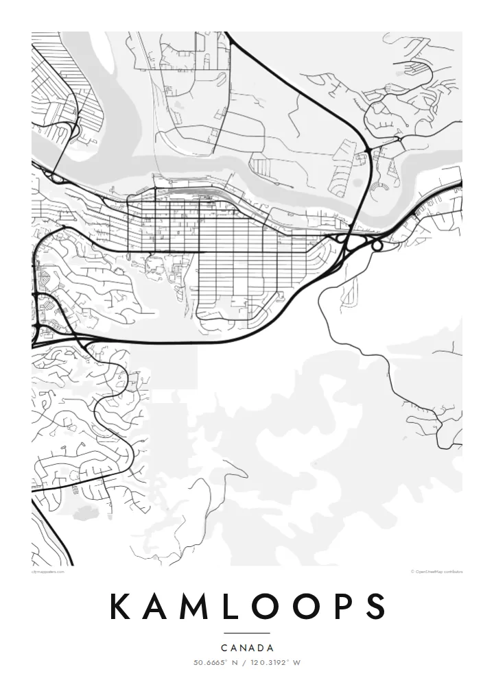
The North and South Thompson rivers meet near the city centre, forming the Y shape that defines Kamloops on any map.
Simpol poster blong map · Canada
50.6665° N / 120.3192° W
Two rivers meeting in a dry valley, with the city climbing onto benchlands and hills


Wan taon, faef filing
Klikim wan style blong luk hem antap long wol. Evri style i sem prais nomo — sapos yu prinim, putum insaed frem, o daonlodem olsem HD file.
 Trufala pixel · 24 × 36″ prin file
Klia blong prent
Hemia i wan 100% haf blong trufala prin file. Evri poster — sapos prinim, putum insaed frem, o daonlodem — mifala i wokem long server blong mifala long 300 DPI, kasem 7,200 × 10,800 pixel, mekem se nomata ol smol rod tu oli klia gud long wan 24 × 36″ prin.
Long wol


Map
Kamloops sits at the confluence of the North and South Thompson rivers in the southern interior of British Columbia. From above, the rivers form a clear Y shape, with the combined Thompson flowing west. The downtown lies on the south bank near the junction, and neighbourhoods climb the benchlands and sage-covered hills above the valley floor.
The name comes from the Secwepemc word Tk'emlúps, usually translated as meeting of the waters. The city is a major junction for highways and railways, and the Trans-Canada Highway passes through it. The semi-arid climate gives the surrounding hills a landscape of grassland and sagebrush that is unusual for Canada.
A Kamloops map poster is built around the confluence: two rivers join in the middle, bridges connect the banks, and streets spread in terraces up the valley sides. Rail lines follow the rivers, and the outer districts thin out into open hillsides.
The North and South Thompson rivers meet near the city centre, forming the Y shape that defines Kamloops on any map.
Neighbourhoods on the higher benches have curving streets that follow the contours, set above the older grid on the valley floor.
Railways follow the river valleys, and the Trans-Canada Highway crosses the southern slopes, adding long lines to the landscape.
Mekem i blong yu
Putum wan dei, wan nem o wan laen blong yu, jenisim stael, saes o saed.
Fri preview i lo-resolusen mo i gat watermak. Prin mo HD file oli wok long 300 DPI, kasem 7,200 × 10,800 px, i no gat watermak.
From wanem Kamloops
The poster suits people who grew up in Kamloops, studied at Thompson Rivers University or drove through on the Trans-Canada Highway. The meeting of two rivers is a strong and simple image to live with.
Change the title to a family name or a year, and choose Classic black & white or one of four other styles. The $9 digital files cover six print sizes, and printed posters with an optional wooden frame ship within Canada and to 30+ countries.
Odarem poster blong Kamloops| Saes blong prent | Rezolusen | Ol fael |
|---|---|---|
| 30 × 40 cm11.8 × 15.7″ | 3,543 × 4,724 px | PNG · PDF |
| 29.7 × 42 cm (A3)11.7 × 16.5″ | 3,508 × 4,961 px | PNG · PDF |
| 42 × 59.4 cm (A2)16.5 × 23.4″ | 4,961 × 7,016 px | PNG · PDF |
| 45.7 × 61 cm18 × 24″ | 5,400 × 7,200 px | PNG · PDF |
| 50 × 70 cm19.7 × 27.6″ | 5,906 × 8,268 px | PNG · PDF |
| 61 × 91.4 cm24 × 36″ | 7,200 × 10,800 px | PNG · PDF |
Blong yu save komperem, fri priviu i 900 px long waed, i gat wotamak mo i blong skrin nomo. Ol HD fael oli gat kasem 8× moa rezolusen long evri saed mo oli prent klia long ful saes blong poster.
Jusum wan style antap long pej, biaen jusum Prinim Poster — wan saes mo, sapos yu wantem, wan frem — o Digital HD Files. Pemen i wan step nomo, mo pej blong oda blong yu i apdet stret taem pemen i pas.
Mifala i prinim long gudfala 200 gsm matte pepa, long wan long 6 saes, statem long 30 × 40 cm kasem 24 × 36″. Prin poster i statem long $39, sipin i insaed finis.
Yes. Jusum wan strong wud frem long kala blak, waet, natural oak, o tudak wud. I gat glas we i no save brok isi, mo i rere blong hangem stret. Poster wetem frem i statem long $99, sipin i insaed finis.
Shipping i fri i go long 60+ kantri. Evri poster i kam from wan long ol prin pATna blong mifala we i stap kolosap moa long 30+ kantri, mo i save kasem yu long 3–7 wokin dei. Yu save lukluk stetus mo tracking long My Orders. Sam kantri i tekem 2–5 wik, mo long ol ples we mifala i no sendem yet, saet i talem yu bifo yu pem.
Sendem wan foto long mifala insaed 14 dei afta i kasem yu, mo mifala bae i prinim wan niufala fri o givim bak mane blong yu.
Yes. Long editor long pej ya, jenisim taetol, sabtaetol, mo laen blong koordinet i go long wanem yu wantem, mo jusum wan style mo saes. Prin, frem, mo digital oda oli yusum stret design blong yu.
Long $9 yu kasem 300 DPI PNG mo PDF file we i rere blong prinim, long evri 6 saes, i no gat watermak, mo yu save prinim long enisave ples. Yu no sua yet? Daonlodem wan fri preview wetem watermak fastaem.
Klosap
