Karaj River
The river cuts through the city from the northern mountains. It divides the urban area and marks the route up the valley towards the dam.
Simpol poster blong map · Iran
35.8327° N / 50.9915° E
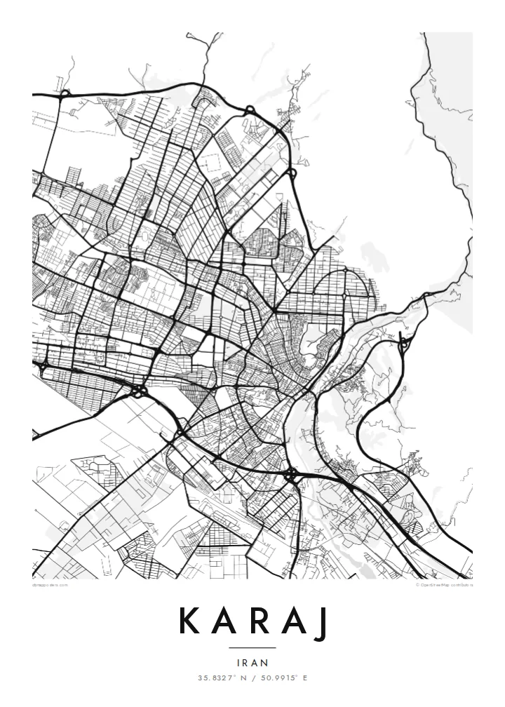
A city stretched along the Alborz foothills, cut by the Karaj River and tied to Tehran by long highways



Wan taon, faef filing
Klikim wan style blong luk hem antap long wol. Evri style i sem prais nomo — sapos yu prinim, putum insaed frem, o daonlodem olsem HD file.
 Trufala pixel · 24 × 36″ prin file
Klia blong prent
Hemia i wan 100% haf blong trufala prin file. Evri poster — sapos prinim, putum insaed frem, o daonlodem — mifala i wokem long server blong mifala long 300 DPI, kasem 7,200 × 10,800 pixel, mekem se nomata ol smol rod tu oli klia gud long wan 24 × 36″ prin.
Long wol


Map
Karaj lies at the foot of the Alborz mountains, west of Tehran, and serves as the capital of Alborz Province. The Karaj River comes down from the mountains to the north and passes through the city before it flows onto the plain. The urban area spreads east and west along the foothills, following the line where mountain slopes meet flat ground.
North of the city, the river valley leads up to the Amir Kabir Dam, which supplies water to the wider Tehran region. Several expressways and the railway run east towards the capital, and the built-up area almost merges with Tehran's western suburbs. Karaj has grown rapidly in recent decades as people moved out from Tehran.
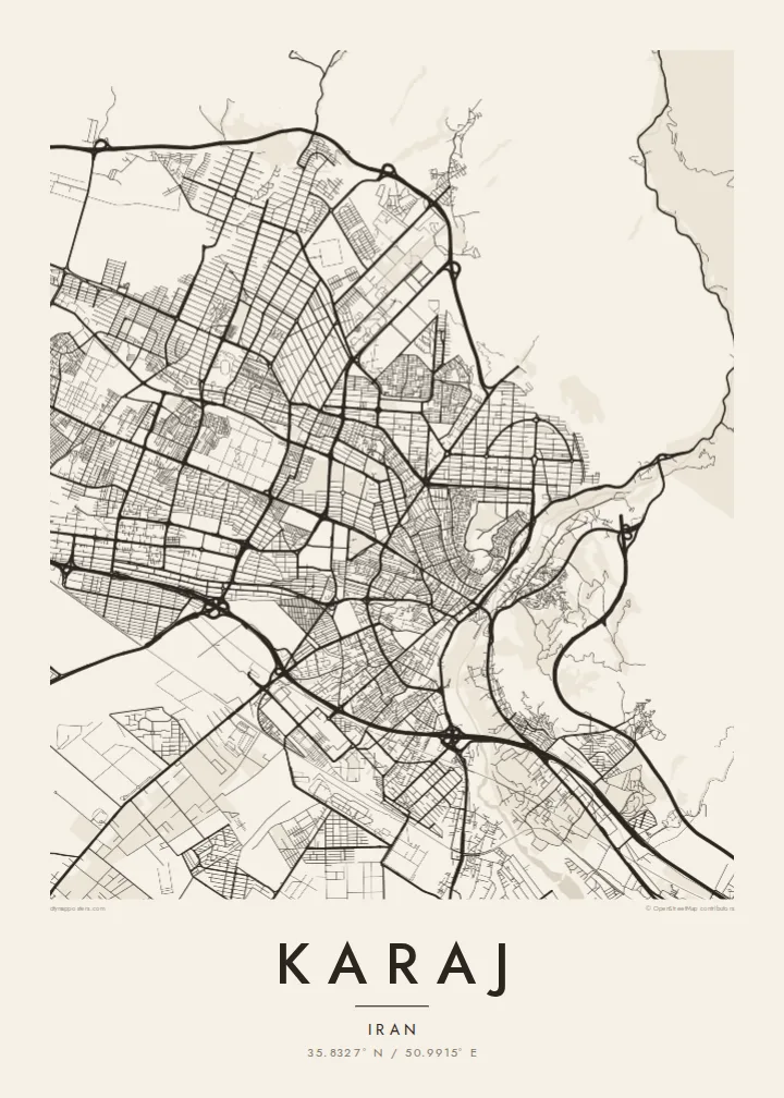
A Karaj map poster shows a linear city shaped by mountains and transport lines. There are dense neighbourhoods along the foothills, a river valley opening northwards, and long highway corridors reaching east. The mountains leave an open upper edge to the map, which gives the dense streets below a clear frame.
The river cuts through the city from the northern mountains. It divides the urban area and marks the route up the valley towards the dam.
The mountains rise sharply along the north side. They end the street grid abruptly and give the print a strong natural border.
Parallel expressways and a rail line run east towards Tehran. They form long straight lines that tie the two cities together.
Mekem i blong yu
Putum wan dei, wan nem o wan laen blong yu, jenisim stael, saes o saed.
Fri preview i lo-resolusen mo i gat watermak. Prin mo HD file oli wok long 300 DPI, kasem 7,200 × 10,800 px, i no gat watermak.
From wanem Karaj
Many people have made their home in Karaj while working in Tehran, or grew up there as the city expanded. A map of its foothills and river streets marks that place with quiet precision.
You can enter your own title, subtitle and coordinates, perhaps a district name or an important date. The poster comes in five styles: Classic black & white, Noir, Paper, Blueprint and Sand.
Odarem poster blong Karaj| Saes blong prent | Rezolusen | Ol fael |
|---|---|---|
| 30 × 40 cm (11.8 × 15.7″) | 3,543 × 4,724 px | PNG · PDF |
| 29.7 × 42 cm (A3, 11.7 × 16.5″) | 3,508 × 4,961 px | PNG · PDF |
| 42 × 59.4 cm (A2, 16.5 × 23.4″) | 4,961 × 7,016 px | PNG · PDF |
| 45.7 × 61 cm (18 × 24″) | 5,400 × 7,200 px | PNG · PDF |
| 50 × 70 cm (19.7 × 27.6″) | 5,906 × 8,268 px | PNG · PDF |
| 61 × 91.4 cm (24 × 36″) | 7,200 × 10,800 px | PNG · PDF |
Blong yu save komperem, fri priviu i 900 px long waed, i gat wotamak mo i blong skrin nomo. Ol HD fael oli gat kasem 8× moa rezolusen long evri saed mo oli prent klia long ful saes blong poster.
Jusum wan style antap long pej, biaen jusum Prinim Poster — wan saes mo, sapos yu wantem, wan frem — o Digital HD Files. Pemen i wan step nomo, mo pej blong oda blong yu i apdet stret taem pemen i pas.
Mifala i prinim long gudfala 200 gsm matte pepa, long wan long 6 saes, statem long 30 × 40 cm kasem 24 × 36″. Prin poster i statem long $39, sipin i insaed finis.
Yes. Jusum wan strong wud frem long kala blak, waet, natural oak, o tudak wud. I gat glas we i no save brok isi, mo i rere blong hangem stret. Poster wetem frem i statem long $99, sipin i insaed finis.
Delivri blong poster i fri long olgeta ples long wol. Wan wan poster i prin long wan long ol prin patna blong mifala we i kolosap moa long yu, long moa long 30 kantri, mo bambae i kasem yu long 3–7 wokdei. Yu save lukluk stetes mo trakin long My Orders. Sam kantri i tekem 2–5 wik, mo long ol ples we mifala i no save sendem yet, saet i talem yu bifo yu pem.
Sendem wan foto long mifala insaed 14 dei afta i kasem yu, mo mifala bae i prinim wan niufala fri o givim bak mane blong yu.
Yes. Long editor long pej ya, jenisim taetol, sabtaetol, mo laen blong koordinet i go long wanem yu wantem, mo jusum wan style mo saes. Prin, frem, mo digital oda oli yusum stret design blong yu.
Long $9 yu kasem 300 DPI PNG mo PDF file we i rere blong prinim, long evri 6 saes, i no gat watermak, mo yu save prinim long enisave ples. Yu no sua yet? Daonlodem wan fri preview wetem watermak fastaem.
Klosap
