Ridge-top roads
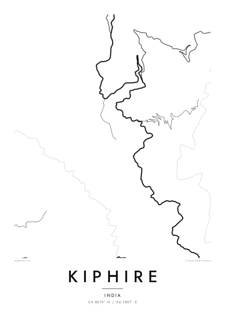
The main roads follow the ridges and wrap around the hillsides, forming looping lines that make up the distinctive shape of the town.
Simpol poster blong map · India
25.8679° N / 94.7857° E
A Naga hill town strung along a ridge, its roads looping around steep slopes above deep forested valleys.


Wan taon, faef filing
Klikim wan style blong luk hem antap long wol. Evri style i sem prais nomo — sapos yu prinim, putum insaed frem, o daonlodem olsem HD file.
 Trufala pixel · 24 × 36″ prin file
Klia blong prent
Hemia i wan 100% haf blong trufala prin file. Evri poster — sapos prinim, putum insaed frem, o daonlodem — mifala i wokem long server blong mifala long 300 DPI, kasem 7,200 × 10,800 pixel, mekem se nomata ol smol rod tu oli klia gud long wan 24 × 36″ prin.
Long wol


Map
Kiphire is the headquarters of Kiphire district in eastern Nagaland, close to the border with Myanmar. It is a hill town, and its map follows the terrain rather than any grid. Roads wind along ridgelines and switch back down slopes, and houses cluster wherever the ground allows. The result is a loose, organic pattern of curving lines with no straight streets at all.
The district includes Mount Saramati, the highest peak in Nagaland, and the wider landscape is one of steep, forested hills cut by river valleys. Kiphire is home to Naga communities, including the Sangtam and Yimkhiung peoples, and it serves as the administrative centre for the surrounding villages.
A Kiphire map poster shows how a mountain town adapts to its setting. Its lines bend in a way lowland towns never do, and the empty spaces between them hint at slopes too steep to build on. Printed large, the map shows the logic of a settlement that has grown along the contours of the land.
The main roads follow the ridges and wrap around the hillsides, forming looping lines that make up the distinctive shape of the town.
Roads climbing into town zigzag across the slopes, and each hairpin bend shows up clearly in the minimalist line style.
Kiphire is the gateway to a district that includes Mount Saramati, Nagaland's highest peak, and the roads leaving town head into steep, forested country.
Mekem i blong yu
Putum wan dei, wan nem o wan laen blong yu, jenisim stael, saes o saed.
Fri preview i lo-resolusen mo i gat watermak. Prin mo HD file oli wok long 300 DPI, kasem 7,200 × 10,800 px, i no gat watermak.
From wanem Kiphire
For people from Kiphire who now live in Kohima, Dimapur or farther away, this map holds the shape of home in a single image. The winding lines are expressive, and the poster looks almost like a drawing.
You can write the title and subtitle in your own words, for example a village name or a family date, and adjust the coordinates line. Choose from five styles and download the $9 HD files, or order a print from a partner.
Odarem poster blong Kiphire| Saes blong prent | Rezolusen | Ol fael |
|---|---|---|
| 30 × 40 cm11.8 × 15.7″ | 3,543 × 4,724 px | PNG · PDF |
| 29.7 × 42 cm (A3)11.7 × 16.5″ | 3,508 × 4,961 px | PNG · PDF |
| 42 × 59.4 cm (A2)16.5 × 23.4″ | 4,961 × 7,016 px | PNG · PDF |
| 45.7 × 61 cm18 × 24″ | 5,400 × 7,200 px | PNG · PDF |
| 50 × 70 cm19.7 × 27.6″ | 5,906 × 8,268 px | PNG · PDF |
| 61 × 91.4 cm24 × 36″ | 7,200 × 10,800 px | PNG · PDF |
Blong yu save komperem, fri priviu i 900 px long waed, i gat wotamak mo i blong skrin nomo. Ol HD fael oli gat kasem 8× moa rezolusen long evri saed mo oli prent klia long ful saes blong poster.
Jusum wan style antap long pej, biaen jusum Prinim Poster — wan saes mo, sapos yu wantem, wan frem — o Digital HD Files. Pemen i wan step nomo, mo pej blong oda blong yu i apdet stret taem pemen i pas.
Mifala i prinim long gudfala 200 gsm matte pepa, long wan long 6 saes, statem long 30 × 40 cm kasem 24 × 36″. Prin poster i statem long $39, sipin i insaed finis.
Yes. Jusum wan strong wud frem long kala blak, waet, natural oak, o tudak wud. I gat glas we i no save brok isi, mo i rere blong hangem stret. Poster wetem frem i statem long $99, sipin i insaed finis.
Shipping i fri i go long 60+ kantri. Evri poster i kam from wan long ol prin pATna blong mifala we i stap kolosap moa long 30+ kantri, mo i save kasem yu long 3–7 wokin dei. Yu save lukluk stetus mo tracking long My Orders. Sam kantri i tekem 2–5 wik, mo long ol ples we mifala i no sendem yet, saet i talem yu bifo yu pem.
Sendem wan foto long mifala insaed 14 dei afta i kasem yu, mo mifala bae i prinim wan niufala fri o givim bak mane blong yu.
Yes. Long editor long pej ya, jenisim taetol, sabtaetol, mo laen blong koordinet i go long wanem yu wantem, mo jusum wan style mo saes. Prin, frem, mo digital oda oli yusum stret design blong yu.
Long $9 yu kasem 300 DPI PNG mo PDF file we i rere blong prinim, long evri 6 saes, i no gat watermak, mo yu save prinim long enisave ples. Yu no sua yet? Daonlodem wan fri preview wetem watermak fastaem.
Klosap
