Asahi River
The river flows south through the city, and its valley holds most of the roads and homes. It is the main line tying the composition together.
Simpol poster blong map · Japan
35.1064° N / 133.7201° E
A mountain city in northern Okayama, threaded by the Asahi River and its valleys, with small towns strung along each one.


Wan taon, faef filing
Klikim wan style blong luk hem antap long wol. Evri style i sem prais nomo — sapos yu prinim, putum insaed frem, o daonlodem olsem HD file.
 Trufala pixel · 24 × 36″ prin file
Klia blong prent
Hemia i wan 100% haf blong trufala prin file. Evri poster — sapos prinim, putum insaed frem, o daonlodem — mifala i wokem long server blong mifala long 300 DPI, kasem 7,200 × 10,800 pixel, mekem se nomata ol smol rod tu oli klia gud long wan 24 × 36″ prin.
Long wol


Map
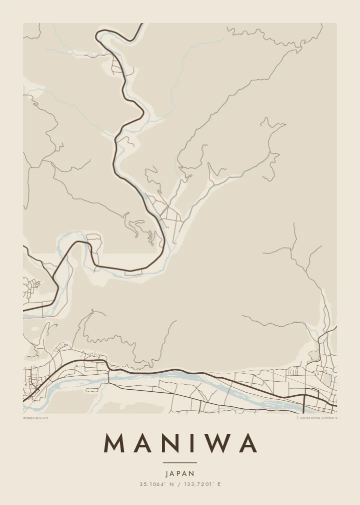
Maniwa covers a large area of the Chūgoku Mountains in northern Okayama Prefecture. Most of it is forested slope, so settlement follows the valleys. On a map, the city looks like several strands: the Asahi River and its tributaries run south, and roads, rail and small town centres line their banks. The highlands to the north are left almost empty.
The city includes the old Katsuyama quarter, where a preserved street of merchant houses is known for fabric noren curtains hung at the doorways. It also includes the Yubara hot springs and the Hiruzen highlands near the prefectural border. Maniwa has built a reputation for its timber industry and for using wood waste as biomass fuel.
A Maniwa map poster gives this spread-out mountain municipality a clear shape. River lines and valley roads carry the drawing, with small, dense clusters where the old towns sit. It is a quieter, more rural kind of Japanese map, and it looks all the better for it.
The river flows south through the city, and its valley holds most of the roads and homes. It is the main line tying the composition together.
The historic merchant quarter shows as a narrow, tightly built strip beside the river. Its fine grain contrasts with the open mountain land around it.
Toward Hiruzen, the map opens out into sparse roads across high ground, leaving generous white space at the top of the frame.
Mekem i blong yu
Putum wan dei, wan nem o wan laen blong yu, jenisim stael, saes o saed.
Fri preview i lo-resolusen mo i gat watermak. Prin mo HD file oli wok long 300 DPI, kasem 7,200 × 10,800 px, i no gat watermak.
From wanem Maniwa
A map of Maniwa suits people who know the valley towns, the hot springs or the highland roads. It captures a place where rivers and mountains shape everyday routes, which makes an unusually calm image for a wall.
Add your own title and subtitle, perhaps a family name or the date of a visit, and set the coordinates line. It is available in five styles: Classic black & white, Noir, Paper, Blueprint and Sand.
Odarem poster blong Maniwa| Saes blong prent | Rezolusen | Ol fael |
|---|---|---|
| 30 × 40 cm11.8 × 15.7″ | 3,543 × 4,724 px | PNG · PDF |
| 29.7 × 42 cm (A3)11.7 × 16.5″ | 3,508 × 4,961 px | PNG · PDF |
| 42 × 59.4 cm (A2)16.5 × 23.4″ | 4,961 × 7,016 px | PNG · PDF |
| 45.7 × 61 cm18 × 24″ | 5,400 × 7,200 px | PNG · PDF |
| 50 × 70 cm19.7 × 27.6″ | 5,906 × 8,268 px | PNG · PDF |
| 61 × 91.4 cm24 × 36″ | 7,200 × 10,800 px | PNG · PDF |
Blong yu save komperem, fri priviu i 900 px long waed, i gat wotamak mo i blong skrin nomo. Ol HD fael oli gat kasem 8× moa rezolusen long evri saed mo oli prent klia long ful saes blong poster.
Jusum wan style antap long pej, biaen jusum Prinim Poster — wan saes mo, sapos yu wantem, wan frem — o Digital HD Files. Pemen i wan step nomo, mo pej blong oda blong yu i apdet stret taem pemen i pas.
Mifala i prinim long gudfala 200 gsm matte pepa, long wan long 6 saes, statem long 30 × 40 cm kasem 24 × 36″. Prin poster i statem long $39, sipin i insaed finis.
Yes. Jusum wan strong wud frem long kala blak, waet, natural oak, o tudak wud. I gat glas we i no save brok isi, mo i rere blong hangem stret. Poster wetem frem i statem long $99, sipin i insaed finis.
Shipping i fri i go long 60+ kantri. Evri poster i kam from wan long ol prin pATna blong mifala we i stap kolosap moa long 30+ kantri, mo i save kasem yu long 3–7 wokin dei. Yu save lukluk stetus mo tracking long My Orders. Sam kantri i tekem 2–5 wik, mo long ol ples we mifala i no sendem yet, saet i talem yu bifo yu pem.
Sendem wan foto long mifala insaed 14 dei afta i kasem yu, mo mifala bae i prinim wan niufala fri o givim bak mane blong yu.
Yes. Long editor long pej ya, jenisim taetol, sabtaetol, mo laen blong koordinet i go long wanem yu wantem, mo jusum wan style mo saes. Prin, frem, mo digital oda oli yusum stret design blong yu.
Long $9 yu kasem 300 DPI PNG mo PDF file we i rere blong prinim, long evri 6 saes, i no gat watermak, mo yu save prinim long enisave ples. Yu no sua yet? Daonlodem wan fri preview wetem watermak fastaem.
Klosap
