Mandara highlands
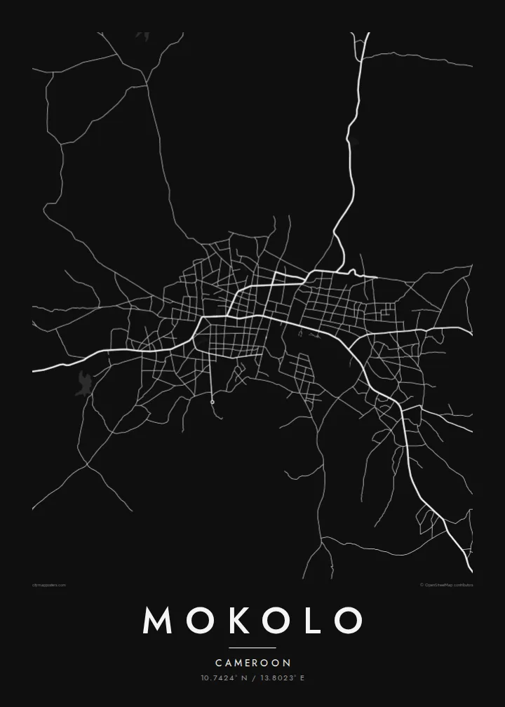
Rocky hills of the Mandara Mountains surround the town. They break the street pattern into irregular shapes and push roads around their slopes.
Simpol poster blong map · Cameroon
10.7424° N / 13.8023° E
A market town in Cameroon's Mandara Mountains, where dirt roads weave between rocky hills near the Nigerian border.



Wan taon, faef filing
Klikim wan style blong luk hem antap long wol. Evri style i sem prais nomo — sapos yu prinim, putum insaed frem, o daonlodem olsem HD file.
 Trufala pixel · 24 × 36″ prin file
Klia blong prent
Hemia i wan 100% haf blong trufala prin file. Evri poster — sapos prinim, putum insaed frem, o daonlodem — mifala i wokem long server blong mifala long 300 DPI, kasem 7,200 × 10,800 pixel, mekem se nomata ol smol rod tu oli klia gud long wan 24 × 36″ prin.
Long wol


Map
Mokolo lies in the Far North Region of Cameroon, among the Mandara Mountains that run along the border with Nigeria. It is the main town of the Mayo-Tsanaga department and a centre of trade for the surrounding highlands, home to the Mafa and several other peoples of the region.
From above, Mokolo sits in a landscape of scattered granite hills, terraced slopes and seasonal watercourses. The town's streets form an irregular network around a central market area, and roads leave in several directions towards villages in the mountains and the plains below. The land is dry for much of the year, and settlement is spread out.
A Mokolo map poster shows an inland mountain town as it really is: compact at its centre, open at its edges, shaped by rock and by the tracks that connect it to the countryside. Printed in monochrome, the uneven terrain and the branching roads make a quietly striking image for anyone with ties to northern Cameroon.
Rocky hills of the Mandara Mountains surround the town. They break the street pattern into irregular shapes and push roads around their slopes.
The densest part of Mokolo gathers around its central market, where streets converge. It is the clearest focal point on an otherwise loose map.
Dry riverbeds that fill during the rainy season cross the area, and their faint, winding lines add movement to the arid landscape around the town.
Mekem i blong yu
Putum wan dei, wan nem o wan laen blong yu, jenisim stael, saes o saed.
Fri preview i lo-resolusen mo i gat watermak. Prin mo HD file oli wok long 300 DPI, kasem 7,200 × 10,800 px, i no gat watermak.
From wanem Mokolo
The Far North of Cameroon is rarely shown in print. A map of Mokolo recognises a real place, whether you grew up there, worked in the region or have family in the Mandara highlands.
You can personalise the title, subtitle and coordinates line, and choose Classic black and white, Noir, Paper, Blueprint or Sand. The digital download comes without watermark, and printed posters are available with an optional wooden frame.
Odarem poster blong Mokolo| Saes blong prent | Rezolusen | Ol fael |
|---|---|---|
| 30 × 40 cm11.8 × 15.7″ | 3,543 × 4,724 px | PNG · PDF |
| 29.7 × 42 cm (A3)11.7 × 16.5″ | 3,508 × 4,961 px | PNG · PDF |
| 42 × 59.4 cm (A2)16.5 × 23.4″ | 4,961 × 7,016 px | PNG · PDF |
| 45.7 × 61 cm18 × 24″ | 5,400 × 7,200 px | PNG · PDF |
| 50 × 70 cm19.7 × 27.6″ | 5,906 × 8,268 px | PNG · PDF |
| 61 × 91.4 cm24 × 36″ | 7,200 × 10,800 px | PNG · PDF |
Blong yu save komperem, fri priviu i 900 px long waed, i gat wotamak mo i blong skrin nomo. Ol HD fael oli gat kasem 8× moa rezolusen long evri saed mo oli prent klia long ful saes blong poster.
Jusum wan style antap long pej, biaen jusum Prinim Poster — wan saes mo, sapos yu wantem, wan frem — o Digital HD Files. Pemen i wan step nomo, mo pej blong oda blong yu i apdet stret taem pemen i pas.
Mifala i prinim long gudfala 200 gsm matte pepa, long wan long 6 saes, statem long 30 × 40 cm kasem 24 × 36″. Prin poster i statem long $39, sipin i insaed finis.
Yes. Jusum wan strong wud frem long kala blak, waet, natural oak, o tudak wud. I gat glas we i no save brok isi, mo i rere blong hangem stret. Poster wetem frem i statem long $99, sipin i insaed finis.
Shipping i fri i go long 60+ kantri. Evri poster i kam from wan long ol prin pATna blong mifala we i stap kolosap moa long 30+ kantri, mo i save kasem yu long 3–7 wokin dei. Yu save lukluk stetus mo tracking long My Orders. Sam kantri i tekem 2–5 wik, mo long ol ples we mifala i no sendem yet, saet i talem yu bifo yu pem.
Sendem wan foto long mifala insaed 14 dei afta i kasem yu, mo mifala bae i prinim wan niufala fri o givim bak mane blong yu.
Yes. Long editor long pej ya, jenisim taetol, sabtaetol, mo laen blong koordinet i go long wanem yu wantem, mo jusum wan style mo saes. Prin, frem, mo digital oda oli yusum stret design blong yu.
Long $9 yu kasem 300 DPI PNG mo PDF file we i rere blong prinim, long evri 6 saes, i no gat watermak, mo yu save prinim long enisave ples. Yu no sua yet? Daonlodem wan fri preview wetem watermak fastaem.
Klosap
