Ming city wall
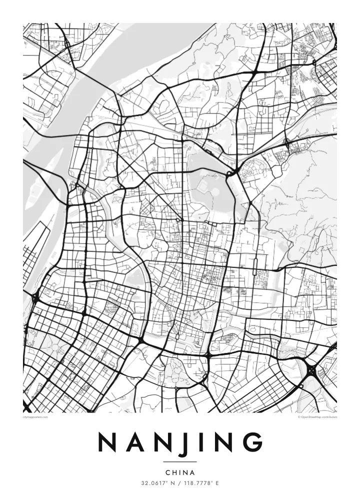
One of the longest surviving city walls in the world, following ridges and lakeshores for more than twenty kilometres. On the poster it forms an irregular loop around the historic core.
Simpol poster blong map · China
32.0617° N / 118.7778° E
The Yangtze sweeping past a Ming-walled city, with Xuanwu Lake pressed against the wall and Purple Mountain rising east.


Wan taon, faef filing
Klikim wan style blong luk hem antap long wol. Evri style i sem prais nomo — sapos yu prinim, putum insaed frem, o daonlodem olsem HD file.
 Trufala pixel · 24 × 36″ prin file
Klia blong prent
Hemia i wan 100% haf blong trufala prin file. Evri poster — sapos prinim, putum insaed frem, o daonlodem — mifala i wokem long server blong mifala long 300 DPI, kasem 7,200 × 10,800 pixel, mekem se nomata ol smol rod tu oli klia gud long wan 24 × 36″ prin.
Long wol


Map
Nanjing lies on the southern bank of the Yangtze, where the river turns northeast, and the city has faced the water for well over two thousand years. Its most distinctive feature from above is the Ming city wall, built in the fourteenth century and still standing along much of its length. The line bends irregularly around hills and lakes rather than forming a neat rectangle.
Inside and around the wall, the city is full of water. Xuanwu Lake lies just beyond the northern stretch, the Qinhuai River curves through the south past the Confucius Temple district, and moats follow the old fortifications. East of the centre, Purple Mountain carries the Sun Yat-sen Mausoleum and the Ming Xiaoling tomb within a large forested area, which reads as open space on the map.
Nanjing served as the capital of China under several dynasties and governments, which explains its ceremonial avenues and monumental gates. Zhonghua Gate in the south is one of the largest surviving city gates in China. A Nanjing map poster frames the river, the wall and the mountain together, the three features most often cited in explaining why the city was chosen as a capital.
One of the longest surviving city walls in the world, following ridges and lakeshores for more than twenty kilometres. On the poster it forms an irregular loop around the historic core.
The river that loops through southern Nanjing, running both outside and inside the wall, past the Confucius Temple and its old lanes. Its bends define the southern edge of the old city.
The forested mountain east of the walls holds the Sun Yat-sen Mausoleum, the Ming Xiaoling tomb and an observatory. On the map it appears as a large, calm area of paths and slopes.
Mekem i blong yu
Putum wan dei, wan nem o wan laen blong yu, jenisim stael, saes o saed.
Fri preview i lo-resolusen mo i gat watermak. Prin mo HD file oli wok long 300 DPI, kasem 7,200 × 10,800 px, i no gat watermak.
From wanem Nanjing
Nanjing is a city people study in, and many graduates of its universities carry a lasting attachment to its plane-tree avenues and old gates. A map of the walled city is a way of keeping those years in view, long after leaving.
Set your own title and subtitle, perhaps a graduation year, and edit the coordinates line if you like. Choose from five styles; Paper and Sand suit the old wall, Blueprint the river crossings. Order the HD files or a matte print with an optional wooden frame.
Odarem poster blong Nanjing| Saes blong prent | Rezolusen | Ol fael |
|---|---|---|
| 30 × 40 cm11.8 × 15.7″ | 3,543 × 4,724 px | PNG · PDF |
| 29.7 × 42 cm (A3)11.7 × 16.5″ | 3,508 × 4,961 px | PNG · PDF |
| 42 × 59.4 cm (A2)16.5 × 23.4″ | 4,961 × 7,016 px | PNG · PDF |
| 45.7 × 61 cm18 × 24″ | 5,400 × 7,200 px | PNG · PDF |
| 50 × 70 cm19.7 × 27.6″ | 5,906 × 8,268 px | PNG · PDF |
| 61 × 91.4 cm24 × 36″ | 7,200 × 10,800 px | PNG · PDF |
Blong yu save komperem, fri priviu i 900 px long waed, i gat wotamak mo i blong skrin nomo. Ol HD fael oli gat kasem 8× moa rezolusen long evri saed mo oli prent klia long ful saes blong poster.
Jusum wan style antap long pej, biaen jusum Prinim Poster — wan saes mo, sapos yu wantem, wan frem — o Digital HD Files. Pemen i wan step nomo, mo pej blong oda blong yu i apdet stret taem pemen i pas.
Mifala i prinim long gudfala 200 gsm matte pepa, long wan long 6 saes, statem long 30 × 40 cm kasem 24 × 36″. Prin poster i statem long $39, sipin i insaed finis.
Yes. Jusum wan strong wud frem long kala blak, waet, natural oak, o tudak wud. I gat glas we i no save brok isi, mo i rere blong hangem stret. Poster wetem frem i statem long $99, sipin i insaed finis.
Shipping i fri i go long 60+ kantri. Evri poster i kam from wan long ol prin pATna blong mifala we i stap kolosap moa long 30+ kantri, mo i save kasem yu long 3–7 wokin dei. Yu save lukluk stetus mo tracking long My Orders. Sam kantri i tekem 2–5 wik, mo long ol ples we mifala i no sendem yet, saet i talem yu bifo yu pem.
Sendem wan foto long mifala insaed 14 dei afta i kasem yu, mo mifala bae i prinim wan niufala fri o givim bak mane blong yu.
Yes. Long editor long pej ya, jenisim taetol, sabtaetol, mo laen blong koordinet i go long wanem yu wantem, mo jusum wan style mo saes. Prin, frem, mo digital oda oli yusum stret design blong yu.
Long $9 yu kasem 300 DPI PNG mo PDF file we i rere blong prinim, long evri 6 saes, i no gat watermak, mo yu save prinim long enisave ples. Yu no sua yet? Daonlodem wan fri preview wetem watermak fastaem.
Klosap
