La Soufrière
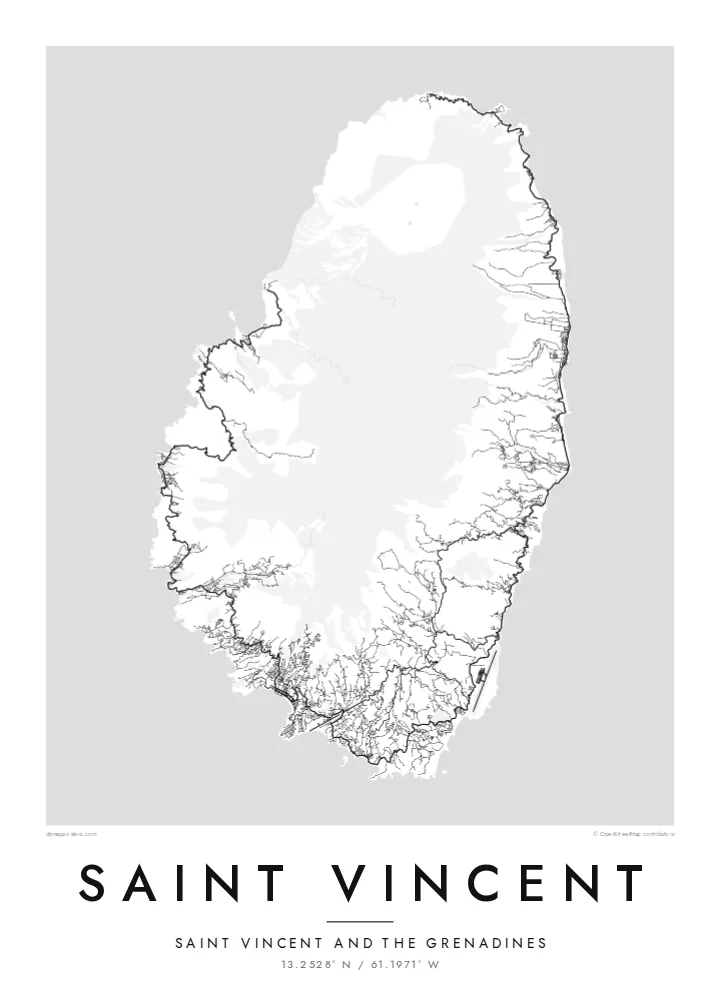
The volcano occupies the northern end of the island. Few roads approach it, so on the map it is a broad, open area of high ground.
Simpol poster blong map · St. Vincent & Grenadines
13.2528° N / 61.1971° W
A green volcanic island shaped like a teardrop, with La Soufrière in the north and Kingstown in the south


Wan taon, faef filing
Klikim wan style blong luk hem antap long wol. Evri style i sem prais nomo — sapos yu prinim, putum insaed frem, o daonlodem olsem HD file.
 Trufala pixel · 24 × 36″ prin file
Klia blong prent
Hemia i wan 100% haf blong trufala prin file. Evri poster — sapos prinim, putum insaed frem, o daonlodem — mifala i wokem long server blong mifala long 300 DPI, kasem 7,200 × 10,800 pixel, mekem se nomata ol smol rod tu oli klia gud long wan 24 × 36″ prin.
Long wol


Map
Saint Vincent is the main island of Saint Vincent and the Grenadines in the eastern Caribbean. Seen from above it is a compact teardrop of steep, forested ridges. The land rises toward La Soufrière, the active volcano that dominates the northern end. Rivers run down from the central highlands in deep valleys to both coasts.
The settled pattern follows the shoreline. Roads run up the leeward west coast and the windward east coast, but they do not meet across the rugged north, so the map shows a loop that stays open at the top. Kingstown, the capital, lies around a bay in the southwest, where the streets are densest.
La Soufrière erupted in 2021 and reshaped the northern slopes. Kingstown's Botanical Gardens, founded in the 1760s, are among the oldest in the Americas. A Saint Vincent map poster brings out the contrast between the dense southern coast and the empty volcanic north.
The volcano occupies the northern end of the island. Few roads approach it, so on the map it is a broad, open area of high ground.
The capital's streets gather around a sheltered bay in the southwest, forming the island's densest and most detailed part.
Separate roads trace the leeward and windward coasts and stop short of the north. Together they give the island an open, horseshoe-like pattern.
Mekem i blong yu
Putum wan dei, wan nem o wan laen blong yu, jenisim stael, saes o saed.
Fri preview i lo-resolusen mo i gat watermak. Prin mo HD file oli wok long 300 DPI, kasem 7,200 × 10,800 px, i no gat watermak.
From wanem Saint Vincent
For Vincentians at home and abroad, this map is a portrait of home in one clear shape. Visitors keep it as a record of the island between sailing trips through the Grenadines. The teardrop outline reads well at every size.
Add a title, a subtitle and a coordinates line, such as a family village, a year or a message. Choose Classic black & white, Noir, Paper, Blueprint or Sand.
Odarem poster blong Saint Vincent| Saes blong prent | Rezolusen | Ol fael |
|---|---|---|
| 30 × 40 cm11.8 × 15.7″ | 3,543 × 4,724 px | PNG · PDF |
| 29.7 × 42 cm (A3)11.7 × 16.5″ | 3,508 × 4,961 px | PNG · PDF |
| 42 × 59.4 cm (A2)16.5 × 23.4″ | 4,961 × 7,016 px | PNG · PDF |
| 45.7 × 61 cm18 × 24″ | 5,400 × 7,200 px | PNG · PDF |
| 50 × 70 cm19.7 × 27.6″ | 5,906 × 8,268 px | PNG · PDF |
| 61 × 91.4 cm24 × 36″ | 7,200 × 10,800 px | PNG · PDF |
Blong yu save komperem, fri priviu i 900 px long waed, i gat wotamak mo i blong skrin nomo. Ol HD fael oli gat kasem 8× moa rezolusen long evri saed mo oli prent klia long ful saes blong poster.
Jusum wan style antap long pej, biaen jusum Prinim Poster — wan saes mo, sapos yu wantem, wan frem — o Digital HD Files. Pemen i wan step nomo, mo pej blong oda blong yu i apdet stret taem pemen i pas.
Mifala i prinim long gudfala 200 gsm matte pepa, long wan long 6 saes, statem long 30 × 40 cm kasem 24 × 36″. Prin poster i statem long $39, sipin i insaed finis.
Yes. Jusum wan strong wud frem long kala blak, waet, natural oak, o tudak wud. I gat glas we i no save brok isi, mo i rere blong hangem stret. Poster wetem frem i statem long $99, sipin i insaed finis.
Shipping i fri i go long 60+ kantri. Evri poster i kam from wan long ol prin pATna blong mifala we i stap kolosap moa long 30+ kantri, mo i save kasem yu long 3–7 wokin dei. Yu save lukluk stetus mo tracking long My Orders. Sam kantri i tekem 2–5 wik, mo long ol ples we mifala i no sendem yet, saet i talem yu bifo yu pem.
Sendem wan foto long mifala insaed 14 dei afta i kasem yu, mo mifala bae i prinim wan niufala fri o givim bak mane blong yu.
Yes. Long editor long pej ya, jenisim taetol, sabtaetol, mo laen blong koordinet i go long wanem yu wantem, mo jusum wan style mo saes. Prin, frem, mo digital oda oli yusum stret design blong yu.
Long $9 yu kasem 300 DPI PNG mo PDF file we i rere blong prinim, long evri 6 saes, i no gat watermak, mo yu save prinim long enisave ples. Yu no sua yet? Daonlodem wan fri preview wetem watermak fastaem.
Klosap
