Old highway line
The route of the former Ōshū Kaidō runs through the centre of town, and the older streets still follow its direction from south to north.
Simpol poster blong map · Japan
36.6833° N / 139.9667° E
A former post town on Tochigi's plain, where a railway line and old highway run through a quilt of rice fields.




Wan taon, faef filing
Klikim wan style blong luk hem antap long wol. Evri style i sem prais nomo — sapos yu prinim, putum insaed frem, o daonlodem olsem HD file.
 Trufala pixel · 24 × 36″ prin file
Klia blong prent
Hemia i wan 100% haf blong trufala prin file. Evri poster — sapos prinim, putum insaed frem, o daonlodem — mifala i wokem long server blong mifala long 300 DPI, kasem 7,200 × 10,800 pixel, mekem se nomata ol smol rod tu oli klia gud long wan 24 × 36″ prin.
Long wol


Map
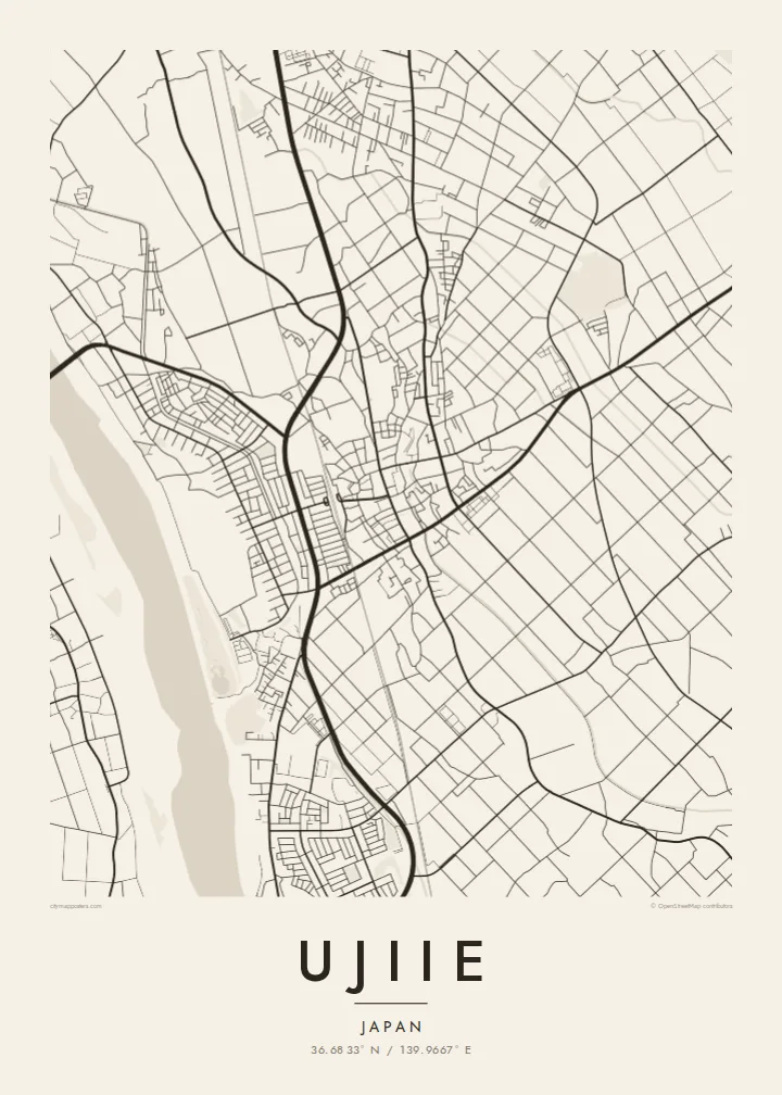
Ujiie lies on the plain north of Utsunomiya in Tochigi Prefecture and today forms part of Sakura City, created in 2005 when Ujiie merged with neighbouring Kitsuregawa. From above, the town is a modest cluster of streets set in wide farmland, with rice paddies divided into neat rectangles that reach almost to the doorsteps of the residential blocks.
In the Edo period Ujiie was a post town on the Ōshū Kaidō, the main road leading north from Edo. The line of that old route can still be traced through the centre, where the densest streets run parallel to it. Today the JR line running north from Utsunomiya stops at Ujiie Station, and the railway draws a firm straight line across the map.
Beyond the town, the pattern of paddies, farm roads and small watercourses continues in every direction, broken by clusters of houses and patches of woodland. A Ujiie map poster shows the balance between an old road town and the agricultural grid of the Kantō plain around it.
The route of the former Ōshū Kaidō runs through the centre of town, and the older streets still follow its direction from south to north.
The railway crosses the town in a long straight line, with the station area forming a secondary focus of streets and buildings.
Rectangular rice fields surround the town on all sides, creating a fine, regular pattern that frames the built-up area like a woven border.
Mekem i blong yu
Putum wan dei, wan nem o wan laen blong yu, jenisim stael, saes o saed.
Fri preview i lo-resolusen mo i gat watermak. Prin mo HD file oli wok long 300 DPI, kasem 7,200 × 10,800 px, i no gat watermak.
From wanem Ujiie
For anyone who grew up in Ujiie or has family in Sakura City, this map offers a calm, graphic portrait of home, with the rice fields and railway that shape daily life there.
Personalise the title, subtitle and coordinates line with a name, a date or a line in Japanese. Choose Classic black & white, Noir, Paper, Blueprint or Sand, and download $9 HD files or order a matte print, with or without a wooden frame.
Odarem poster blong Ujiie| Saes blong prent | Rezolusen | Ol fael |
|---|---|---|
| 30 × 40 cm11.8 × 15.7″ | 3,543 × 4,724 px | PNG · PDF |
| 29.7 × 42 cm (A3)11.7 × 16.5″ | 3,508 × 4,961 px | PNG · PDF |
| 42 × 59.4 cm (A2)16.5 × 23.4″ | 4,961 × 7,016 px | PNG · PDF |
| 45.7 × 61 cm18 × 24″ | 5,400 × 7,200 px | PNG · PDF |
| 50 × 70 cm19.7 × 27.6″ | 5,906 × 8,268 px | PNG · PDF |
| 61 × 91.4 cm24 × 36″ | 7,200 × 10,800 px | PNG · PDF |
Blong yu save komperem, fri priviu i 900 px long waed, i gat wotamak mo i blong skrin nomo. Ol HD fael oli gat kasem 8× moa rezolusen long evri saed mo oli prent klia long ful saes blong poster.
Jusum wan style antap long pej, biaen jusum Prinim Poster — wan saes mo, sapos yu wantem, wan frem — o Digital HD Files. Pemen i wan step nomo, mo pej blong oda blong yu i apdet stret taem pemen i pas.
Mifala i prinim long gudfala 200 gsm matte pepa, long wan long 6 saes, statem long 30 × 40 cm kasem 24 × 36″. Prin poster i statem long $39, sipin i insaed finis.
Yes. Jusum wan strong wud frem long kala blak, waet, natural oak, o tudak wud. I gat glas we i no save brok isi, mo i rere blong hangem stret. Poster wetem frem i statem long $99, sipin i insaed finis.
Shipping i fri i go long 60+ kantri. Evri poster i kam from wan long ol prin pATna blong mifala we i stap kolosap moa long 30+ kantri, mo i save kasem yu long 3–7 wokin dei. Yu save lukluk stetus mo tracking long My Orders. Sam kantri i tekem 2–5 wik, mo long ol ples we mifala i no sendem yet, saet i talem yu bifo yu pem.
Sendem wan foto long mifala insaed 14 dei afta i kasem yu, mo mifala bae i prinim wan niufala fri o givim bak mane blong yu.
Yes. Long editor long pej ya, jenisim taetol, sabtaetol, mo laen blong koordinet i go long wanem yu wantem, mo jusum wan style mo saes. Prin, frem, mo digital oda oli yusum stret design blong yu.
Long $9 yu kasem 300 DPI PNG mo PDF file we i rere blong prinim, long evri 6 saes, i no gat watermak, mo yu save prinim long enisave ples. Yu no sua yet? Daonlodem wan fri preview wetem watermak fastaem.
Klosap
