Misumi West Port
A carefully engineered Meiji-era harbour of cut stone, with canals and quays, lies near the tip of the peninsula. It is one of the few ports of its era to survive largely intact.
Simpol poster blong map · Japan
32.6222° N / 130.6618° E
A coastal city at the root of the Uto Peninsula, facing two inland seas with a Meiji-era stone port at its western tip.



Wan taon, faef filing
Klikim wan style blong luk hem antap long wol. Evri style i sem prais nomo — sapos yu prinim, putum insaed frem, o daonlodem olsem HD file.
 Trufala pixel · 24 × 36″ prin file
Klia blong prent
Hemia i wan 100% haf blong trufala prin file. Evri poster — sapos prinim, putum insaed frem, o daonlodem — mifala i wokem long server blong mifala long 300 DPI, kasem 7,200 × 10,800 pixel, mekem se nomata ol smol rod tu oli klia gud long wan 24 × 36″ prin.
Long wol


Map
Uki sits in Kumamoto Prefecture at the base of the Uto Peninsula, which reaches west toward the Amakusa islands. On a map the city stretches along the peninsula. The Ariake Sea lies to the north and the Yatsushiro Sea to the south, and small towns and fishing harbours are strung along both shores. Hills run down the centre of the peninsula, with farmland and orchards on their lower slopes.
At the western end lies Misumi West Port, a stone harbour built in the late nineteenth century to Dutch designs. It is now a UNESCO World Heritage site as part of the Sites of Japan's Meiji Industrial Revolution. The Yatsushiro Sea off Uki's coast is also associated with the shiranui, a rare optical phenomenon of flickering lights on the water described in local tradition.
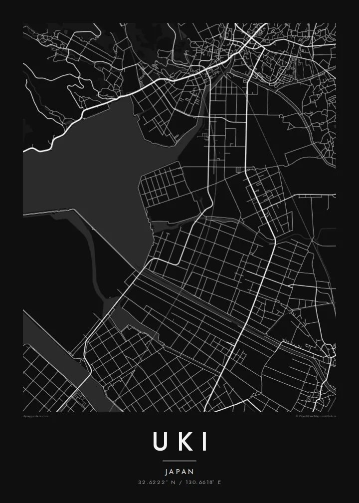
A Uki map poster traces a long, narrow city defined by its shorelines. Coastal roads follow the edge of the land, while a railway runs out along the peninsula toward the port. Smaller settlements appear as clusters where valleys meet the sea. The water surrounding almost every side gives the map a strong, clean silhouette.
A carefully engineered Meiji-era harbour of cut stone, with canals and quays, lies near the tip of the peninsula. It is one of the few ports of its era to survive largely intact.
The Ariake Sea and the Yatsushiro Sea border the city on opposite sides. On the map the peninsula becomes a long strip of land between two open bodies of water.
Hills run along the centre of the peninsula, with roads and small valleys branching toward the coasts. This inland ridge divides the city's northern and southern shores.
Mekem i blong yu
Putum wan dei, wan nem o wan laen blong yu, jenisim stael, saes o saed.
Fri preview i lo-resolusen mo i gat watermak. Prin mo HD file oli wok long 300 DPI, kasem 7,200 × 10,800 px, i no gat watermak.
From wanem Uki
Uki is a place of coastal drives, fishing harbours and evenings looking across the water toward Amakusa. A map of the peninsula keeps that geography in view for residents, for visitors and for anyone with family roots in Kumamoto.
Choose Classic black & white, Noir, Paper, Blueprint or Sand, and add your own title, subtitle and coordinates. The free preview lets you check the framing first. HD files cost $9, and printed posters can ship from partners in more than 30 countries.
Odarem poster blong Uki| Saes blong prent | Rezolusen | Ol fael |
|---|---|---|
| 30 × 40 cm (11.8 × 15.7″) | 3,543 × 4,724 px | PNG · PDF |
| 29.7 × 42 cm (A3, 11.7 × 16.5″) | 3,508 × 4,961 px | PNG · PDF |
| 42 × 59.4 cm (A2, 16.5 × 23.4″) | 4,961 × 7,016 px | PNG · PDF |
| 45.7 × 61 cm (18 × 24″) | 5,400 × 7,200 px | PNG · PDF |
| 50 × 70 cm (19.7 × 27.6″) | 5,906 × 8,268 px | PNG · PDF |
| 61 × 91.4 cm (24 × 36″) | 7,200 × 10,800 px | PNG · PDF |
Blong yu save komperem, fri priviu i 900 px long waed, i gat wotamak mo i blong skrin nomo. Ol HD fael oli gat kasem 8× moa rezolusen long evri saed mo oli prent klia long ful saes blong poster.
Jusum wan style antap long pej, biaen jusum Prinim Poster — wan saes mo, sapos yu wantem, wan frem — o Digital HD Files. Pemen i wan step nomo, mo pej blong oda blong yu i apdet stret taem pemen i pas.
Mifala i prinim long gudfala 200 gsm matte pepa, long wan long 6 saes, statem long 30 × 40 cm kasem 24 × 36″. Prin poster i statem long $39, sipin i insaed finis.
Yes. Jusum wan strong wud frem long kala blak, waet, natural oak, o tudak wud. I gat glas we i no save brok isi, mo i rere blong hangem stret. Poster wetem frem i statem long $99, sipin i insaed finis.
Delivri blong poster i fri long olgeta ples long wol. Wan wan poster i prin long wan long ol prin patna blong mifala we i kolosap moa long yu, long moa long 30 kantri, mo bambae i kasem yu long 3–7 wokdei. Yu save lukluk stetes mo trakin long My Orders. Sam kantri i tekem 2–5 wik, mo long ol ples we mifala i no save sendem yet, saet i talem yu bifo yu pem.
Sendem wan foto long mifala insaed 14 dei afta i kasem yu, mo mifala bae i prinim wan niufala fri o givim bak mane blong yu.
Yes. Long editor long pej ya, jenisim taetol, sabtaetol, mo laen blong koordinet i go long wanem yu wantem, mo jusum wan style mo saes. Prin, frem, mo digital oda oli yusum stret design blong yu.
Long $9 yu kasem 300 DPI PNG mo PDF file we i rere blong prinim, long evri 6 saes, i no gat watermak, mo yu save prinim long enisave ples. Yu no sua yet? Daonlodem wan fri preview wetem watermak fastaem.
Klosap
