Mays Island
A narrow island in the Cedar River holding civic buildings, linked to both banks by bridges. On the poster it appears as a small block of streets floating in the middle of the water.
Minimalistický plakát s mapou · Spojené státy
42.0083° N / 91.6441° W
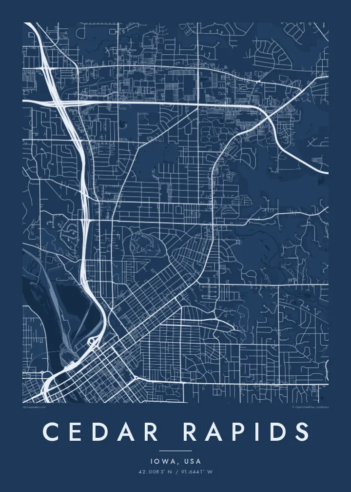
A river city split diagonally by the Cedar, with an island at its centre and four quadrants of numbered streets.



Jedno město, pět nálad
Klepnutím na styl si ho prohlédnete na zdi. Všechny styly stojí stejně – jako tisk, v rámu i jako HD soubory.
 Skutečné pixely · tisková předloha 24 × 36″
Ostré i v tisku
Toto je 100% výřez ze skutečné tiskové předlohy. Každý plakát – tištěný, v rámu i ke stažení – vykreslujeme na našich serverech ve 300 DPI, až 7,200 × 10,800 pixelů, takže i ty nejjemnější uličky zůstanou ostré i na tisku 24 × 36″.
Na zdi


Mapa
From above, Cedar Rapids is organised around the Cedar River, which cuts through the city from northwest to southeast. Streets and avenues are numbered and labelled by quadrant (NE, NW, SE and SW), so the map reads as four grids meeting at the water. Downtown sits on the east bank, and a series of bridges connects it to the west side and to Mays Island in the middle of the channel.
Mays Island is the detail most people remember. Civic buildings stand on it, which makes Cedar Rapids one of very few American cities with its seat of government on a river island. A short walk upstream, the large Quaker Oats plant reflects the city's long connection to grain processing, and on some days the smell of toasted oats drifts across downtown.
A Cedar Rapids map poster shows the whole arrangement at once: the river, the island, Interstate 380 curving through the centre and residential blocks spreading toward the farmland of eastern Iowa. The painter Grant Wood lived and worked here, and his ordered, clean-lined view of the Midwest suits the calm geometry of a black-and-white street map.
A narrow island in the Cedar River holding civic buildings, linked to both banks by bridges. On the poster it appears as a small block of streets floating in the middle of the water.
Numbered streets and avenues divide into NE, NW, SE and SW sections. The result is four slightly offset grids that meet along the river and give the map its structure.
The interstate runs north to south through the city and crosses the river close to downtown. Its long, smooth curves stand out against the square blocks on either side.
Přizpůsobte si ho
Přidejte datum, jméno nebo vlastní text, změňte styl, velikost či orientaci.
Bezplatný náhled má nízké rozlišení a vodoznak. Tisky a HD soubory se vykreslují ve 300 DPI, až 7,200 × 10,800 px, bez vodoznaku.
Proč Cedar Rapids
Cedar Rapids maps tend to go to people with a long attachment to the city: those who grew up in its quadrants, worked in its plants and offices, or helped rebuild after the 2008 flood. The river and the island make the layout recognisable even without labels.
The title, subtitle and coordinates line can all be personalised, for example with a family name or a date that matters, and the map comes in five styles: Classic black & white, Noir, Paper, Blueprint and Sand. Choose the $9 digital HD files or a printed poster with an optional wooden frame.
Objednat plakát Cedar Rapids| Velikost tisku | Rozlišení | Soubory |
|---|---|---|
| 30 × 40 cm (11.8 × 15.7″) | 3,543 × 4,724 px | PNG · PDF |
| 29.7 × 42 cm (A3, 11.7 × 16.5″) | 3,508 × 4,961 px | PNG · PDF |
| 42 × 59.4 cm (A2, 16.5 × 23.4″) | 4,961 × 7,016 px | PNG · PDF |
| 45.7 × 61 cm (18 × 24″) | 5,400 × 7,200 px | PNG · PDF |
| 50 × 70 cm (19.7 × 27.6″) | 5,906 × 8,268 px | PNG · PDF |
| 61 × 91.4 cm (24 × 36″) | 7,200 × 10,800 px | PNG · PDF |
Pro srovnání: bezplatný náhled má šířku 900 px, obsahuje vodoznak a je určen pro obrazovky. HD soubory mají až 8× vyšší rozlišení v každém směru a vytisknou se čistě i v plné velikosti plakátu.
Nahoře na stránce vyberte styl a poté zvolte Tištěný plakát – velikost a případně rám – nebo Digitální HD soubory. Objednávka proběhne na jeden krok a stránka objednávky se aktualizuje hned po zaplacení.
Tiskne se na prémiový matný papír 200 g/m² v jedné ze šesti velikostí, od 30 × 40 cm až po 24 × 36″. Tištěné plakáty začínají na {printFrom} s dopravou v ceně.
Ano. Vyberte si masivní dřevěný rám v černé, bílé, přírodní dubové nebo tmavé dřevěné variantě. Součástí je nerozbitné sklo a plakát je hned připravený k zavěšení. Plakáty v rámu začínají na {framedFrom} s dopravou v ceně.
Doprava je po celém světě zdarma. Každý plakát vytiskne nejbližší z našich tiskových partnerů ve více než 30 zemích a obvykle dorazí do 3–7 pracovních dnů. Stav zásilky a sledování najdete v sekci Moje objednávky. Do některých zemí trvá doručení 2–5 týdnů a tam, kam zatím nedoručujeme, vás web upozorní ještě před platbou.
Do 14 dnů od doručení nám pošlete fotku a my ho zdarma vytiskneme znovu nebo vám vrátíme peníze.
Ano. V editoru na této stránce si upravte nadpis, podnadpis a řádek se souřadnicemi podle libosti a vyberte styl a velikost. Tištěné, zarámované i digitální objednávky vždy odpovídají přesně vašemu návrhu.
Za $9 získáte soubory PNG ve 300 DPI a PDF připravené k tisku ve všech šesti velikostech, bez vodoznaku, k tisku kdekoli. Ještě si nejste jistí? Nejdřív si stáhněte bezplatný náhled s vodoznakem.
