Køge Bay shoreline
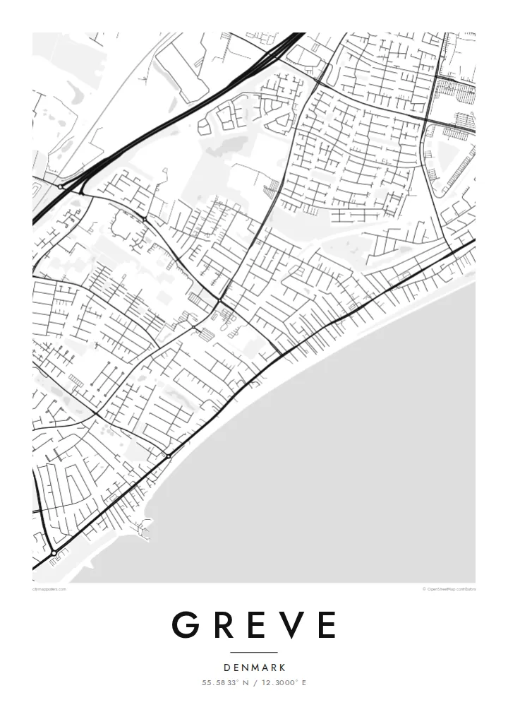
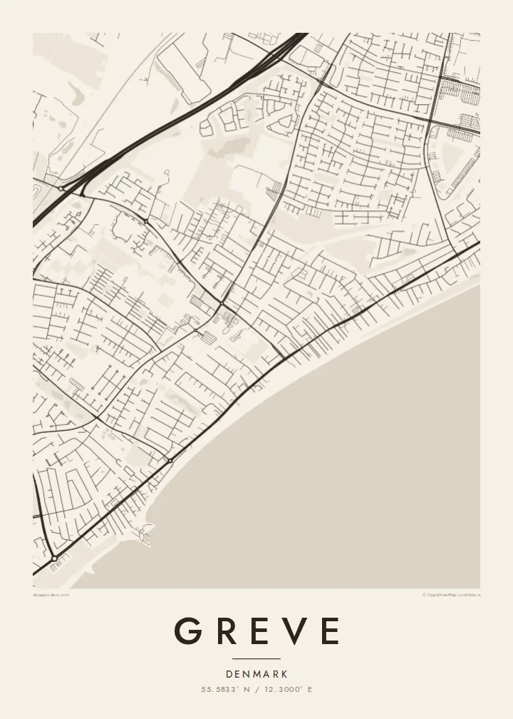
The eastern edge of the map is one long, gently curving coastline. The open water of Køge Bay takes up the side of the frame and gives the composition a calm, horizontal weight.
Minimalistický plakát s mapou · Dánsko
55.5833° N / 12.3000° E
A long, straight shoreline on Køge Bay, with a railway and a motorway running beside it and low suburban streets filling the land between



Jedno město, pět nálad
Klepnutím na styl si ho prohlédnete na zdi. Všechny styly stojí stejně – jako tisk, v rámu i jako HD soubory.
 Skutečné pixely · tisková předloha 24 × 36″
Ostré i v tisku
Toto je 100% výřez ze skutečné tiskové předlohy. Každý plakát – tištěný, v rámu i ke stažení – vykreslujeme na našich serverech ve 300 DPI, až 7,200 × 10,800 pixelů, takže i ty nejjemnější uličky zůstanou ostré i na tisku 24 × 36″.
Na zdi


Mapa
Seen from above, Greve is shaped by lines that run side by side. The coast of Køge Bay runs roughly north to south along its eastern edge. Just inland, a railway follows the same direction, and further west a motorway does too. Between these parallel strokes, the town fills in with residential streets, cul-de-sacs and small green pockets. The result is a pattern that is long and narrow and clearly tied to the water.
Much of Greve's shoreline is part of Køge Bugt Strandpark, a man-made beach park built along the bay in the late twentieth century. It brought sand, dunes and sheltered lagoons to a coast that had been flat and marshy. On the map, this shows up as a smooth outer edge of beach with a thin band of enclosed water behind it. It is one of the most distinctive shapes around Copenhagen's southern suburbs.
A Greve map poster shows how the town grew up as a coastal suburb of the capital. Denser pieces of street pattern gather around the stations. Older village cores sit a little further inland, and newer housing spreads in loops and branches between them. Printed in plain black and white, the drawing reads like a cross-section of Zealand's east coast, running from open water through beach and rail to farmland at the far edge.
The eastern edge of the map is one long, gently curving coastline. The open water of Køge Bay takes up the side of the frame and gives the composition a calm, horizontal weight.
Behind the reshaped beach, narrow lagoons and dunes form a second, inner line parallel to the sea. This double edge is easy to spot and sets Greve apart from neighbouring stretches of coast.
A suburban railway and a major motorway both run north to south through the municipality. They divide the town into long bands, with residential streets tucked between them and bridges or underpasses stitching the sides together.
Přizpůsobte si ho
Přidejte datum, jméno nebo vlastní text, změňte styl, velikost či orientaci.
Bezplatný náhled má nízké rozlišení a vodoznak. Tisky a HD soubory se vykreslují ve 300 DPI, až 7,200 × 10,800 px, bez vodoznaku.
Proč Greve
Greve is where many people have their first home outside Copenhagen, or their summer mornings on the beach. For them, this map is a quiet reminder of walks along the bay and train rides into the city. It also marks the part of the coast they still think of as theirs.
You can personalise the title, subtitle and coordinates line with a street name, a date or a family name. Then choose one of five styles: Classic black & white, Noir, Paper, Blueprint or Sand. Download the HD files for $9, or order a printed poster with an optional wooden frame.
Objednat plakát Greve| Velikost tisku | Rozlišení | Soubory |
|---|---|---|
| 30 × 40 cm (11.8 × 15.7″) | 3,543 × 4,724 px | PNG · PDF |
| 29.7 × 42 cm (A3, 11.7 × 16.5″) | 3,508 × 4,961 px | PNG · PDF |
| 42 × 59.4 cm (A2, 16.5 × 23.4″) | 4,961 × 7,016 px | PNG · PDF |
| 45.7 × 61 cm (18 × 24″) | 5,400 × 7,200 px | PNG · PDF |
| 50 × 70 cm (19.7 × 27.6″) | 5,906 × 8,268 px | PNG · PDF |
| 61 × 91.4 cm (24 × 36″) | 7,200 × 10,800 px | PNG · PDF |
Pro srovnání: bezplatný náhled má šířku 900 px, obsahuje vodoznak a je určen pro obrazovky. HD soubory mají až 8× vyšší rozlišení v každém směru a vytisknou se čistě i v plné velikosti plakátu.
Nahoře na stránce vyberte styl a poté zvolte Tištěný plakát – velikost a případně rám – nebo Digitální HD soubory. Objednávka proběhne na jeden krok a stránka objednávky se aktualizuje hned po zaplacení.
Tiskne se na prémiový matný papír 200 g/m² v jedné ze šesti velikostí, od 30 × 40 cm až po 24 × 36″. Tištěné plakáty začínají na {printFrom} s dopravou v ceně.
Ano. Vyberte si masivní dřevěný rám v černé, bílé, přírodní dubové nebo tmavé dřevěné variantě. Součástí je nerozbitné sklo a plakát je hned připravený k zavěšení. Plakáty v rámu začínají na {framedFrom} s dopravou v ceně.
Doprava je po celém světě zdarma. Každý plakát vytiskne nejbližší z našich tiskových partnerů ve více než 30 zemích a obvykle dorazí do 3–7 pracovních dnů. Stav zásilky a sledování najdete v sekci Moje objednávky. Do některých zemí trvá doručení 2–5 týdnů a tam, kam zatím nedoručujeme, vás web upozorní ještě před platbou.
Do 14 dnů od doručení nám pošlete fotku a my ho zdarma vytiskneme znovu nebo vám vrátíme peníze.
Ano. V editoru na této stránce si upravte nadpis, podnadpis a řádek se souřadnicemi podle libosti a vyberte styl a velikost. Tištěné, zarámované i digitální objednávky vždy odpovídají přesně vašemu návrhu.
Za $9 získáte soubory PNG ve 300 DPI a PDF připravené k tisku ve všech šesti velikostech, bez vodoznaku, k tisku kdekoli. Ještě si nejste jistí? Nejdřív si stáhněte bezplatný náhled s vodoznakem.
