Strait of Magellan
The city's whole eastern side faces the strait. On the poster it appears as a broad open plane, with the city running along one shore and Tierra del Fuego across the water.
Minimalistický plakát s mapou · Chile
53.1628° S / 70.9092° W
A windswept grid on the Strait of Magellan, where straight streets run down to the water facing Tierra del Fuego




Jedno město, pět nálad
Klepnutím na styl si ho prohlédnete na zdi. Všechny styly stojí stejně – jako tisk, v rámu i jako HD soubory.
 Skutečné pixely · tisková předloha 24 × 36″
Ostré i v tisku
Toto je 100% výřez ze skutečné tiskové předlohy. Každý plakát – tištěný, v rámu i ke stažení – vykreslujeme na našich serverech ve 300 DPI, až 7,200 × 10,800 pixelů, takže i ty nejjemnější uličky zůstanou ostré i na tisku 24 × 36″.
Na zdi


Mapa
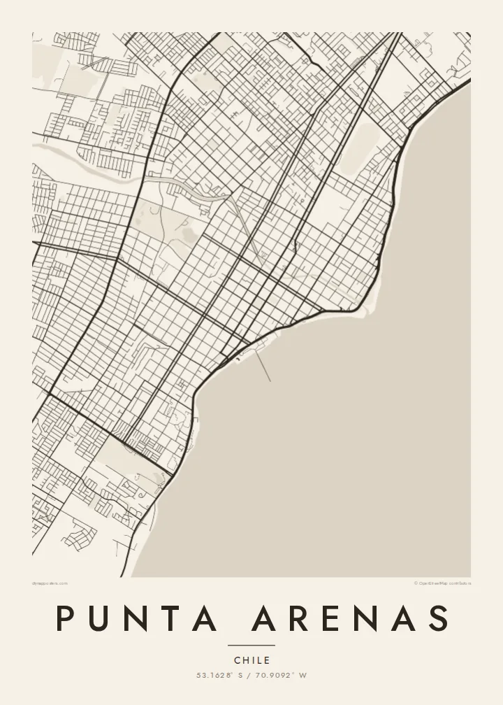
Punta Arenas stretches along the western shore of the Strait of Magellan and is one of the southernmost cities in the world. From above, it is a disciplined grid of straight streets and square blocks. The grid runs from the coastline up gentle slopes toward the hills and the Patagonian steppe. The Costanera road follows the shore, and to the east lies the open water of the strait, with Tierra del Fuego on the far side.
The city was founded in 1848 as a Chilean outpost. It prospered as a port on the route between the Atlantic and Pacific before the Panama Canal opened, and later as a centre of the sheep-farming trade. Its central square, Plaza Muñoz Gamero, is laid out around a monument to Magellan. A Punta Arenas map poster shows the plaza at the heart of a regular plan that seems built to hold firm against the wind.
In black and white, the contrast between land and sea is stark. The dense grid stops at a clean coastline, and the strait fills the rest of the frame as a single calm field. Small rivers and ravines come down from the hills and break into the rows of blocks. The result is a graphic image of a city at the edge of the continent.
The city's whole eastern side faces the strait. On the poster it appears as a broad open plane, with the city running along one shore and Tierra del Fuego across the water.
The main square sits at the centre of the grid, surrounded by regular blocks. The Magellan monument stands there, and the square is the anchor of the whole plan.
Straight streets climb from the coast toward the western hills in long parallel rows. They give the city its orderly, almost drafted look against the open landscape.
Přizpůsobte si ho
Přidejte datum, jméno nebo vlastní text, změňte styl, velikost či orientaci.
Bezplatný náhled má nízké rozlišení a vodoznak. Tisky a HD soubory se vykreslují ve 300 DPI, až 7,200 × 10,800 px, bez vodoznaku.
Proč Punta Arenas
Punta Arenas is often a gateway to Torres del Paine, Antarctic voyages and Tierra del Fuego, so its map works as a keepsake of a journey to the far south. For residents, it is a striking portrait of a city defined by its coastline.
You can personalise the title, subtitle and coordinates line, for example with an expedition date or a family name. Choose from five styles: Classic black & white, Noir, Paper, Blueprint and Sand. Blueprint suits the seafaring history of the port. Order it as a digital file or as a printed poster.
Objednat plakát Punta Arenas| Velikost tisku | Rozlišení | Soubory |
|---|---|---|
| 30 × 40 cm (11.8 × 15.7″) | 3,543 × 4,724 px | PNG · PDF |
| 29.7 × 42 cm (A3, 11.7 × 16.5″) | 3,508 × 4,961 px | PNG · PDF |
| 42 × 59.4 cm (A2, 16.5 × 23.4″) | 4,961 × 7,016 px | PNG · PDF |
| 45.7 × 61 cm (18 × 24″) | 5,400 × 7,200 px | PNG · PDF |
| 50 × 70 cm (19.7 × 27.6″) | 5,906 × 8,268 px | PNG · PDF |
| 61 × 91.4 cm (24 × 36″) | 7,200 × 10,800 px | PNG · PDF |
Pro srovnání: bezplatný náhled má šířku 900 px, obsahuje vodoznak a je určen pro obrazovky. HD soubory mají až 8× vyšší rozlišení v každém směru a vytisknou se čistě i v plné velikosti plakátu.
Nahoře na stránce vyberte styl a poté zvolte Tištěný plakát – velikost a případně rám – nebo Digitální HD soubory. Objednávka proběhne na jeden krok a stránka objednávky se aktualizuje hned po zaplacení.
Tiskne se na prémiový matný papír 200 g/m² v jedné ze šesti velikostí, od 30 × 40 cm až po 24 × 36″. Tištěné plakáty začínají na $39 s dopravou v ceně.
Ano. Vyberte si masivní dřevěný rám v černé, bílé, přírodní dubové nebo tmavé dřevěné variantě. Součástí je nerozbitné sklo a plakát je hned připravený k zavěšení. Plakáty v rámu začínají na $99 s dopravou v ceně.
Doprava je po celém světě zdarma. Každý plakát vytiskne nejbližší z našich tiskových partnerů ve více než 30 zemích a obvykle dorazí do 3–7 pracovních dnů. Stav zásilky a sledování najdete v sekci Moje objednávky. Do některých zemí trvá doručení 2–5 týdnů a tam, kam zatím nedoručujeme, vás web upozorní ještě před platbou.
Do 14 dnů od doručení nám pošlete fotku a my ho zdarma vytiskneme znovu nebo vám vrátíme peníze.
Ano. V editoru na této stránce si upravte nadpis, podnadpis a řádek se souřadnicemi podle libosti a vyberte styl a velikost. Tištěné, zarámované i digitální objednávky vždy odpovídají přesně vašemu návrhu.
Za $9 získáte soubory PNG ve 300 DPI a PDF připravené k tisku ve všech šesti velikostech, bez vodoznaku, k tisku kdekoli. Ještě si nejste jistí? Nejdřív si stáhněte bezplatný náhled s vodoznakem.
V okolí
