Misumi West Port
A carefully engineered Meiji-era harbour of cut stone, with canals and quays, lies near the tip of the peninsula. It is one of the few ports of its era to survive largely intact.
Minimalistický plakát s mapou · Japonsko
32.6222° N / 130.6618° E
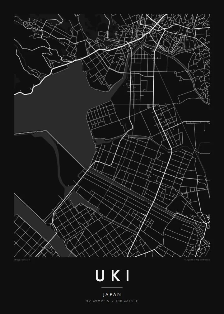
A coastal city at the root of the Uto Peninsula, facing two inland seas with a Meiji-era stone port at its western tip.



Jedno město, pět nálad
Klepnutím na styl si ho prohlédnete na zdi. Všechny styly stojí stejně – jako tisk, v rámu i jako HD soubory.
 Skutečné pixely · tisková předloha 24 × 36″
Ostré i v tisku
Toto je 100% výřez ze skutečné tiskové předlohy. Každý plakát – tištěný, v rámu i ke stažení – vykreslujeme na našich serverech ve 300 DPI, až 7,200 × 10,800 pixelů, takže i ty nejjemnější uličky zůstanou ostré i na tisku 24 × 36″.
Na zdi


Mapa
Uki sits in Kumamoto Prefecture at the base of the Uto Peninsula, which reaches west toward the Amakusa islands. On a map the city stretches along the peninsula. The Ariake Sea lies to the north and the Yatsushiro Sea to the south, and small towns and fishing harbours are strung along both shores. Hills run down the centre of the peninsula, with farmland and orchards on their lower slopes.
At the western end lies Misumi West Port, a stone harbour built in the late nineteenth century to Dutch designs. It is now a UNESCO World Heritage site as part of the Sites of Japan's Meiji Industrial Revolution. The Yatsushiro Sea off Uki's coast is also associated with the shiranui, a rare optical phenomenon of flickering lights on the water described in local tradition.
A Uki map poster traces a long, narrow city defined by its shorelines. Coastal roads follow the edge of the land, while a railway runs out along the peninsula toward the port. Smaller settlements appear as clusters where valleys meet the sea. The water surrounding almost every side gives the map a strong, clean silhouette.
A carefully engineered Meiji-era harbour of cut stone, with canals and quays, lies near the tip of the peninsula. It is one of the few ports of its era to survive largely intact.
The Ariake Sea and the Yatsushiro Sea border the city on opposite sides. On the map the peninsula becomes a long strip of land between two open bodies of water.
Hills run along the centre of the peninsula, with roads and small valleys branching toward the coasts. This inland ridge divides the city's northern and southern shores.
Přizpůsobte si ho
Přidejte datum, jméno nebo vlastní text, změňte styl, velikost či orientaci.
Bezplatný náhled má nízké rozlišení a vodoznak. Tisky a HD soubory se vykreslují ve 300 DPI, až 7,200 × 10,800 px, bez vodoznaku.
Proč Uki
Uki is a place of coastal drives, fishing harbours and evenings looking across the water toward Amakusa. A map of the peninsula keeps that geography in view for residents, for visitors and for anyone with family roots in Kumamoto.
Choose Classic black & white, Noir, Paper, Blueprint or Sand, and add your own title, subtitle and coordinates. The free preview lets you check the framing first. HD files cost $9, and printed posters can ship from partners in more than 30 countries.
Objednat plakát Uki| Velikost tisku | Rozlišení | Soubory |
|---|---|---|
| 30 × 40 cm (11.8 × 15.7″) | 3,543 × 4,724 px | PNG · PDF |
| 29.7 × 42 cm (A3, 11.7 × 16.5″) | 3,508 × 4,961 px | PNG · PDF |
| 42 × 59.4 cm (A2, 16.5 × 23.4″) | 4,961 × 7,016 px | PNG · PDF |
| 45.7 × 61 cm (18 × 24″) | 5,400 × 7,200 px | PNG · PDF |
| 50 × 70 cm (19.7 × 27.6″) | 5,906 × 8,268 px | PNG · PDF |
| 61 × 91.4 cm (24 × 36″) | 7,200 × 10,800 px | PNG · PDF |
Pro srovnání: bezplatný náhled má šířku 900 px, obsahuje vodoznak a je určen pro obrazovky. HD soubory mají až 8× vyšší rozlišení v každém směru a vytisknou se čistě i v plné velikosti plakátu.
Nahoře na stránce vyberte styl a poté zvolte Tištěný plakát – velikost a případně rám – nebo Digitální HD soubory. Objednávka proběhne na jeden krok a stránka objednávky se aktualizuje hned po zaplacení.
Tiskne se na prémiový matný papír 200 g/m² v jedné ze šesti velikostí, od 30 × 40 cm až po 24 × 36″. Tištěné plakáty začínají na {printFrom} s dopravou v ceně.
Ano. Vyberte si masivní dřevěný rám v černé, bílé, přírodní dubové nebo tmavé dřevěné variantě. Součástí je nerozbitné sklo a plakát je hned připravený k zavěšení. Plakáty v rámu začínají na {framedFrom} s dopravou v ceně.
Doprava je zdarma po celém světě. Každý plakát tiskne nejbližší z našich tiskových partnerů ve více než 30 zemích a obvykle dorazí za 3–7 pracovních dní. Stav a sledování zásilky najdete v sekci Moje objednávky.
Do 14 dnů od doručení nám pošlete fotku a my ho zdarma vytiskneme znovu nebo vám vrátíme peníze.
Ano. V editoru na této stránce si upravte nadpis, podnadpis a řádek se souřadnicemi podle libosti a vyberte styl a velikost. Tištěné, zarámované i digitální objednávky vždy odpovídají přesně vašemu návrhu.
Za $9 získáte soubory PNG ve 300 DPI a PDF připravené k tisku ve všech šesti velikostech, bez vodoznaku, k tisku kdekoli. Ještě si nejste jistí? Nejdřív si stáhněte bezplatný náhled s vodoznakem.
