Cliff-bound coastline
The shoreline is mostly steep rock, with only a few inlets where boats can approach. On the poster the edge of the island appears sharp and irregular, giving the landmass a clear, almost sculpted outline.
Minimalistisk kortplakat · Grækenland
35.8644° N / 23.2989° E
A small, steep-sided island between Kythera and Crete, its rocky outline broken by a few coves and a single harbour.


Én by, fem stemninger
Tryk på en stil for at se den på væggen. Alle stilarter koster det samme — trykt, indrammet eller som HD-filer.
 Faktiske pixels · 24 × 36″ trykfil
Knivskarpt tryk
Dette er et 100% udsnit af den rigtige trykfil. Hver plakat — trykt, indrammet eller downloadet — genereres på vores servere ved 300 DPI, op til 7,200 × 10,800 pixels, så selv de mindste veje forbliver skarpe på et 24 × 36″ tryk.
På væggen


Kortet
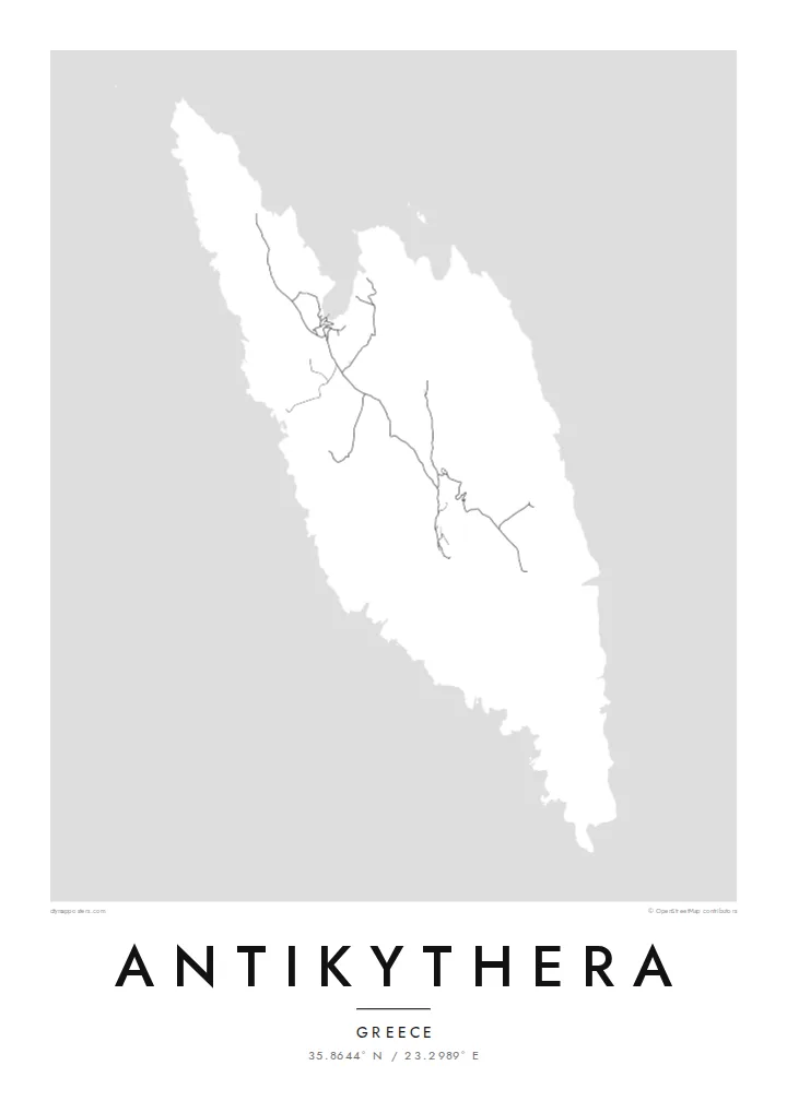
Antikythera sits alone in the strait between Kythera and Crete, a compact wedge of limestone with very little flat ground. From above, the island reads as a rough, elongated shape fringed by cliffs, with a handful of tracks threading between a small harbour settlement and scattered hamlets. The sea takes up most of the frame, and the land becomes a single pale form surrounded by open water.
The island is known worldwide for what was found just offshore. At the start of the twentieth century, sponge divers came across an ancient shipwreck here, and among its cargo was the Antikythera mechanism, a geared bronze device often described as the oldest known analogue computer. The object is now kept in the National Archaeological Museum in Athens, but its name will always point back to this coastline.
An Antikythera map poster is an exercise in restraint. There is no dense grid to fill the paper, only a coastline, a thin network of roads and the contour of the island against a wide field of white or black. The result is quiet and graphic, a shape that people who know the island tend to recognise at once, and that others find simply striking.
The shoreline is mostly steep rock, with only a few inlets where boats can approach. On the poster the edge of the island appears sharp and irregular, giving the landmass a clear, almost sculpted outline.
A small sheltered cove on the northern side serves as the island's port and its link to the ferries. It is where the few roads converge, which makes it the natural focal point of the map.
The waters off the island hold the wreck that yielded the famous mechanism. Nothing marks the spot on a street map, yet the empty sea around the coast carries that story for anyone who knows it.
Gør den til din egen
Tilføj en dato, et navn eller din egen tekst, og skift stil, størrelse eller retning.
Den gratis forhåndsvisning er i lav opløsning med vandmærke. Tryk og HD-filer genereres ved 300 DPI, op til 7,200 × 10,800 px, uden vandmærke.
Hvorfor Antikythera
Antikythera appeals to people who care about the history of science, to divers and sailors, and to anyone who has made the long ferry crossing to reach it. The poster is less about streets than about one island standing alone in open sea, a small object with an outsized story.
You can add your own title and subtitle, such as the date of a visit or a line about the mechanism, and adjust the coordinates line. Choose from Classic black & white, Noir, Paper, Blueprint or Sand; Blueprint suits the scientific theme particularly well. Download HD files for $9 or order a printed poster.
Bestil Antikythera-plakaten| Trykstørrelse | Opløsning | Filer |
|---|---|---|
| 30 × 40 cm11.8 × 15.7″ | 3,543 × 4,724 px | PNG · PDF |
| 29.7 × 42 cm (A3)11.7 × 16.5″ | 3,508 × 4,961 px | PNG · PDF |
| 42 × 59.4 cm (A2)16.5 × 23.4″ | 4,961 × 7,016 px | PNG · PDF |
| 45.7 × 61 cm18 × 24″ | 5,400 × 7,200 px | PNG · PDF |
| 50 × 70 cm19.7 × 27.6″ | 5,906 × 8,268 px | PNG · PDF |
| 61 × 91.4 cm24 × 36″ | 7,200 × 10,800 px | PNG · PDF |
Til sammenligning er det gratis preview 900 px bredt, har vandmærke og er beregnet til skærme. HD-filerne har op til 8× opløsningen i hver retning og kan trykkes skarpt i fuld plakatstørrelse.
Vælg en stil øverst på siden, og vælg derefter Trykt Plakat — en størrelse og, hvis du vil, en ramme — eller Digitale HD-Filer. Betalingen tager ét trin, og din ordreside opdateres, så snart betalingen er gennemført.
Den trykkes på 200 g/m² mat kvalitetspapir i en af seks størrelser, fra 30 × 40 cm til 24 × 36″. Trykte plakater starter ved $39, inkl. fragt.
Ja. Vælg en ramme i massivt træ i sort, hvid, naturlig eg eller mørkt træ. Den leveres med splintsikkert glas og er klar til at hænge op. Indrammede plakater starter ved $99, inkl. fragt.
Fragten er gratis til 60+ lande. Hver plakat bliver trykt af den nærmeste af vores trykpartnere i 30+ lande og er som regel fremme på 3–7 hverdage. Du kan følge status og sporing under Mine ordrer. Nogle få lande har 2–5 ugers leveringstid, og hvis vi endnu ikke leverer til dit land, fortæller siden dig det, før du betaler.
Send os et billede inden for 14 dage efter levering, så trykker vi den om gratis eller refunderer dig.
Ja. I editoren på denne side kan du ændre titlen, undertitlen og koordinatlinjen til hvad du vil, og vælge stil og størrelse. Trykte, indrammede og digitale ordrer bruger alle præcis dit design.
For $9 får du PNG i 300 DPI og trykklare PDF-filer i alle seks størrelser, uden vandmærke, så du kan trykke hvor som helst. Ikke helt sikker endnu? Download først en gratis forhåndsvisning med vandmærke.
