Mays Island
A narrow island in the Cedar River holding civic buildings, linked to both banks by bridges. On the poster it appears as a small block of streets floating in the middle of the water.
Minimalistisk kortplakat · USA
42.0083° N / 91.6441° W
A river city split diagonally by the Cedar, with an island at its centre and four quadrants of numbered streets.



Én by, fem stemninger
Tryk på en stil for at se den på væggen. Alle stilarter koster det samme — trykt, indrammet eller som HD-filer.
 Faktiske pixels · 24 × 36″ trykfil
Knivskarpt tryk
Dette er et 100% udsnit af den rigtige trykfil. Hver plakat — trykt, indrammet eller downloadet — genereres på vores servere ved 300 DPI, op til 7,200 × 10,800 pixels, så selv de mindste veje forbliver skarpe på et 24 × 36″ tryk.
På væggen


Kortet
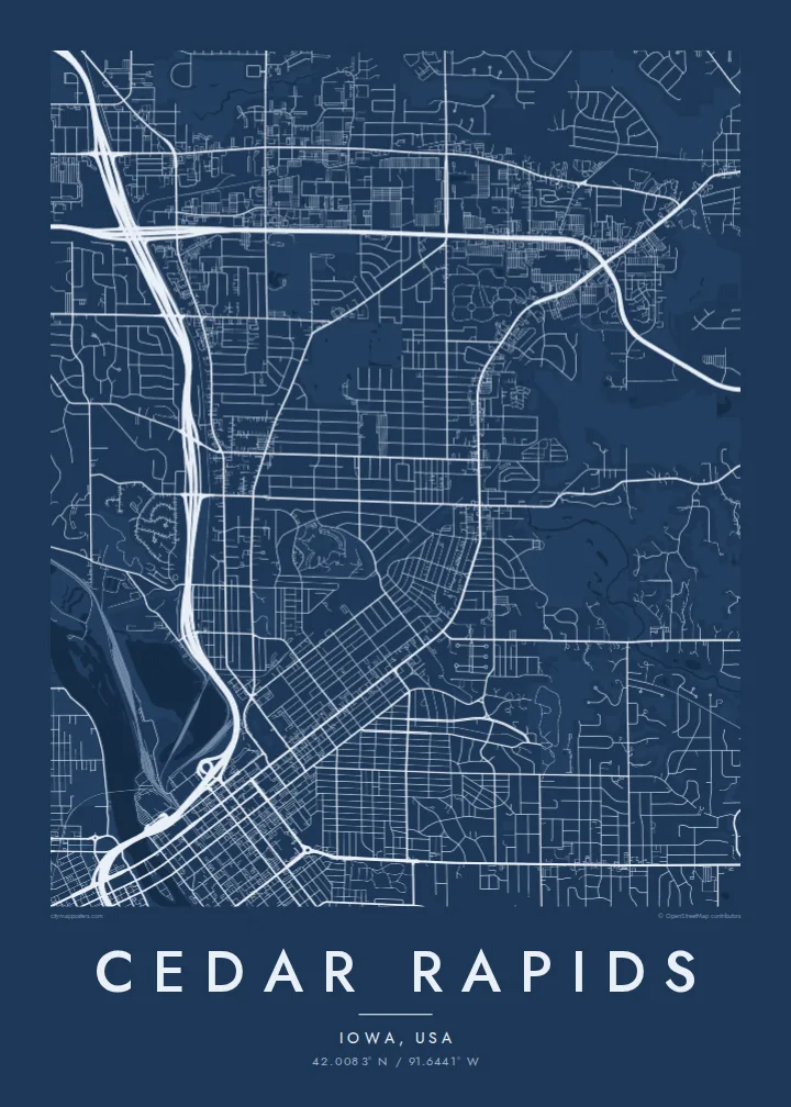
From above, Cedar Rapids is organised around the Cedar River, which cuts through the city from northwest to southeast. Streets and avenues are numbered and labelled by quadrant (NE, NW, SE and SW), so the map reads as four grids meeting at the water. Downtown sits on the east bank, and a series of bridges connects it to the west side and to Mays Island in the middle of the channel.
Mays Island is the detail most people remember. Civic buildings stand on it, which makes Cedar Rapids one of very few American cities with its seat of government on a river island. A short walk upstream, the large Quaker Oats plant reflects the city's long connection to grain processing, and on some days the smell of toasted oats drifts across downtown.
A Cedar Rapids map poster shows the whole arrangement at once: the river, the island, Interstate 380 curving through the centre and residential blocks spreading toward the farmland of eastern Iowa. The painter Grant Wood lived and worked here, and his ordered, clean-lined view of the Midwest suits the calm geometry of a black-and-white street map.
A narrow island in the Cedar River holding civic buildings, linked to both banks by bridges. On the poster it appears as a small block of streets floating in the middle of the water.
Numbered streets and avenues divide into NE, NW, SE and SW sections. The result is four slightly offset grids that meet along the river and give the map its structure.
The interstate runs north to south through the city and crosses the river close to downtown. Its long, smooth curves stand out against the square blocks on either side.
Gør den til din egen
Tilføj en dato, et navn eller din egen tekst, og skift stil, størrelse eller retning.
Den gratis forhåndsvisning er i lav opløsning med vandmærke. Tryk og HD-filer genereres ved 300 DPI, op til 7,200 × 10,800 px, uden vandmærke.
Hvorfor Cedar Rapids
Cedar Rapids maps tend to go to people with a long attachment to the city: those who grew up in its quadrants, worked in its plants and offices, or helped rebuild after the 2008 flood. The river and the island make the layout recognisable even without labels.
The title, subtitle and coordinates line can all be personalised, for example with a family name or a date that matters, and the map comes in five styles: Classic black & white, Noir, Paper, Blueprint and Sand. Choose the $9 digital HD files or a printed poster with an optional wooden frame.
Bestil Cedar Rapids-plakaten| Trykstørrelse | Opløsning | Filer |
|---|---|---|
| 30 × 40 cm (11.8 × 15.7″) | 3,543 × 4,724 px | PNG · PDF |
| 29.7 × 42 cm (A3, 11.7 × 16.5″) | 3,508 × 4,961 px | PNG · PDF |
| 42 × 59.4 cm (A2, 16.5 × 23.4″) | 4,961 × 7,016 px | PNG · PDF |
| 45.7 × 61 cm (18 × 24″) | 5,400 × 7,200 px | PNG · PDF |
| 50 × 70 cm (19.7 × 27.6″) | 5,906 × 8,268 px | PNG · PDF |
| 61 × 91.4 cm (24 × 36″) | 7,200 × 10,800 px | PNG · PDF |
Til sammenligning er det gratis preview 900 px bredt, har vandmærke og er beregnet til skærme. HD-filerne har op til 8× opløsningen i hver retning og kan trykkes skarpt i fuld plakatstørrelse.
Vælg en stil øverst på siden, og vælg derefter Trykt Plakat — en størrelse og, hvis du vil, en ramme — eller Digitale HD-Filer. Betalingen tager ét trin, og din ordreside opdateres, så snart betalingen er gennemført.
Den trykkes på 200 g/m² mat kvalitetspapir i en af seks størrelser, fra 30 × 40 cm til 24 × 36″. Trykte plakater starter ved {printFrom}, inkl. fragt.
Ja. Vælg en ramme i massivt træ i sort, hvid, naturlig eg eller mørkt træ. Den leveres med splintsikkert glas og er klar til at hænge op. Indrammede plakater starter ved {framedFrom}, inkl. fragt.
Forsendelse er gratis i hele verden. Hver plakat bliver trykt af den nærmeste af vores trykpartnere i mere end 30 lande og er som regel fremme på 3–7 hverdage. Du kan følge status og sporing under Mine ordrer. Nogle få lande har en leveringstid på 2–5 uger, og hvis vi endnu ikke leverer til dit land, fortæller siden dig det, før du betaler.
Send os et billede inden for 14 dage efter levering, så trykker vi den om gratis eller refunderer dig.
Ja. I editoren på denne side kan du ændre titlen, undertitlen og koordinatlinjen til hvad du vil, og vælge stil og størrelse. Trykte, indrammede og digitale ordrer bruger alle præcis dit design.
For $9 får du PNG i 300 DPI og trykklare PDF-filer i alle seks størrelser, uden vandmærke, så du kan trykke hvor som helst. Ikke helt sikker endnu? Download først en gratis forhåndsvisning med vandmærke.
