Island outline
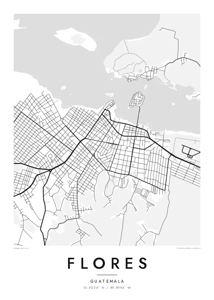
The whole old town fits on a small island surrounded by the lake. On the map it's a single, almost round shape, very easy to recognise.
Minimalistisches Kartenposter · Guatemala
16.9226° N / 89.8994° W
A small, round island town in Lake Petén Itzá, joined to the shore by a single causeway



Eine Stadt, fünf Stimmungen
Tippen Sie auf einen Stil, um ihn an der Wand zu sehen. Jeder Stil kostet gleich viel – gedruckt, gerahmt oder als HD-Dateien.
 Originalpixel · 24 × 36″ Druckdatei
Gestochen scharf
Dies ist ein 100%-Ausschnitt der echten Druckdatei. Jedes Poster – gedruckt, gerahmt oder heruntergeladen – wird auf unseren Servern mit 300 DPI und bis zu 7,200 × 10,800 Pixeln gerendert, sodass selbst die kleinsten Straßen auf einem 24 × 36″-Druck gestochen scharf bleiben.
An der Wand


Die Karte
Flores, the capital of Petén department, is one of the most distinctive shapes of any town in Central America. It covers a small, almost circular island in Lake Petén Itzá. Streets ring the shoreline, lanes climb to a church at the highest point, and a causeway links the island to Santa Elena and San Benito on the southern shore.
The island was once Nojpetén, the capital of the Itza Maya. It was the last independent Maya kingdom and fell to the Spanish in 1697. Today Flores is the usual base for visiting Tikal, whose ruins lie in the forest to the northeast.
A Flores map poster shows the island's compact outline, the water around it and the denser mainland towns across the causeway. It's an unusual composition: a small town completely surrounded by open lake, with a wider grid of streets on the shore.
The whole old town fits on a small island surrounded by the lake. On the map it's a single, almost round shape, very easy to recognise.
A single road crosses the water to Santa Elena. It's the island's only link to the mainland and a clear line on the print.
The streets climb to the church and plaza at the island's centre. The lanes rise from the shoreline road toward it.
Mach es zu deinem
Füge ein Datum, einen Namen oder eine eigene Zeile hinzu und ändere Stil, Größe oder Ausrichtung.
Die kostenlose Vorschau ist niedrig aufgelöst und mit Wasserzeichen. Drucke und HD-Dateien werden mit 300 DPI, bis zu 7,200 × 10,800 px, ohne Wasserzeichen gerendert.
Warum Flores
Many travellers stay in Flores on their way to Tikal, and many remember the lakeside evenings long after the trip. The island's shape makes a strong, simple poster that almost anyone will recognise.
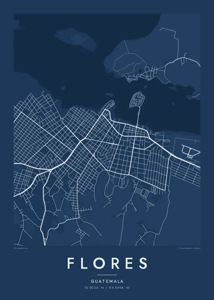
Add a title, travel dates or a line about the trip, and set the coordinates. Choose Classic black & white, Noir, Paper, Blueprint or Sand. Blueprint shows the water around the island especially well.
Poster „Flores“ bestellen| Druckgröße | Auflösung | Dateien |
|---|---|---|
| 30 × 40 cm11.8 × 15.7″ | 3,543 × 4,724 px | PNG · PDF |
| 29.7 × 42 cm (A3)11.7 × 16.5″ | 3,508 × 4,961 px | PNG · PDF |
| 42 × 59.4 cm (A2)16.5 × 23.4″ | 4,961 × 7,016 px | PNG · PDF |
| 45.7 × 61 cm18 × 24″ | 5,400 × 7,200 px | PNG · PDF |
| 50 × 70 cm19.7 × 27.6″ | 5,906 × 8,268 px | PNG · PDF |
| 61 × 91.4 cm24 × 36″ | 7,200 × 10,800 px | PNG · PDF |
Zum Vergleich: Die kostenlose Vorschau ist 900 px breit, hat ein Wasserzeichen und ist für Bildschirme gedacht. Die HD-Dateien haben bis zu 8× so viel Auflösung in jede Richtung und lassen sich sauber in voller Postergröße drucken.
Wählen Sie oben auf der Seite einen Stil und dann Gedrucktes Poster – eine Größe und, wenn gewünscht, einen Rahmen – oder Digitale HD-Dateien. Der Checkout dauert nur einen Schritt, und Ihre Bestellseite wird aktualisiert, sobald die Zahlung eingegangen ist.
Es wird auf hochwertigem 200-g/m²-Mattpapier in einer von sechs Größen gedruckt, von 30 × 40 cm bis 24 × 36″. Gedruckte Poster kosten ab $39, Versand inklusive.
Ja. Wählen Sie einen Rahmen aus massivem Holz in Schwarz, Weiß, natürlicher Eiche oder dunklem Holz. Er hat splitterschutzsicheres Glas und ist sofort aufhängbar. Gerahmte Poster kosten ab $99, Versand inklusive.
Der Versand ist in über 60 Länder kostenlos. Jedes Poster wird vom nächstgelegenen unserer Druckpartner in über 30 Ländern gedruckt und kommt in der Regel innerhalb von 3–7 Werktagen an. Status und Sendungsverfolgung findest du unter „Meine Bestellungen“. In einigen Ländern dauert die Lieferung 2–5 Wochen, und wohin wir noch nicht liefern, zeigt dir die Website vor der Zahlung an.
Schicken Sie uns innerhalb von 14 Tagen nach Lieferung ein Foto, und wir drucken es kostenlos neu oder erstatten Ihr Geld zurück.
Ja. Ändern Sie im Editor auf dieser Seite den Titel, den Untertitel und die Koordinatenzeile nach Belieben und wählen Sie einen Stil und eine Größe. Gedruckte, gerahmte und digitale Bestellungen verwenden alle genau Ihr Design.
Für $9 erhalten Sie 300-DPI-PNG- und druckfertige PDF-Dateien in allen sechs Größen, ohne Wasserzeichen, zum Drucken überall. Noch nicht sicher? Laden Sie zuerst eine kostenlose Vorschau mit Wasserzeichen herunter.
In der Nähe
