Charlotte Amalie
The capital wraps around a broad harbour, and its historic centre climbs in steep, stepped lanes above the waterfront. It is the densest part of the map.
Minimalistisches Kartenposter · Vereinigte Staaten
18.3429° N / 64.9370° W
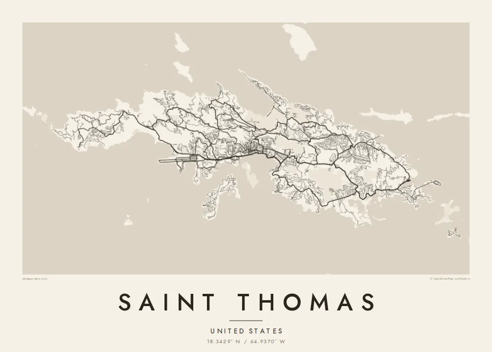
A steep, ridged Caribbean island with a harbour capital on its south coast and a deep, rounded bay on the north.




Eine Stadt, fünf Stimmungen
Tippen Sie auf einen Stil, um ihn an der Wand zu sehen. Jeder Stil kostet gleich viel – gedruckt, gerahmt oder als HD-Dateien.
 Originalpixel · 24 × 36″ Druckdatei
Gestochen scharf
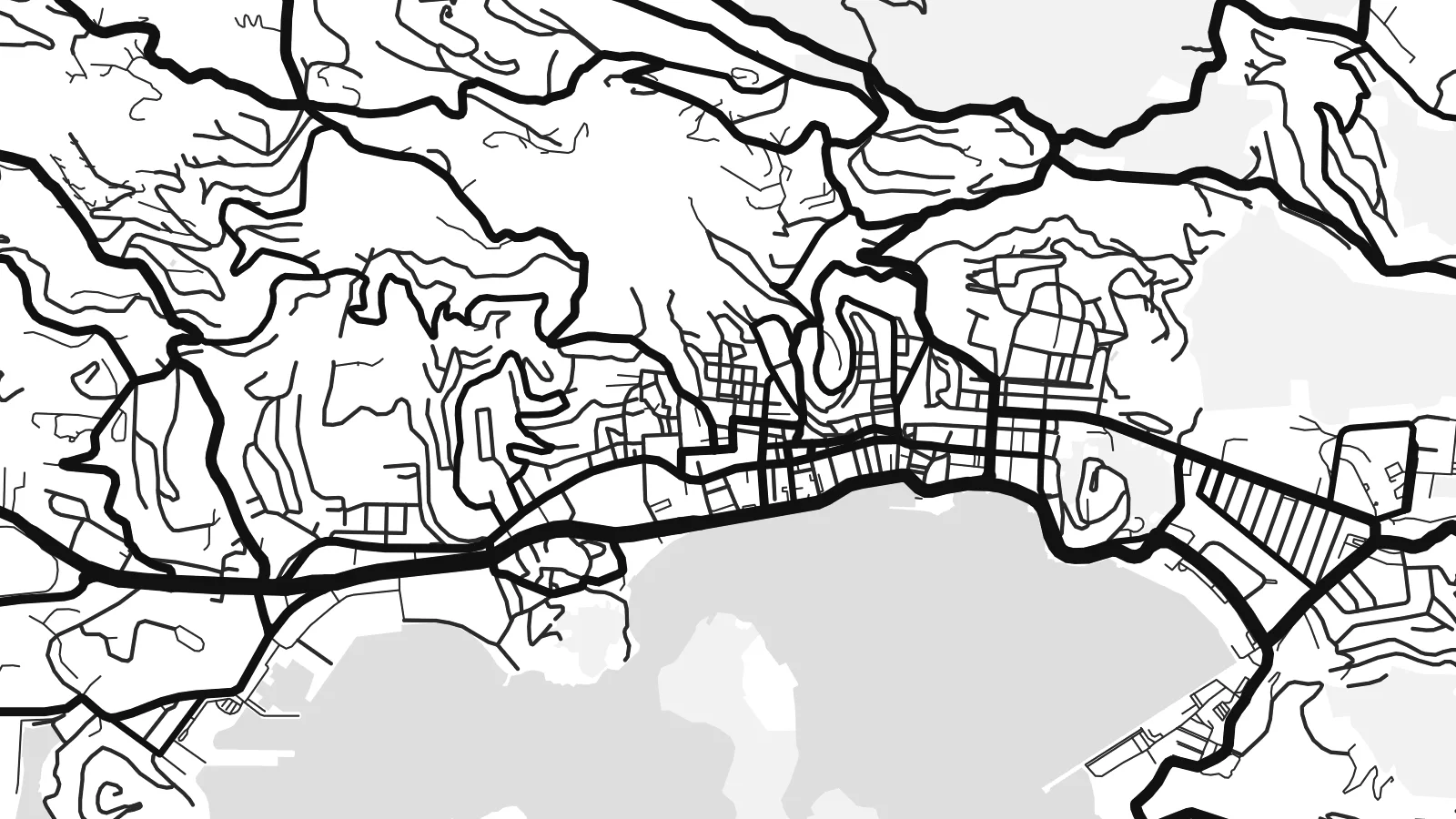
Dies ist ein 100%-Ausschnitt der echten Druckdatei. Jedes Poster – gedruckt, gerahmt oder heruntergeladen – wird auf unseren Servern mit 300 DPI und bis zu 7,200 × 10,800 Pixeln gerendert, sodass selbst die kleinsten Straßen auf einem 24 × 36″-Druck gestochen scharf bleiben.
An der Wand


Die Karte
Saint Thomas is one of the three main United States Virgin Islands, a narrow island with a high ridge along its length. From above, the coast is intricate, with headlands, coves and small offshore islands on every side. The land rises steeply almost everywhere, so roads follow the contours in long switchbacks. Most building is spread along the southern shore.
Charlotte Amalie, the territorial capital, lines a wide harbour on the south coast. Cruise piers and a waterfront road front a historic core of narrow lanes and stepped streets that climb the hill. On the north side, Magens Bay forms a deep, rounded bite into the coast, sheltered by long headlands. A Saint Thomas map poster brings out both shapes clearly.
The island was a Danish colony for more than two centuries, until the United States bought the Danish West Indies in 1917. Danish street names and buildings still mark Charlotte Amalie. Cars still drive on the left, a long-standing local convention, even though most vehicles on the island are built for driving on the right.
The capital wraps around a broad harbour, and its historic centre climbs in steep, stepped lanes above the waterfront. It is the densest part of the map.
A deep, sheltered bay on the north shore, almost enclosed by two long headlands. Its rounded shape is one of the most recognisable features on the island.
A mountainous spine runs east to west through the island. The roads that climb it twist into tight curves before dropping down to either coast.
Mach es zu deinem
Füge ein Datum, einen Namen oder eine eigene Zeile hinzu und ändere Stil, Größe oder Ausrichtung.
Die kostenlose Vorschau ist niedrig aufgelöst und mit Wasserzeichen. Drucke und HD-Dateien werden mit 300 DPI, bis zu 7,200 × 10,800 px, ohne Wasserzeichen gerendert.
Warum Saint Thomas
Saint Thomas is a landmark for cruise passengers, sailors and people who have made a life in the Virgin Islands. The map is a lasting keepsake of a harbour arrival, a wedding on the beach or years spent living on the hillside.
You can personalise the title and subtitle, add the coordinates of a favourite bay, and pick one of five styles. Download the HD files for $9 in any of six sizes, or order a matte print with an optional wooden frame.
Poster „Saint Thomas“ bestellen| Druckgröße | Auflösung | Dateien |
|---|---|---|
| 30 × 40 cm (11.8 × 15.7″) | 3,543 × 4,724 px | PNG · PDF |
| 29.7 × 42 cm (A3, 11.7 × 16.5″) | 3,508 × 4,961 px | PNG · PDF |
| 42 × 59.4 cm (A2, 16.5 × 23.4″) | 4,961 × 7,016 px | PNG · PDF |
| 45.7 × 61 cm (18 × 24″) | 5,400 × 7,200 px | PNG · PDF |
| 50 × 70 cm (19.7 × 27.6″) | 5,906 × 8,268 px | PNG · PDF |
| 61 × 91.4 cm (24 × 36″) | 7,200 × 10,800 px | PNG · PDF |
Zum Vergleich: Die kostenlose Vorschau ist 900 px breit, hat ein Wasserzeichen und ist für Bildschirme gedacht. Die HD-Dateien haben bis zu 8× so viel Auflösung in jede Richtung und lassen sich sauber in voller Postergröße drucken.
Wählen Sie oben auf der Seite einen Stil und dann Gedrucktes Poster – eine Größe und, wenn gewünscht, einen Rahmen – oder Digitale HD-Dateien. Der Checkout dauert nur einen Schritt, und Ihre Bestellseite wird aktualisiert, sobald die Zahlung eingegangen ist.
Es wird auf hochwertigem 200-g/m²-Mattpapier in einer von sechs Größen gedruckt, von 30 × 40 cm bis 24 × 36″. Gedruckte Poster kosten ab $39, Versand inklusive.
Ja. Wählen Sie einen Rahmen aus massivem Holz in Schwarz, Weiß, natürlicher Eiche oder dunklem Holz. Er hat splitterschutzsicheres Glas und ist sofort aufhängbar. Gerahmte Poster kosten ab $99, Versand inklusive.
Der Versand ist weltweit kostenlos. Jedes Poster wird vom nächstgelegenen unserer Druckpartner in über 30 Ländern gedruckt und kommt in der Regel in 3–7 Werktagen an. Status und Sendungsverfolgung findest du unter „Meine Bestellungen“. In einigen Ländern dauert es 2–5 Wochen, und wohin wir noch nicht liefern, sagt dir die Seite vor der Zahlung Bescheid.
Schicken Sie uns innerhalb von 14 Tagen nach Lieferung ein Foto, und wir drucken es kostenlos neu oder erstatten Ihr Geld zurück.
Ja. Ändern Sie im Editor auf dieser Seite den Titel, den Untertitel und die Koordinatenzeile nach Belieben und wählen Sie einen Stil und eine Größe. Gedruckte, gerahmte und digitale Bestellungen verwenden alle genau Ihr Design.
Für $9 erhalten Sie 300-DPI-PNG- und druckfertige PDF-Dateien in allen sechs Größen, ohne Wasserzeichen, zum Drucken überall. Noch nicht sicher? Laden Sie zuerst eine kostenlose Vorschau mit Wasserzeichen herunter.
In der Nähe
