Creek-cut shoreline
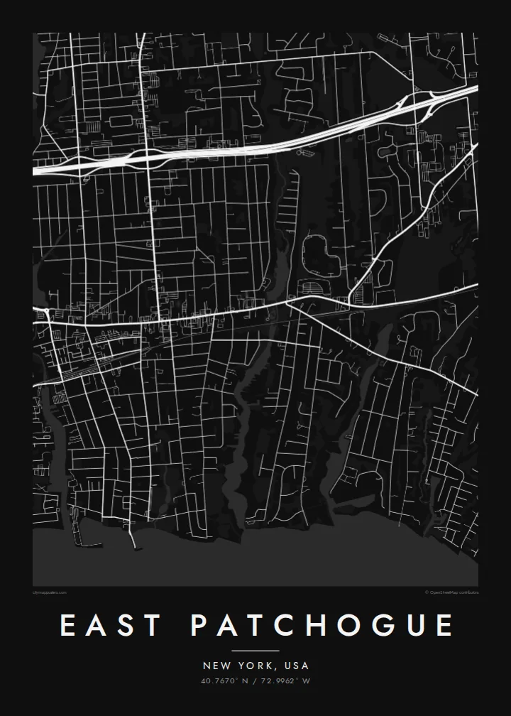
The southern edge breaks into creeks, coves and short dead-end streets that end at the water. It is the most intricate part of the map.
བཟོ་རྣམ་འཇམ་ཏོང་ས་ཁྲའི་པོས་ཊར · ཡུ་ཨེས་ཨེ
40.7670° N / 72.9962° W
A south shore Long Island community of quiet streets reaching down to creeks and the Great South Bay


ཁྲོམ་གཅིག་ སེམས་ཁམས་ལྔ།
སྟའེལ་ཅིག་ལུ་ཨེབ་གཏང་འབད་ནི་ཨིནམ་ད་ཕྱག་ཤོག་གུར་ག་དེ་སྦེ་མཐོང་ནི་ཨིན་ན་བལྟ། སྟའེལ་ག་ར་གི་གོང་ཚད་གཅིག་མཚུངས་ཨིན། པར་བསྐྲུན་འབད་ཡོད་མི་དང་སྒམ་བཙུགས་ཡོད་མི་ནམ་ HD ཡིག་སྣོད་ཚུ་ཨིན་རུང་མཐུན་ཨིན།
 དངོས་སུའི་ pixels · 24 × 36″ པར་བསྐྲུན་ཡིག་སྣོད
དཔར་ནིའི་གསལ་ཚད།
འདི་དངོས་སུའི་པར་བསྐྲུན་ཡིག་སྣོད་ཀྱི་ ༡༠༠% ཁ་སྐོང་ཨིན། པར་བསྐྲུན་འབད་ཡོད་མི་དང་སྒམ་བཙུགས་ཡོད་མི་དང་ཕབ་ལེན་འབད་ཡོད་མི་ཕྱག་ཤོག་ག་ར་ང་བཅུད་ Server ལུ་ 300 DPI ནང་7,200 × 10,800 pixels་ཚུན་བཟོ་བཏོན་འབདཝ་ཨིནམ་ལས་ལམ་གནམ་མེད་ས་མེད་ཆུང་ཀུའི་ལམ་ཚུ་ཡང་ 24 × 36″ པར་བསྐྲུན་གུར་གསལ་བཏུབ་ཨིན།
རྩིག་པའི་གུར


ས་ཁྲ།
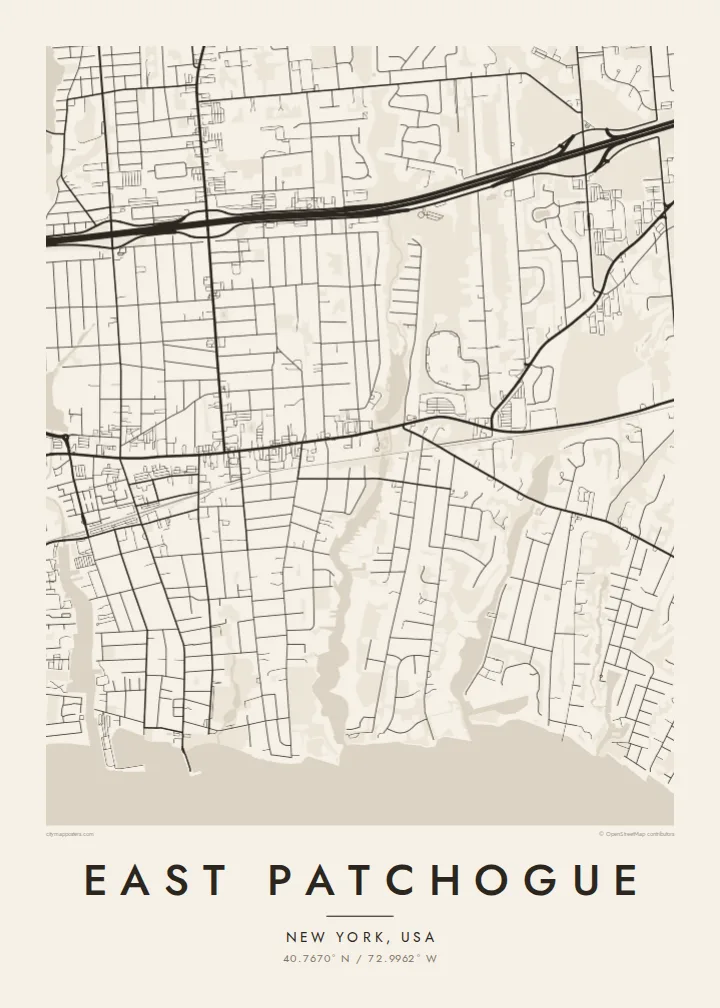
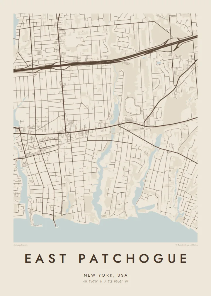
East Patchogue is a hamlet in the Town of Brookhaven, on the south shore of Long Island. The map runs north to south in clear bands. Sunrise Highway crosses the northern part, Montauk Highway runs through the middle, and to the south residential streets end at narrow creeks and inlets that open into the Great South Bay.
This is a typical south shore pattern. Older streets sit close to the water and to the village of Patchogue to the west. Post-war subdivisions fill the land in between with short blocks and cul-de-sacs. The long barrier beach of Fire Island lies across the bay, and it frames the view from the waterfront streets.
An East Patchogue map poster works because of the shoreline. The ragged edge of creeks, marinas and small peninsulas contrasts with the regular suburban streets above it. In black and white the water is a large calm area at the bottom of the frame, and the neighbourhood's streets run down to meet it.
The southern edge breaks into creeks, coves and short dead-end streets that end at the water. It is the most intricate part of the map.
The old east-west road along the south shore passes through the hamlet. Local shops and older buildings line it, and it is the main thread of the map.
South of the shoreline the bay opens wide toward Fire Island. It gives the poster a broad, quiet space that balances the dense streets inland.
ཁྱོད་རའི་དོན་ལུ་བཟོ།
ཚེས་གྲངས་ མིང་ ཡང་ན་ ཁྱོད་རའི་ཚིག་ཐིག་ཅིག་བཙུགས། བཟོ་རྣམ་ ཚད་ ཡང་ན་ ཁ་ཕྱོགས་སོར།
རིན་མེད་ preview འདི་གྲངས་ཐིག་དམའ་ཞིང་ཡིག་རྟགས་དང་བཅས་ཨིན། པར་བསྐྲུན་དང་ HD ཡིག་སྣོད་ཚུ་ 300 DPI ནང་7,200 × 10,800 px་ཚུན་ཡིག་རྟགས་མེད་པར་བཟོ་བཏོན་འབདཝ་ཨིན།
ག་ཅི་འབད་ East Patchogue
For families who live near the bay, East Patchogue is about the water, the boats and the short walks to the shore. A map poster keeps that geography close. It suits a new homeowner, or someone who grew up on the south shore and moved away.
You can personalise the title, subtitle and coordinates line and choose one of five styles, from crisp Classic black & white to warm Sand or technical Blueprint. The $9 digital files come in six print sizes. You can also order a printed poster with an optional wooden frame.
East Patchogue ཕྱག་ཤོག་བཙུགས་བཏབ| དཔར་ཚད། | གསལ་ཚད། | ཡིག་སྣོད། |
|---|---|---|
| 30 × 40 cm11.8 × 15.7″ | 3,543 × 4,724 px | PNG · PDF |
| 29.7 × 42 cm (A3)11.7 × 16.5″ | 3,508 × 4,961 px | PNG · PDF |
| 42 × 59.4 cm (A2)16.5 × 23.4″ | 4,961 × 7,016 px | PNG · PDF |
| 45.7 × 61 cm18 × 24″ | 5,400 × 7,200 px | PNG · PDF |
| 50 × 70 cm19.7 × 27.6″ | 5,906 × 8,268 px | PNG · PDF |
| 61 × 91.4 cm24 × 36″ | 7,200 × 10,800 px | PNG · PDF |
ག་བསྡུར་འབད་བ་ཅིན་ རིན་མེད་སྔོན་ལྟ་འདི་ རྒྱ་ཚད་ 900 px ཡོདཔ་དང་ ཆུ་རྟགས་ཡོད་པའི་ གསལ་གཞི་ནང་བལྟ་ནིའི་དོན་ལུ་ཨིན། HD ཡིག་སྣོད་ཚུ་ ཁ་ཕྱོགས་རེ་རེ་ནང་ གསལ་ཚད་ 8× ཚུན་ཡོདཔ་ལས་ པོས་ཊར་ཚད་ཆ་ཚང་ནང་ གསལ་ཏོག་ཏོ་སྦེ་དཔར་ཚུགས།
ཤོག་ལེབ་གུར་སྟའེལ་ཅིག་སེལ་འཐུ་འབད་བའི་ཤུལ་ལས་ Printed Poster (ཚད་ཅིག་དང་དགོ་པ་ཅིན་སྒམ་ཅིག) ཡང་ན་ Digital HD Files སེལ་འཐུ་འབད། Checkout ལུ་གནས་སྐབས་གཅིག་རྐྱང་དགོཔ་ཨིནམ་ད་སྤྲོད་ལེན་ལེགས་ཤོམ་བྱུང་མ་ཐག་ ཁྱོད་རའི་བཙུགས་བཏབ་ཤོག་ལེབ་གསར་བཅོས་འབད་འོང་།
འདི་ 200 gsm matte ཤོག་བུ་ཡག་ཤོས་གུར་ 30 × 40 cm ལས་ 24 × 36″ ཚུན་ཚད་དྲུག་གི་ནང་ལས་གཅིག་ནང་པར་བསྐྲུན་འབདཝ་ཨིན། པར་བསྐྲུན་ཕྱག་ཤོག་ཚུ་ $39 ལས་འགོ་བཙུགསཔ་ཨིནམ་ད་འགྲེམ་སྤེལ་ཡང་ཚུད་ཡོདཔ་ཨིན།
བཏུབ་ཨིན། ཤིང་གི་སྒམ་ཚོས་གདོང་ནག་པོ་ཡང་ན་དཀར་པོ་ ཡང་ན་ oak ཐོན་ཁུངས་ ཡང་ན་ ཤིང་ནག་ཅིག་སེལ་འཐུ་འབད། འདི་ཤེལ་མི་བོར་མི་ཤོག་ཐང་དང་བཅས་བརྟེན་འོངམ་ཨིནམ་ད་ཨེབ་ནི་ལུ་གྲ་སྒྲིག་ཡོད། སྒམ་བཙུགས་ཡོད་མི་ཕྱག་ཤོག་ཚུ་ $99 ལས་འགོ་བཙུགསཔ་ཨིནམ་ད་འགྲེམ་སྤེལ་ཡང་ཚུད་ཡོདཔ་ཨིན།
རྒྱལ་ཁབ་ ༦༠+ ལུ་ སྐྱེལ་འདྲེན་ཁེ་མེད་ཨིན། པོ་སི་ཊར་ག་ར་ རྒྱལ་ཁབ་ ༣༠+ ནང་ལྷོད་པའི་ ང་བཅས་ཀྱི་ པར་འདེབས་མཉམ་གཅིག་པ་ཚུ་ ནང་ལས་ ཉེ་ཤོས་གཅིག་གིས་ པར་བཏབ་སྟེ་ སྤྱིར་བཏང་ལུ་ ལས་ཀའི་ཉིནམ་ ༣–༧ ནང་ལྷོད་ནི་ཨིན། གནས་སྟངས་དང་ རྗེས་འདེད་ཚུ་ “ངེའི་ཨོ་ཌར་” ནང་ལས་ བལྟ་ཚུགས། རྒྱལ་ཁབ་ལ་ལུ་ བདུན་ཕྲག་ ༢–༥ ཅིག་ འགོ་ནི་ཨིན། ད་ལྟོ་ཡང་ སྐྱེལ་མི་བཏུབ་པའི་ས་ཁོངས་ལུ་ དངུལ་སྤྲོད་མ་འབད་བའི་ཧེ་མར་ དྲ་ཚིགས་ཀྱིས་ ཁྱོད་ལུ་ གསལ་བཤད་འབདཝ་ཨིན།
ཐོབ་ཤུལ་ཉིན་གྲངས་ 14 གྱི་ནང་འཁོད་པར་ཅིག་བཏང་ ང་བཅས་ཀྱིས་རིན་མེད་ཐོག་ལས་སླར་པར་བསྐྲུན་འབད་འོང་ ཡང་ན་སོང་ཡོད་མི་སྤྲོད་འོང་།
བཏུབ་ཨིན། ཤོག་ལེབ་འདི་གུར་ Editor ནང་མགོ་མིང་དང་མགོ་མིང་འོག་མ་དེ་ལས་ལོངས་ཚད་ཡིག་ཐིག་དེ་ག་ཅི་འབད་ཡང་བསྒྱུར་བཅོས་འབད་དེ་སྟའེལ་དང་ཚད་ཅིག་སེལ་འཐུ་འབད། པར་བསྐྲུན་དང་སྒམ་བཙུགས་དང་ digital བཙུགས་བཏབ་ཚུ་ག་ར་ཁྱོད་རའི་བཟོ་རྣམ་དེ་རྐྱངམ་ཅིག་བེད་སྤྱོད་འབད་འོང་།
$9 ཐོག་ལས་ 300 DPI PNG དང་པར་བསྐྲུན་ལུ་གྲ་སྒྲིག་འབད་ཡོད་མི་ PDF ཡིག་སྣོད་ཚུ་ཚད་དྲུག་ཆ་མཉམ་ ཡིག་རྟགས་མེད་པར་ཐོབ་ནི་ཨིནམ་ད་གནས་ག་ཏེ་ལུ་ཡང་པར་བསྐྲུན་འབད་བཏུབ། ང་བཅས་ལུ་ཡིད་ཆེས་མེད་པ་ཅིན་ཡིག་རྟགས་ཡོད་མི་ rin med preview ཅིག་ཧེ་མ་ཕབ་ལེན་འབད་བལྟ།
ཉེ་འདབས།
