The Old City walls
The Ottoman walls, completed under Suleiman the Magnificent in the 1530s, enclose the Old City in an unmistakable outline. Gates such as Damascus Gate and Herod's Gate open onto the northern districts.
Μινιμαλιστική αφίσα χάρτη · Παλαιστινιακά Εδάφη
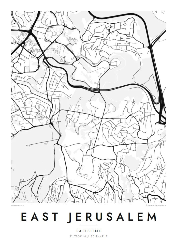
31.7868° N / 35.2449° E
Walled Old City at the centre, the Kidron Valley and Mount of Olives to the east, neighbourhoods spreading north and south


Μία πόλη, πέντε διαθέσεις
Πατήστε ένα στιλ για να το δείτε στον τοίχο. Κάθε στιλ κοστίζει το ίδιο — τυπωμένο, με κορνίζα ή ως αρχεία HD.
 Πραγματικά pixel · αρχείο εκτύπωσης 24 × 36″
Ευκρίνεια εκτύπωσης
Αυτό είναι απόσπασμα 100% από το πραγματικό αρχείο εκτύπωσης. Κάθε αφίσα — τυπωμένη, με κορνίζα ή σε ψηφιακή μορφή — αποδίδεται στους διακομιστές μας στα 300 DPI, έως 7,200 × 10,800 pixel, ώστε ακόμη και οι πιο λεπτές λεπτομέρειες να παραμένουν ευκρινείς σε εκτύπωση 24 × 36″.
Στον τοίχο


Ο χάρτης
From above, East Jerusalem arranges itself around the walled Old City. The walls form a clear, slightly skewed quadrilateral. Roads leave its gates and climb into the hills in every direction. To the east, the ground drops into the Kidron Valley and rises again to the Mount of Olives. Its slopes are marked by terraced cemeteries and a thin line of roads that follows the contours.
North of Damascus Gate, the street pattern becomes denser and more regular. Neighbourhoods such as Sheikh Jarrah spread along the road towards Ramallah. Further out, the map fragments into hilltop quarters separated by wadis and main roads. Because the terrain shapes almost every street, a East Jerusalem map poster reads as much like a relief study as a plan of a city.
The eastern side of the city has been contested since 1967, when Israel took control of the area. Its status remains central to Israeli–Palestinian negotiations. On paper, the lines are quieter. Gates, valleys, ridges and the long road descending towards Jericho are all shown with the same even weight. That lets the geography speak before the politics does.
The Ottoman walls, completed under Suleiman the Magnificent in the 1530s, enclose the Old City in an unmistakable outline. Gates such as Damascus Gate and Herod's Gate open onto the northern districts.
A deep, narrow valley runs north to south between the Old City and the Mount of Olives. On the map it shows as a clean gap between two dense areas of streets.
The ridge east of the Old City carries winding roads and large cemetery grounds. From above, its streets curve with the slope rather than following a grid.
Κάν' την δική σου
Πρόσθεσε μια ημερομηνία, ένα όνομα ή μια δική σου φράση, άλλαξε στιλ, μέγεθος ή προσανατολισμό.
Η δωρεάν προεπισκόπηση είναι χαμηλής ανάλυσης με υδατογράφημα. Οι εκτυπώσεις και τα αρχεία HD αποδίδονται στα 300 DPI, έως 7,200 × 10,800 px, χωρίς υδατογράφημα.
Γιατί East Jerusalem
People who have lived in, studied in or prayed in this part of Jerusalem often want a map that is honest and restrained. A black-and-white plan of streets and slopes keeps the focus on the place itself, not on the headlines.
You can set your own title and add a subtitle with a date, a family name or a line of coordinates. Then choose from five styles: Classic black & white, Noir, Paper, Blueprint or Sand. The same composition can suit a study wall or a quiet hallway.
Παραγγείλετε την αφίσα East Jerusalem| Μέγεθος εκτύπωσης | Ανάλυση | Αρχεία |
|---|---|---|
| 30 × 40 cm11.8 × 15.7″ | 3,543 × 4,724 px | PNG · PDF |
| 29.7 × 42 cm (A3)11.7 × 16.5″ | 3,508 × 4,961 px | PNG · PDF |
| 42 × 59.4 cm (A2)16.5 × 23.4″ | 4,961 × 7,016 px | PNG · PDF |
| 45.7 × 61 cm18 × 24″ | 5,400 × 7,200 px | PNG · PDF |
| 50 × 70 cm19.7 × 27.6″ | 5,906 × 8,268 px | PNG · PDF |
| 61 × 91.4 cm24 × 36″ | 7,200 × 10,800 px | PNG · PDF |
Για σύγκριση, η δωρεάν προεπισκόπηση έχει πλάτος 900 px, φέρει υδατογράφημα και προορίζεται για οθόνες. Τα αρχεία HD έχουν έως 8× μεγαλύτερη ανάλυση σε κάθε διάσταση και τυπώνονται καθαρά σε πλήρες μέγεθος αφίσας.
Επιλέξτε ένα στιλ στο πάνω μέρος της σελίδας και μετά διαλέξτε Τυπωμένη Αφίσα — μέγεθος και, αν θέλετε, κορνίζα — ή Ψηφιακά Αρχεία HD. Η ολοκλήρωση παραγγελίας γίνεται σε ένα βήμα και η σελίδα παραγγελίας σας ενημερώνεται μόλις ολοκληρωθεί η πληρωμή.
Τυπώνεται σε premium ματ χαρτί 200 gsm σε ένα από έξι μεγέθη, από 30 × 40 cm έως 24 × 36″. Οι τυπωμένες αφίσες ξεκινούν από $39, με τα μεταφορικά συμπεριλαμβανόμενα.
Ναι. Επιλέξτε μασίφ ξύλινη κορνίζα σε μαύρο, λευκό, φυσική βελανιδιά ή σκούρο ξύλο. Έρχεται με άθραυστο τζάμι και είναι έτοιμη για ανάρτηση. Οι αφίσες με κορνίζα ξεκινούν από $99, με τα μεταφορικά συμπεριλαμβανόμενα.
Η αποστολή είναι δωρεάν σε 60+ χώρες. Κάθε αφίσα τυπώνεται από τον πλησιέστερο συνεργάτη εκτύπωσης μας, σε 30+ χώρες, και συνήθως φτάνει σε 3–7 εργάσιμες ημέρες. Μπορείτε να παρακολουθείτε την κατάσταση και την αποστολή στις Παραγγελίες μου. Σε μερικές χώρες χρειάζονται 2–5 εβδομάδες, και όπου δεν στέλνουμε ακόμη, το site σάς ενημερώνει πριν πληρώσετε.
Στείλτε μας μια φωτογραφία εντός 14 ημερών από την παράδοση και θα την τυπώσουμε ξανά δωρεάν ή θα σας επιστρέψουμε τα χρήματα.
Ναι. Στον επεξεργαστή σε αυτή τη σελίδα, αλλάξτε τον τίτλο, τον υπότιτλο και τη γραμμή συντεταγμένων όπως θέλετε, και επιλέξτε στιλ και μέγεθος. Οι τυπωμένες, με κορνίζα και ψηφιακές παραγγελίες χρησιμοποιούν ακριβώς το δικό σας σχέδιο.
Για $9 λαμβάνετε αρχεία PNG στα 300 DPI και έτοιμα για εκτύπωση PDF και στα έξι μεγέθη, χωρίς υδατογράφημα, για εκτύπωση οπουδήποτε. Δεν είστε ακόμη σίγουροι; Κατεβάστε πρώτα μια δωρεάν προεπισκόπηση με υδατογράφημα.
Κοντά
