Balcón de Europa
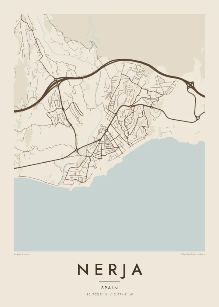
The promontory at the heart of town projects into the Mediterranean like a small pier of rock, a sharp point on the coastline that gives the map its focal centre.
Μινιμαλιστική αφίσα χάρτη · Ισπανία
36.7528° N / 3.8744° W
A cliff-top town on a scalloped coastline, cut by ravines and anchored by the Balcón de Europa promontory


Μία πόλη, πέντε διαθέσεις
Πατήστε ένα στιλ για να το δείτε στον τοίχο. Κάθε στιλ κοστίζει το ίδιο — τυπωμένο, με κορνίζα ή ως αρχεία HD.
 Πραγματικά pixel · αρχείο εκτύπωσης 24 × 36″
Ευκρίνεια εκτύπωσης
Αυτό είναι απόσπασμα 100% από το πραγματικό αρχείο εκτύπωσης. Κάθε αφίσα — τυπωμένη, με κορνίζα ή σε ψηφιακή μορφή — αποδίδεται στους διακομιστές μας στα 300 DPI, έως 7,200 × 10,800 pixel, ώστε ακόμη και οι πιο λεπτές λεπτομέρειες να παραμένουν ευκρινείς σε εκτύπωση 24 × 36″.
Στον τοίχο


Ο χάρτης
Nerja sits at the eastern end of the Málaga coast, where the Sierra Almijara drops steeply toward the Mediterranean. The town occupies a low plateau above the sea, and on a map its edge is anything but straight: small coves, rocky points and beaches alternate along the shore, each tucked between cliffs. Behind the town the mountains close in, leaving a narrow strip for streets and terraces.
At the centre of that coastline is the Balcón de Europa, a promontory that juts into the sea from the old town and forms the most recognisable point on any map of Nerja. Around it the historic streets are short and irregular. East of the centre, Burriana beach traces a long curve, and beyond it the river Chíllar cuts its valley down from the sierra.
Nerja is widely known for its caves, a vast cavern system discovered in 1959 just east of town near the village of Maro, now among the most visited sites in Andalusia. A Nerja map poster brings together the elements that make the place distinct from above: the jagged shore, the promontory, the ravines running to the sea and the mountain wall that frames it all.
The promontory at the heart of town projects into the Mediterranean like a small pier of rock, a sharp point on the coastline that gives the map its focal centre.
Between cliffs, a series of beaches and small coves gives the shoreline a scalloped outline, with Burriana forming the longest and most open curve east of the old town.
The Chíllar descends from the Sierra Almijara along the eastern side of town, its narrow valley tracing a line from the mountains down to the sea.
Κάν' την δική σου
Πρόσθεσε μια ημερομηνία, ένα όνομα ή μια δική σου φράση, άλλαξε στιλ, μέγεθος ή προσανατολισμό.
Η δωρεάν προεπισκόπηση είναι χαμηλής ανάλυσης με υδατογράφημα. Οι εκτυπώσεις και τα αρχεία HD αποδίδονται στα 300 DPI, έως 7,200 × 10,800 px, χωρίς υδατογράφημα.
Γιατί Nerja
Nerja is a place people return to year after year, and many Spaniards first saw it in the television series Verano azul, filmed here in the early 1980s. A map of the town is a way to keep those summers at home, from the promontory to the beach where you always swam.
Add a title and subtitle, perhaps the year you first came or the name of your street, and choose Classic black & white, Noir, Paper, Blueprint or Sand. Sand suits the coastline especially well. Get HD files for $9 or a matte printed poster, framed if you prefer.
Παραγγείλετε την αφίσα Nerja| Μέγεθος εκτύπωσης | Ανάλυση | Αρχεία |
|---|---|---|
| 30 × 40 cm (11.8 × 15.7″) | 3,543 × 4,724 px | PNG · PDF |
| 29.7 × 42 cm (A3, 11.7 × 16.5″) | 3,508 × 4,961 px | PNG · PDF |
| 42 × 59.4 cm (A2, 16.5 × 23.4″) | 4,961 × 7,016 px | PNG · PDF |
| 45.7 × 61 cm (18 × 24″) | 5,400 × 7,200 px | PNG · PDF |
| 50 × 70 cm (19.7 × 27.6″) | 5,906 × 8,268 px | PNG · PDF |
| 61 × 91.4 cm (24 × 36″) | 7,200 × 10,800 px | PNG · PDF |
Για σύγκριση, η δωρεάν προεπισκόπηση έχει πλάτος 900 px, φέρει υδατογράφημα και προορίζεται για οθόνες. Τα αρχεία HD έχουν έως 8× μεγαλύτερη ανάλυση σε κάθε διάσταση και τυπώνονται καθαρά σε πλήρες μέγεθος αφίσας.
Επιλέξτε ένα στιλ στο πάνω μέρος της σελίδας και μετά διαλέξτε Τυπωμένη Αφίσα — μέγεθος και, αν θέλετε, κορνίζα — ή Ψηφιακά Αρχεία HD. Η ολοκλήρωση παραγγελίας γίνεται σε ένα βήμα και η σελίδα παραγγελίας σας ενημερώνεται μόλις ολοκληρωθεί η πληρωμή.
Τυπώνεται σε premium ματ χαρτί 200 gsm σε ένα από έξι μεγέθη, από 30 × 40 cm έως 24 × 36″. Οι τυπωμένες αφίσες ξεκινούν από {printFrom}, με τα μεταφορικά συμπεριλαμβανόμενα.
Ναι. Επιλέξτε μασίφ ξύλινη κορνίζα σε μαύρο, λευκό, φυσική βελανιδιά ή σκούρο ξύλο. Έρχεται με άθραυστο τζάμι και είναι έτοιμη για ανάρτηση. Οι αφίσες με κορνίζα ξεκινούν από {framedFrom}, με τα μεταφορικά συμπεριλαμβανόμενα.
Η αποστολή είναι δωρεάν παγκοσμίως. Κάθε αφίσα τυπώνεται από τον πλησιέστερο συνεργάτη εκτύπωσης από τους συνεργάτες μας σε 30+ χώρες και συνήθως φτάνει σε 3–7 εργάσιμες ημέρες. Μπορείτε να παρακολουθείτε την κατάσταση και τον αριθμό αποστολής στο Οι Παραγγελίες μου.
Στείλτε μας μια φωτογραφία εντός 14 ημερών από την παράδοση και θα την τυπώσουμε ξανά δωρεάν ή θα σας επιστρέψουμε τα χρήματα.
Ναι. Στον επεξεργαστή σε αυτή τη σελίδα, αλλάξτε τον τίτλο, τον υπότιτλο και τη γραμμή συντεταγμένων όπως θέλετε, και επιλέξτε στιλ και μέγεθος. Οι τυπωμένες, με κορνίζα και ψηφιακές παραγγελίες χρησιμοποιούν ακριβώς το δικό σας σχέδιο.
Για $9 λαμβάνετε αρχεία PNG στα 300 DPI και έτοιμα για εκτύπωση PDF και στα έξι μεγέθη, χωρίς υδατογράφημα, για εκτύπωση οπουδήποτε. Δεν είστε ακόμη σίγουροι; Κατεβάστε πρώτα μια δωρεάν προεπισκόπηση με υδατογράφημα.
