Vila Bay waterfront
The curve of the harbour anchors the whole composition. The main streets trace the shoreline and quays, then the grid loosens and climbs the hillsides behind the town.
Μινιμαλιστική αφίσα χάρτη · Βανουάτου
17.7365° S / 168.3137° E
A harbour town wrapped around Vila Bay, with Iririki Island just offshore and lagoons reaching inland from the south.


Μία πόλη, πέντε διαθέσεις
Πατήστε ένα στιλ για να το δείτε στον τοίχο. Κάθε στιλ κοστίζει το ίδιο — τυπωμένο, με κορνίζα ή ως αρχεία HD.
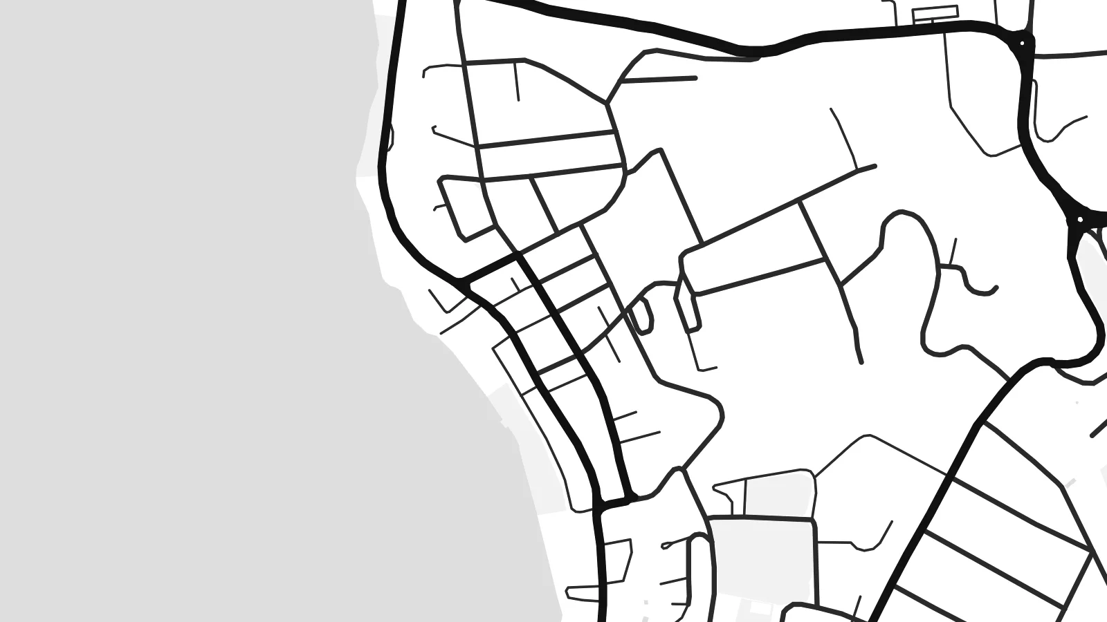 Πραγματικά pixel · αρχείο εκτύπωσης 24 × 36″
Ευκρίνεια εκτύπωσης
Αυτό είναι απόσπασμα 100% από το πραγματικό αρχείο εκτύπωσης. Κάθε αφίσα — τυπωμένη, με κορνίζα ή σε ψηφιακή μορφή — αποδίδεται στους διακομιστές μας στα 300 DPI, έως 7,200 × 10,800 pixel, ώστε ακόμη και οι πιο λεπτές λεπτομέρειες να παραμένουν ευκρινείς σε εκτύπωση 24 × 36″.
Στον τοίχο


Ο χάρτης
Port-Vila sits on the southwest coast of Efate, the island that holds the capital of Vanuatu. From above, water shapes the town on almost every side. The deep curve of Vila Bay lies in front, small islands sit just offshore, and the long arms of Erakor Lagoon push in from the south. Streets follow the shoreline first, then climb in loops toward the ridges behind.
The central waterfront is compact. A short run of commercial streets follows the harbour, and residential roads spread across the slopes above it. Iririki Island is a short crossing from town and shows on paper as a small rounded shape in the bay. Further west, Mele Bay opens to the sea. The coastline breaks into headlands, inlets and reef edges that give the map real texture at its edges.
The town grew as the administrative centre of the New Hebrides, which Britain and France governed jointly until independence in 1980. Both languages still appear in its place names. A Port-Vila map poster keeps that story in line form: an irregular street network bounded by water, a sheltered harbour and a scatter of islands, printed in quiet black and white.
The curve of the harbour anchors the whole composition. The main streets trace the shoreline and quays, then the grid loosens and climbs the hillsides behind the town.
A small island set just off the centre. It sits close enough to read as part of the town but stays clearly separate, and it gives the bay a focal point on the printed sheet.
South of the centre, a winding lagoon cuts deep into the land. It leaves narrow peninsulas and soft, irregular shorelines that contrast with the straighter lines of the streets.
Κάν' την δική σου
Πρόσθεσε μια ημερομηνία, ένα όνομα ή μια δική σου φράση, άλλαξε στιλ, μέγεθος ή προσανατολισμό.
Η δωρεάν προεπισκόπηση είναι χαμηλής ανάλυσης με υδατογράφημα. Οι εκτυπώσεις και τα αρχεία HD αποδίδονται στα 300 DPI, έως 7,200 × 10,800 px, χωρίς υδατογράφημα.
Γιατί Port-Vila
If you have lived, worked or sailed in Vanuatu, this map is a daily reminder of warm water and a small capital built around its harbour. The mix of open sea, lagoon and looping roads also works simply as a graphic piece, calm enough for a hallway or a study.
You can set your own title and subtitle, add a date such as an arrival or a wedding, and adjust the coordinates line. Choose from five styles: Classic black & white, Noir, Paper, Blueprint or Sand. Then download the $9 HD files or order a printed poster.
Παραγγείλετε την αφίσα Port-Vila| Μέγεθος εκτύπωσης | Ανάλυση | Αρχεία |
|---|---|---|
| 30 × 40 cm11.8 × 15.7″ | 3,543 × 4,724 px | PNG · PDF |
| 29.7 × 42 cm (A3)11.7 × 16.5″ | 3,508 × 4,961 px | PNG · PDF |
| 42 × 59.4 cm (A2)16.5 × 23.4″ | 4,961 × 7,016 px | PNG · PDF |
| 45.7 × 61 cm18 × 24″ | 5,400 × 7,200 px | PNG · PDF |
| 50 × 70 cm19.7 × 27.6″ | 5,906 × 8,268 px | PNG · PDF |
| 61 × 91.4 cm24 × 36″ | 7,200 × 10,800 px | PNG · PDF |
Για σύγκριση, η δωρεάν προεπισκόπηση έχει πλάτος 900 px, φέρει υδατογράφημα και προορίζεται για οθόνες. Τα αρχεία HD έχουν έως 8× μεγαλύτερη ανάλυση σε κάθε διάσταση και τυπώνονται καθαρά σε πλήρες μέγεθος αφίσας.
Επιλέξτε ένα στιλ στο πάνω μέρος της σελίδας και μετά διαλέξτε Τυπωμένη Αφίσα — μέγεθος και, αν θέλετε, κορνίζα — ή Ψηφιακά Αρχεία HD. Η ολοκλήρωση παραγγελίας γίνεται σε ένα βήμα και η σελίδα παραγγελίας σας ενημερώνεται μόλις ολοκληρωθεί η πληρωμή.
Τυπώνεται σε premium ματ χαρτί 200 gsm σε ένα από έξι μεγέθη, από 30 × 40 cm έως 24 × 36″. Οι τυπωμένες αφίσες ξεκινούν από $39, με τα μεταφορικά συμπεριλαμβανόμενα.
Ναι. Επιλέξτε μασίφ ξύλινη κορνίζα σε μαύρο, λευκό, φυσική βελανιδιά ή σκούρο ξύλο. Έρχεται με άθραυστο τζάμι και είναι έτοιμη για ανάρτηση. Οι αφίσες με κορνίζα ξεκινούν από $99, με τα μεταφορικά συμπεριλαμβανόμενα.
Η αποστολή είναι δωρεάν σε 60+ χώρες. Κάθε αφίσα τυπώνεται από τον πλησιέστερο συνεργάτη εκτύπωσης μας, σε 30+ χώρες, και συνήθως φτάνει σε 3–7 εργάσιμες ημέρες. Μπορείτε να παρακολουθείτε την κατάσταση και την αποστολή στις Παραγγελίες μου. Σε μερικές χώρες χρειάζονται 2–5 εβδομάδες, και όπου δεν στέλνουμε ακόμη, το site σάς ενημερώνει πριν πληρώσετε.
Στείλτε μας μια φωτογραφία εντός 14 ημερών από την παράδοση και θα την τυπώσουμε ξανά δωρεάν ή θα σας επιστρέψουμε τα χρήματα.
Ναι. Στον επεξεργαστή σε αυτή τη σελίδα, αλλάξτε τον τίτλο, τον υπότιτλο και τη γραμμή συντεταγμένων όπως θέλετε, και επιλέξτε στιλ και μέγεθος. Οι τυπωμένες, με κορνίζα και ψηφιακές παραγγελίες χρησιμοποιούν ακριβώς το δικό σας σχέδιο.
Για $9 λαμβάνετε αρχεία PNG στα 300 DPI και έτοιμα για εκτύπωση PDF και στα έξι μεγέθη, χωρίς υδατογράφημα, για εκτύπωση οπουδήποτε. Δεν είστε ακόμη σίγουροι; Κατεβάστε πρώτα μια δωρεάν προεπισκόπηση με υδατογράφημα.
