Former lakebed
The city sits on the dried bed of Lake Chalco. The flat ground allowed long, straight street grids to be laid out.
Minimalistinen karttajuliste · Meksiko
19.2617° N / 98.8978° W
A city on the dry bed of a former lake in the Valley of Mexico, with volcanoes rising to the east


Yksi kaupunki, viisi tunnelmaa
Napauta tyyliä nähdäksesi sen seinällä. Kaikki tyylit maksavat saman verran — painettuna, kehystettynä tai HD-tiedostoina.
 Todelliset pikselit · 24 × 36″ tulostustiedosto
Terävä painojälki
Tämä on 100 %:n rajaus todellisesta tulostustiedostosta. Jokainen juliste — painettu, kehystetty tai ladattu — renderöidään palvelimillamme 300 DPI:n tarkkuudella, jopa 7,200 × 10,800 pikseliin asti, joten pienimmätkin kadut pysyvät terävinä 24 × 36″ -tulosteessa.
Seinällä

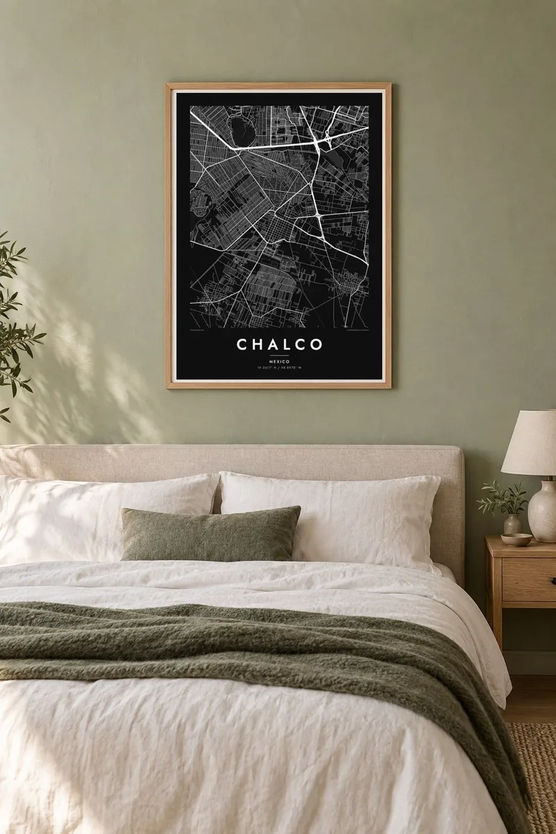
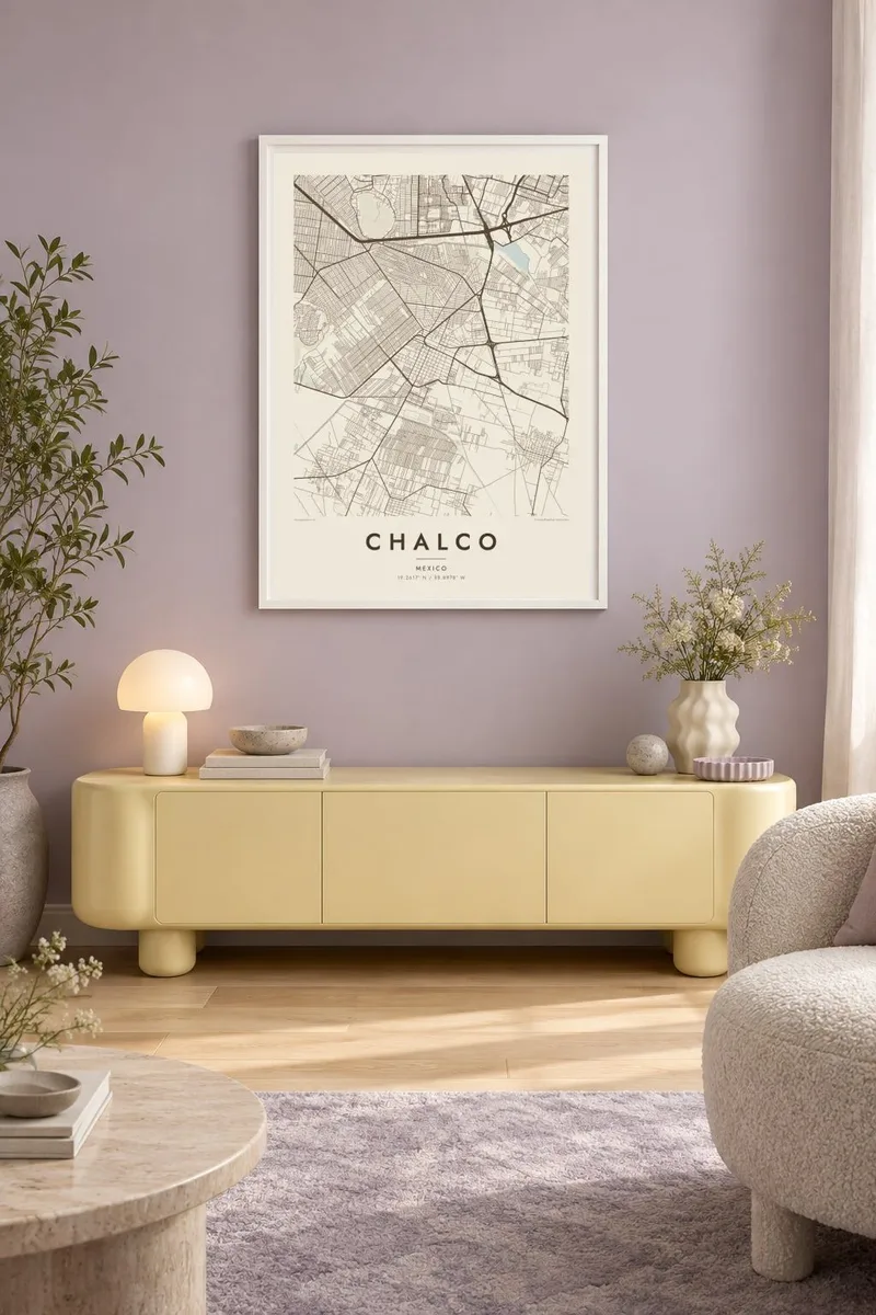
Kartta
Chalco lies in the southeast of the Valley of Mexico, in the State of México, on land that was once the bed of Lake Chalco. The lake was one of the five connected lakes in the valley before the Spanish conquest, and it was gradually drained over several centuries. The flat terrain it left behind is the base for the city's streets today.
On a map, Chalco's older centre forms a small cluster within a much wider urban area that has grown rapidly in recent decades, merging with neighbouring municipalities. The land is almost completely flat, so the new streets follow long, straight grids. East of the city, the ground rises toward the volcanoes Iztaccíhuatl and Popocatépetl.
A Chalco map poster shows the flat grid of the former lakebed, the older town at its heart, and the main highways connecting it to Mexico City. The regular pattern tells the story of a lake turned into land and then into city. It is a thoughtful choice for anyone whose family history is tied to this part of the valley.
The city sits on the dried bed of Lake Chalco. The flat ground allowed long, straight street grids to be laid out.
The older town forms a small, compact core within the much larger urban area that has grown up around it.
Highways lead east, where the land rises toward Iztaccíhuatl and Popocatépetl. The terrain on that side of the map becomes less regular.
Tee siitä omasi
Lisää päivämäärä, nimi tai oma tekstisi, vaihda tyyliä, kokoa tai suuntaa.
Ilmainen esikatselu on matalaresoluutioinen ja vesileimattu. Painetut julisteet ja HD-tiedostot renderöidään 300 DPI:n tarkkuudella, jopa 7,200 × 10,800 px asti, ilman vesileimaa.
Miksi Chalco
Chalco is home to a large community with deep ties to the Valley of Mexico. Its map shows how the city grew from a small town on the lakeshore into a large urban area on the former lakebed.
You can add a title, a subtitle with a family name or date, and the coordinates. Choose one of five styles: Classic black & white, Noir, Paper, Blueprint or Sand. Blueprint suits the straight lines of the former lakebed grid.
Tilaa Chalco-juliste| Tulostekoko | Resoluutio | Tiedostot |
|---|---|---|
| 30 × 40 cm (11.8 × 15.7″) | 3,543 × 4,724 px | PNG · PDF |
| 29.7 × 42 cm (A3, 11.7 × 16.5″) | 3,508 × 4,961 px | PNG · PDF |
| 42 × 59.4 cm (A2, 16.5 × 23.4″) | 4,961 × 7,016 px | PNG · PDF |
| 45.7 × 61 cm (18 × 24″) | 5,400 × 7,200 px | PNG · PDF |
| 50 × 70 cm (19.7 × 27.6″) | 5,906 × 8,268 px | PNG · PDF |
| 61 × 91.4 cm (24 × 36″) | 7,200 × 10,800 px | PNG · PDF |
Vertailun vuoksi: ilmainen esikatselu on 900 px leveä, vesileimattu ja tarkoitettu näytöille. HD-tiedostojen resoluutio on jopa 8-kertainen kumpaankin suuntaan, ja ne tulostuvat siististi täydessä julistekoossa.
Valitse tyyli sivun yläosasta ja sen jälkeen Painettu juliste — koko ja halutessasi kehys — tai Digitaaliset HD-tiedostot. Kassalla on vain yksi vaihe, ja tilaussivusi päivittyy heti maksun jälkeen.
Se painetaan laadukkaalle 200 g/m² mattapaperille kuudessa eri koossa, 30 × 40 cm:stä 24 × 36″:een. Painetut julisteet alkaen {printFrom}, toimitus sisältyy hintaan.
Kyllä. Valitse massiivipuinen kehys mustana, valkoisena, luonnontammena tai tummana puuna. Kehykseen kuuluu iskunkestävä lasitus, ja se on heti ripustusvalmis. Kehystetyt julisteet alkaen {framedFrom}, toimitus sisältyy hintaan.
Toimitus on ilmainen kaikkialle maailmaan. Jokainen juliste painetaan lähimmän tulostuskumppanimme luona yli 30 maassa ja saapuu yleensä 3–7 arkipäivässä. Voit seurata tilaustasi ja seurantatietoja kohdasta Omat tilaukset.
Lähetä meille kuva 14 päivän kuluessa toimituksesta, niin painamme uuden veloituksetta tai palautamme rahasi.
Kyllä. Muokkaa tämän sivun editorissa otsikkoa, alaotsikkoa ja koordinaattirivi haluamallasi tavalla, ja valitse tyyli ja koko. Painetut, kehystetyt ja digitaaliset tilaukset käyttävät kaikki juuri sinun suunnitelmaasi.
Hintaan $9 saat 300 DPI:n PNG- ja tulostusvalmiit PDF-tiedostot kaikissa kuudessa koossa, ilman vesileimaa, tulostettavaksi missä tahansa. Etkö ole vielä varma? Lataa ensin ilmainen esikatselu vesileimalla.
