Castle ruins
The remains of Levice Castle sit at the edge of the historic centre, and the streets around them bend to fit the old fortified site.
Minimalistinen karttajuliste · Slovakia
48.2156° N / 18.6071° E
A southern Slovak town gathered around castle ruins, its streets opening onto the plain at the edge of the Hron valley


Yksi kaupunki, viisi tunnelmaa
Napauta tyyliä nähdäksesi sen seinällä. Kaikki tyylit maksavat saman verran — painettuna, kehystettynä tai HD-tiedostoina.
 Todelliset pikselit · 24 × 36″ tulostustiedosto
Terävä painojälki
Tämä on 100 %:n rajaus todellisesta tulostustiedostosta. Jokainen juliste — painettu, kehystetty tai ladattu — renderöidään palvelimillamme 300 DPI:n tarkkuudella, jopa 7,200 × 10,800 pikseliin asti, joten pienimmätkin kadut pysyvät terävinä 24 × 36″ -tulosteessa.
Seinällä


Kartta
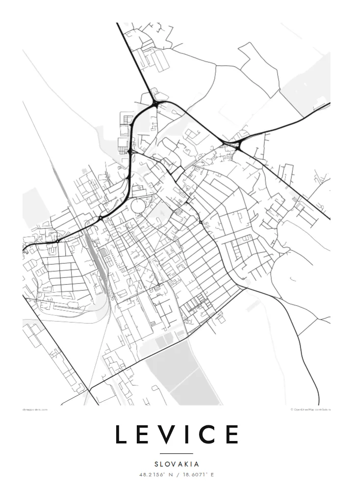
Levice lies in the Nitra Region of southern Slovakia, where the hills of central Slovakia give way to lowland. For centuries it was the seat of the historic Tekov county, and the ruins of Levice Castle still stand at the edge of the old town. From above, the historic centre forms a compact core, with newer housing districts spreading outward in larger, more regular blocks.
The town's layout shows the layers of its growth. Older streets curve around the castle area and the main square, while the outer neighbourhoods are laid out in the broader grid typical of twentieth-century expansion. Roads and a railway line lead out across the surrounding farmland toward neighbouring towns in the region.
A Levice map poster works well for anyone connected to this part of Slovakia, including the many families with ties to both Slovak and Hungarian heritage in the area. In black and white, the contrast between the tight historic core and the open fields around it gives the map a clear, balanced structure.
The remains of Levice Castle sit at the edge of the historic centre, and the streets around them bend to fit the old fortified site.
The central square and the streets that radiate from it form the densest part of the plan, a reminder of the town's role as a county seat.
Beyond the housing estates the map opens into wide agricultural land crossed by straight roads, framing the town within the lowland landscape.
Tee siitä omasi
Lisää päivämäärä, nimi tai oma tekstisi, vaihda tyyliä, kokoa tai suuntaa.
Ilmainen esikatselu on matalaresoluutioinen ja vesileimattu. Painetut julisteet ja HD-tiedostot renderöidään 300 DPI:n tarkkuudella, jopa 7,200 × 10,800 px asti, ilman vesileimaa.
Miksi Levice
Levice is the kind of place people carry with them: a childhood town, a university stop, a family's home for generations. A map poster turns its streets into a calm, lasting reminder that fits any room.
Add a title, a subtitle and your own coordinates line, then choose Classic black & white, Noir, Paper, Blueprint or Sand. The result is a personal piece rather than a generic city print.
Tilaa Levice-juliste| Tulostekoko | Resoluutio | Tiedostot |
|---|---|---|
| 30 × 40 cm (11.8 × 15.7″) | 3,543 × 4,724 px | PNG · PDF |
| 29.7 × 42 cm (A3, 11.7 × 16.5″) | 3,508 × 4,961 px | PNG · PDF |
| 42 × 59.4 cm (A2, 16.5 × 23.4″) | 4,961 × 7,016 px | PNG · PDF |
| 45.7 × 61 cm (18 × 24″) | 5,400 × 7,200 px | PNG · PDF |
| 50 × 70 cm (19.7 × 27.6″) | 5,906 × 8,268 px | PNG · PDF |
| 61 × 91.4 cm (24 × 36″) | 7,200 × 10,800 px | PNG · PDF |
Vertailun vuoksi: ilmainen esikatselu on 900 px leveä, vesileimattu ja tarkoitettu näytöille. HD-tiedostojen resoluutio on jopa 8-kertainen kumpaankin suuntaan, ja ne tulostuvat siististi täydessä julistekoossa.
Valitse tyyli sivun yläosasta ja sen jälkeen Painettu juliste — koko ja halutessasi kehys — tai Digitaaliset HD-tiedostot. Kassalla on vain yksi vaihe, ja tilaussivusi päivittyy heti maksun jälkeen.
Se painetaan laadukkaalle 200 g/m² mattapaperille kuudessa eri koossa, 30 × 40 cm:stä 24 × 36″:een. Painetut julisteet alkaen {printFrom}, toimitus sisältyy hintaan.
Kyllä. Valitse massiivipuinen kehys mustana, valkoisena, luonnontammena tai tummana puuna. Kehykseen kuuluu iskunkestävä lasitus, ja se on heti ripustusvalmis. Kehystetyt julisteet alkaen {framedFrom}, toimitus sisältyy hintaan.
Toimitus on ilmainen kaikkialle maailmaan. Jokainen juliste painetaan lähimmän tulostuskumppanimme luona yli 30 maassa ja saapuu yleensä 3–7 arkipäivässä. Voit seurata tilaustasi ja seurantatietoja kohdasta Omat tilaukset.
Lähetä meille kuva 14 päivän kuluessa toimituksesta, niin painamme uuden veloituksetta tai palautamme rahasi.
Kyllä. Muokkaa tämän sivun editorissa otsikkoa, alaotsikkoa ja koordinaattirivi haluamallasi tavalla, ja valitse tyyli ja koko. Painetut, kehystetyt ja digitaaliset tilaukset käyttävät kaikki juuri sinun suunnitelmaasi.
Hintaan $9 saat 300 DPI:n PNG- ja tulostusvalmiit PDF-tiedostot kaikissa kuudessa koossa, ilman vesileimaa, tulostettavaksi missä tahansa. Etkö ole vielä varma? Lataa ensin ilmainen esikatselu vesileimalla.
