Misumi West Port
A carefully engineered Meiji-era harbour of cut stone, with canals and quays, lies near the tip of the peninsula. It is one of the few ports of its era to survive largely intact.
Minimalistinen karttajuliste · Japani
32.6222° N / 130.6618° E
A coastal city at the root of the Uto Peninsula, facing two inland seas with a Meiji-era stone port at its western tip.

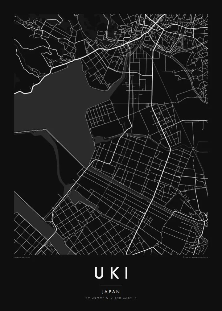


Yksi kaupunki, viisi tunnelmaa
Napauta tyyliä nähdäksesi sen seinällä. Kaikki tyylit maksavat saman verran — painettuna, kehystettynä tai HD-tiedostoina.
 Todelliset pikselit · 24 × 36″ tulostustiedosto
Terävä painojälki
Tämä on 100 %:n rajaus todellisesta tulostustiedostosta. Jokainen juliste — painettu, kehystetty tai ladattu — renderöidään palvelimillamme 300 DPI:n tarkkuudella, jopa 7,200 × 10,800 pikseliin asti, joten pienimmätkin kadut pysyvät terävinä 24 × 36″ -tulosteessa.
Seinällä


Kartta
Uki sits in Kumamoto Prefecture at the base of the Uto Peninsula, which reaches west toward the Amakusa islands. On a map the city stretches along the peninsula. The Ariake Sea lies to the north and the Yatsushiro Sea to the south, and small towns and fishing harbours are strung along both shores. Hills run down the centre of the peninsula, with farmland and orchards on their lower slopes.
At the western end lies Misumi West Port, a stone harbour built in the late nineteenth century to Dutch designs. It is now a UNESCO World Heritage site as part of the Sites of Japan's Meiji Industrial Revolution. The Yatsushiro Sea off Uki's coast is also associated with the shiranui, a rare optical phenomenon of flickering lights on the water described in local tradition.
A Uki map poster traces a long, narrow city defined by its shorelines. Coastal roads follow the edge of the land, while a railway runs out along the peninsula toward the port. Smaller settlements appear as clusters where valleys meet the sea. The water surrounding almost every side gives the map a strong, clean silhouette.
A carefully engineered Meiji-era harbour of cut stone, with canals and quays, lies near the tip of the peninsula. It is one of the few ports of its era to survive largely intact.
The Ariake Sea and the Yatsushiro Sea border the city on opposite sides. On the map the peninsula becomes a long strip of land between two open bodies of water.
Hills run along the centre of the peninsula, with roads and small valleys branching toward the coasts. This inland ridge divides the city's northern and southern shores.
Tee siitä omasi
Lisää päivämäärä, nimi tai oma tekstisi, vaihda tyyliä, kokoa tai suuntaa.
Ilmainen esikatselu on matalaresoluutioinen ja vesileimattu. Painetut julisteet ja HD-tiedostot renderöidään 300 DPI:n tarkkuudella, jopa 7,200 × 10,800 px asti, ilman vesileimaa.
Miksi Uki
Uki is a place of coastal drives, fishing harbours and evenings looking across the water toward Amakusa. A map of the peninsula keeps that geography in view for residents, for visitors and for anyone with family roots in Kumamoto.
Choose Classic black & white, Noir, Paper, Blueprint or Sand, and add your own title, subtitle and coordinates. The free preview lets you check the framing first. HD files cost $9, and printed posters can ship from partners in more than 30 countries.
Tilaa Uki-juliste| Tulostekoko | Resoluutio | Tiedostot |
|---|---|---|
| 30 × 40 cm (11.8 × 15.7″) | 3,543 × 4,724 px | PNG · PDF |
| 29.7 × 42 cm (A3, 11.7 × 16.5″) | 3,508 × 4,961 px | PNG · PDF |
| 42 × 59.4 cm (A2, 16.5 × 23.4″) | 4,961 × 7,016 px | PNG · PDF |
| 45.7 × 61 cm (18 × 24″) | 5,400 × 7,200 px | PNG · PDF |
| 50 × 70 cm (19.7 × 27.6″) | 5,906 × 8,268 px | PNG · PDF |
| 61 × 91.4 cm (24 × 36″) | 7,200 × 10,800 px | PNG · PDF |
Vertailun vuoksi: ilmainen esikatselu on 900 px leveä, vesileimattu ja tarkoitettu näytöille. HD-tiedostojen resoluutio on jopa 8-kertainen kumpaankin suuntaan, ja ne tulostuvat siististi täydessä julistekoossa.
Valitse tyyli sivun yläosasta ja sen jälkeen Painettu juliste — koko ja halutessasi kehys — tai Digitaaliset HD-tiedostot. Kassalla on vain yksi vaihe, ja tilaussivusi päivittyy heti maksun jälkeen.
Se painetaan laadukkaalle 200 g/m² mattapaperille kuudessa eri koossa, 30 × 40 cm:stä 24 × 36″:een. Painetut julisteet alkaen {printFrom}, toimitus sisältyy hintaan.
Kyllä. Valitse massiivipuinen kehys mustana, valkoisena, luonnontammena tai tummana puuna. Kehykseen kuuluu iskunkestävä lasitus, ja se on heti ripustusvalmis. Kehystetyt julisteet alkaen {framedFrom}, toimitus sisältyy hintaan.
Toimitus on ilmainen kaikkialle maailmaan. Jokaisen julisteen painaa lähin yli 30 maassa toimivista painokumppaneistamme, ja se saapuu yleensä 3–7 arkipäivässä. Tilauksen tilaa ja seurantatietoja voi seurata kohdassa Omat tilaukset. Joihinkin maihin toimitus kestää 2–5 viikkoa, ja jos emme vielä toimita maahasi, sivusto kertoo siitä ennen maksamista.
Lähetä meille kuva 14 päivän kuluessa toimituksesta, niin painamme uuden veloituksetta tai palautamme rahasi.
Kyllä. Muokkaa tämän sivun editorissa otsikkoa, alaotsikkoa ja koordinaattirivi haluamallasi tavalla, ja valitse tyyli ja koko. Painetut, kehystetyt ja digitaaliset tilaukset käyttävät kaikki juuri sinun suunnitelmaasi.
Hintaan $9 saat 300 DPI:n PNG- ja tulostusvalmiit PDF-tiedostot kaikissa kuudessa koossa, ilman vesileimaa, tulostettavaksi missä tahansa. Etkö ole vielä varma? Lataa ensin ilmainen esikatselu vesileimalla.
Lähistöllä
