Lincoln Highway
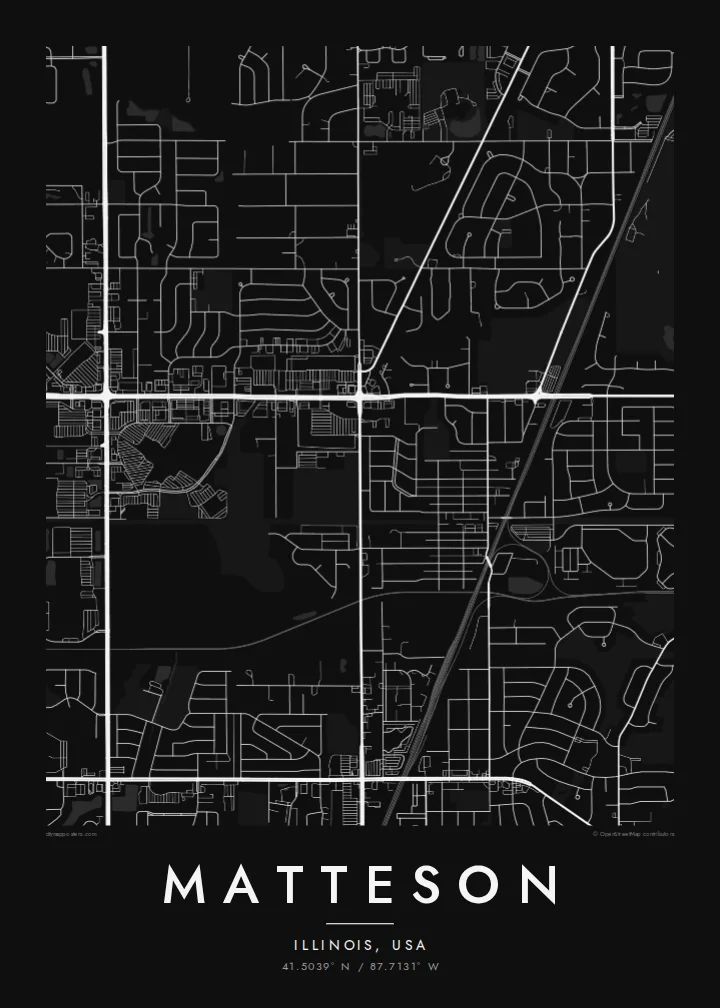
US 30 crosses the village east to west along the route of the Lincoln Highway, the early twentieth-century road linking New York and San Francisco. On the poster it is one of the longest straight lines.
Minimalist na map poster · Estados Unidos
41.5039° N / 87.7131° W
A south-suburban Chicago grid where Interstate 57, the Lincoln Highway and the Metra Electric line cut clean lines across former prairie.



Isang lungsod, limang mood
I-tap ang isang estilo para makita ito sa dingding. Pareho ang presyo ng bawat estilo — naka-print, naka-frame, o bilang HD files.
 Aktwal na pixels · 24 × 36″ print file
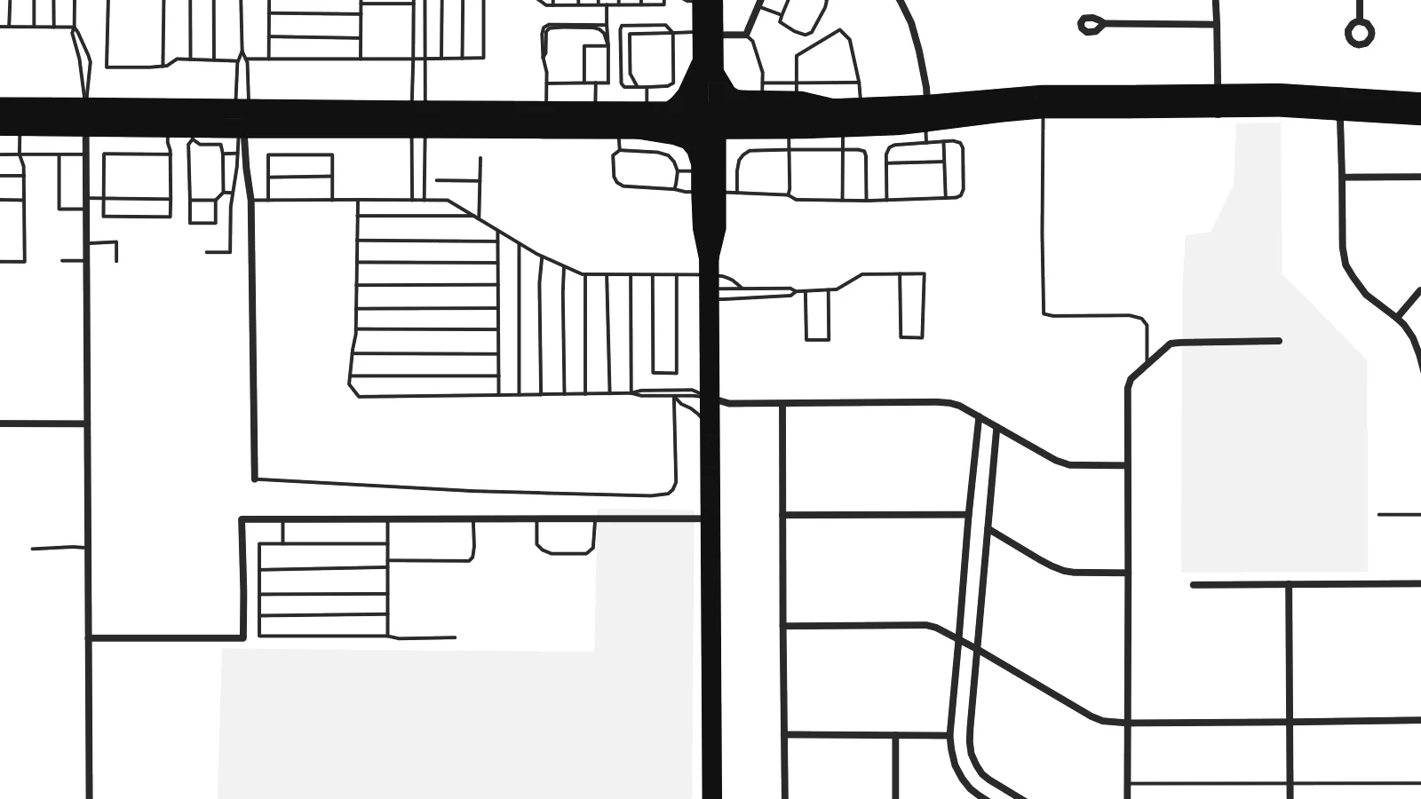
Matalas sa print
Ito ay 100% crop ng aktwal na print file. Bawat poster — naka-print, naka-frame, o na-download — ay ginagawa sa aming mga server sa 300 DPI, hanggang 7,200 × 10,800 pixels, kaya malinaw pa rin ang pinakamaliliit na kalye kahit sa 24 × 36″ na print.
Sa dingding


Ang mapa
Matteson sits on the flat land south of Chicago, where the old prairie was divided into survey-mile squares long before the houses arrived. From above, that pattern is still easy to read. Section-line roads run straight north–south and east–west, and the residential streets inside each square form the loops, cul-de-sacs and short crescents typical of postwar Illinois suburbs.
The village began as a railroad settlement and is named after Joel Matteson, a governor of Illinois in the 1850s. The rail corridor still runs through town and now carries Metra Electric commuter trains toward downtown Chicago. On the map it reads as a long, unbroken line, and most streets meet it at right angles instead of crossing it at random.
Two major roads frame the picture. Interstate 57 runs north–south through the village with its interchange ramps, and US 30, the historic Lincoln Highway, runs east–west along one of the country's earliest coast-to-coast routes. A Matteson map poster shows where a transcontinental road, a commuter railway and quiet residential blocks meet, all in one orderly composition.
US 30 crosses the village east to west along the route of the Lincoln Highway, the early twentieth-century road linking New York and San Francisco. On the poster it is one of the longest straight lines.
The interstate runs north–south through the village. Its interchange ramps are the most curved, sculptural shapes on an otherwise rectilinear map.
Between the section-line roads, subdivisions use curving drives and cul-de-sacs. Each square mile gets its own pattern of rounded lines inside a rigid outer frame.
Gawin mong sa iyo
Magdagdag ng petsa, pangalan o sarili mong linya, at palitan ang estilo, sukat o oryentasyon.
Ang libreng preview ay low-resolution na may watermark. Ang mga print at HD files ay ginagawa sa 300 DPI, hanggang 7,200 × 10,800 px, walang watermark.
Bakit Matteson
For people who grew up in the south suburbs or rode the Metra from here, the map is a quiet record of daily routes: the station, the highway ramps, the street where the family house stood. It suits a hallway, a home office or a first apartment in the city.
You can set your own title, subtitle and coordinates line, for example a family name or a move-in date, and choose Classic black & white, Noir, Paper, Blueprint or Sand. The $9 digital download includes six print sizes as 300 DPI PNG and PDF files. Printed and framed versions ship from partners in 30+ countries.
I-order ang Matteson poster| Sukat ng print | Resolution | Mga file |
|---|---|---|
| 30 × 40 cm11.8 × 15.7″ | 3,543 × 4,724 px | PNG · PDF |
| 29.7 × 42 cm (A3)11.7 × 16.5″ | 3,508 × 4,961 px | PNG · PDF |
| 42 × 59.4 cm (A2)16.5 × 23.4″ | 4,961 × 7,016 px | PNG · PDF |
| 45.7 × 61 cm18 × 24″ | 5,400 × 7,200 px | PNG · PDF |
| 50 × 70 cm19.7 × 27.6″ | 5,906 × 8,268 px | PNG · PDF |
| 61 × 91.4 cm24 × 36″ | 7,200 × 10,800 px | PNG · PDF |
Bilang paghahambing, ang libreng preview ay 900 px ang lapad, may watermark at para lang sa screen. Ang HD files ay may hanggang 8× na resolution sa bawat direksyon at malinis na napi-print sa buong laki ng poster.
Pumili ng estilo sa itaas ng page, pagkatapos ay piliin ang Printed Poster — isang size at, kung gusto mo, isang frame — o Digital HD Files. Isang hakbang lang ang checkout, at agad na mag-a-update ang iyong order page kapag natapos na ang bayad.
Naka-print ito sa premium na 200 gsm matte paper sa isa sa anim na sizes, mula 30 × 40 cm hanggang 24 × 36″. Nagsisimula ang naka-print na poster sa $39, kasama na ang shipping.
Oo. Pumili ng solid wood frame sa itim, puti, natural oak, o dark wood. May kasamang shatterproof glazing at handa nang isabit. Nagsisimula ang naka-frame na poster sa $99, kasama na ang shipping.
Libre ang shipping sa 60+ bansa. Ipi-print ang bawat poster ng pinakamalapit sa aming mga print partner sa 30+ bansa, at karaniwang dumarating ito sa loob ng 3–7 araw ng negosyo. Masusundan mo ang status at tracking sa Aking Mga Order. Ang ilang bansa ay inaabot ng 2–5 linggo, at kung hindi pa kami nagpapadala sa inyo, sasabihin ito ng site bago ka magbayad.
Magpadala lang ng larawan sa loob ng 14 na araw mula sa paghahatid at ipapa-print namin ulit ito nang libre o irerefund ka namin.
Oo. Sa editor sa page na ito, baguhin ang title, subtitle, at coordinates line sa anumang gusto mo, at pumili ng estilo at size. Ginagamit ng naka-print, naka-frame, at digital na order ang eksaktong disenyo mo.
Para sa $9, makukuha mo ang 300 DPI PNG at print-ready PDF files sa lahat ng anim na sizes, walang watermark, para ma-print kahit saan. Hindi pa sigurado? Mag-download muna ng libreng preview na may watermark.
