Nakanoshima island
A long, narrow island between the Dojima and Tosabori rivers, holding museums, offices and parks. On the map it forms a slender shape in the city centre.
Minimalist na map poster · Japan
34.6938° N / 135.5011° E
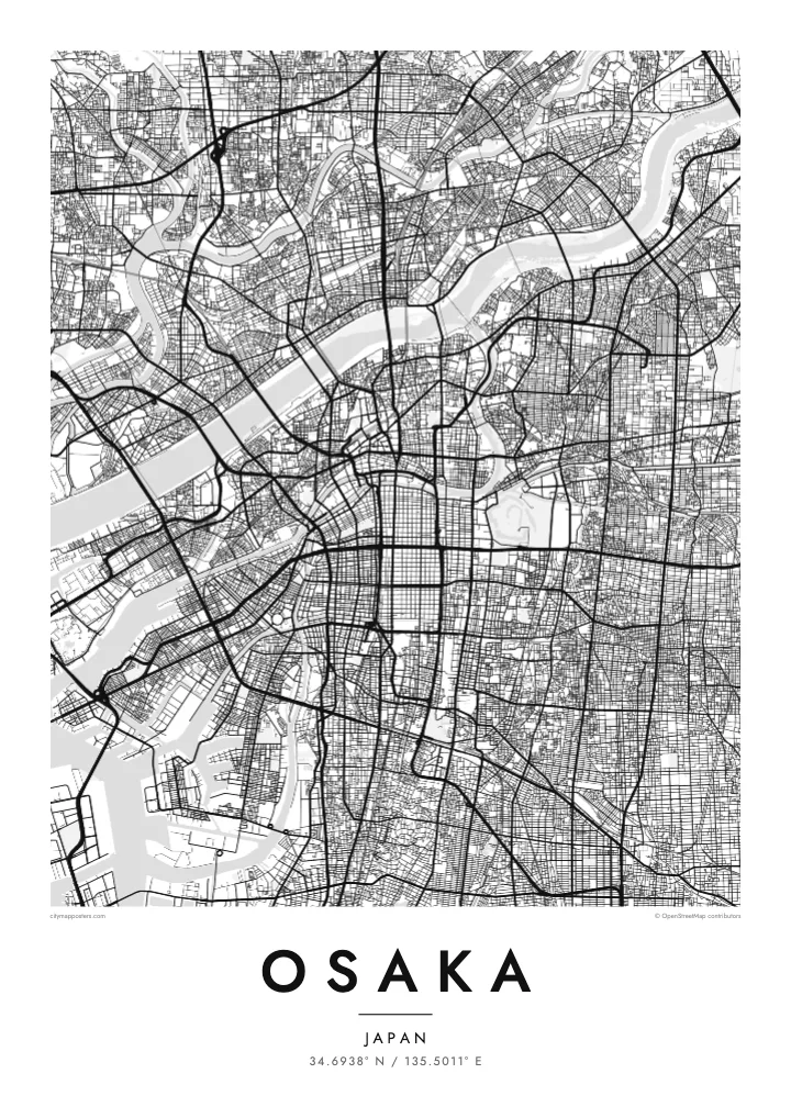
A dense bay city laced with rivers and canals, with a castle park and a long central boulevard


Isang lungsod, limang mood
I-tap ang isang estilo para makita ito sa dingding. Pareho ang presyo ng bawat estilo — naka-print, naka-frame, o bilang HD files.
 Aktwal na pixels · 24 × 36″ print file
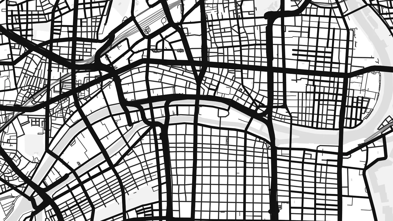
Matalas sa print
Ito ay 100% crop ng aktwal na print file. Bawat poster — naka-print, naka-frame, o na-download — ay ginagawa sa aming mga server sa 300 DPI, hanggang 7,200 × 10,800 pixels, kaya malinaw pa rin ang pinakamaliliit na kalye kahit sa 24 × 36″ na print.
Sa dingding


Ang mapa
Osaka sits on Osaka Bay, at the mouth of the Yodo River. From above, the city is a dense web of streets, criss-crossed by rivers and canals. The historic merchant city grew on this network of water, and many of its districts are still defined by the channels around them.
Nakanoshima, a long island between two rivers, holds public buildings and parks in the heart of the city. Midosuji, a wide boulevard, runs north–south through the centre. To the south, the Dotonbori canal cuts through one of the city's best-known entertainment districts, lined with neon signs and bridges.
On higher ground to the east lies Osaka Castle, surrounded by moats and a large park. The Osaka Loop Line rail circle runs around the central districts. An Osaka map poster shows how the rivers, canals, castle and boulevards come together in one of Japan's largest cities.
A long, narrow island between the Dojima and Tosabori rivers, holding museums, offices and parks. On the map it forms a slender shape in the city centre.
The castle stands within layered moats and a large park on higher ground east of the centre. It appears as a large, rectangular green space.
This canal runs east–west through the Namba area, crossed by many bridges. On the map it creates a thin, straight line through dense blocks.
Gawin mong sa iyo
Magdagdag ng petsa, pangalan o sarili mong linya, at palitan ang estilo, sukat o oryentasyon.
Ang libreng preview ay low-resolution na may watermark. Ang mga print at HD files ay ginagawa sa 300 DPI, hanggang 7,200 × 10,800 px, walang watermark.
Bakit Osaka
Osaka is remembered for food streets, river walks and late evenings in its neighbourhoods. For those who lived there or visited, a map of its rivers and canals is a clean reminder of the city.
Personalise the title, subtitle and coordinates, for instance with a ward name or a date, and choose Classic black & white, Noir, Paper, Blueprint or Sand. Get it as a digital file or printed poster.
I-order ang Osaka poster| Sukat ng print | Resolution | Mga file |
|---|---|---|
| 30 × 40 cm11.8 × 15.7″ | 3,543 × 4,724 px | PNG · PDF |
| 29.7 × 42 cm (A3)11.7 × 16.5″ | 3,508 × 4,961 px | PNG · PDF |
| 42 × 59.4 cm (A2)16.5 × 23.4″ | 4,961 × 7,016 px | PNG · PDF |
| 45.7 × 61 cm18 × 24″ | 5,400 × 7,200 px | PNG · PDF |
| 50 × 70 cm19.7 × 27.6″ | 5,906 × 8,268 px | PNG · PDF |
| 61 × 91.4 cm24 × 36″ | 7,200 × 10,800 px | PNG · PDF |
Bilang paghahambing, ang libreng preview ay 900 px ang lapad, may watermark at para lang sa screen. Ang HD files ay may hanggang 8× na resolution sa bawat direksyon at malinis na napi-print sa buong laki ng poster.
Pumili ng estilo sa itaas ng page, pagkatapos ay piliin ang Printed Poster — isang size at, kung gusto mo, isang frame — o Digital HD Files. Isang hakbang lang ang checkout, at agad na mag-a-update ang iyong order page kapag natapos na ang bayad.
Naka-print ito sa premium na 200 gsm matte paper sa isa sa anim na sizes, mula 30 × 40 cm hanggang 24 × 36″. Nagsisimula ang naka-print na poster sa $39, kasama na ang shipping.
Oo. Pumili ng solid wood frame sa itim, puti, natural oak, o dark wood. May kasamang shatterproof glazing at handa nang isabit. Nagsisimula ang naka-frame na poster sa $99, kasama na ang shipping.
Libre ang shipping sa 60+ bansa. Ipi-print ang bawat poster ng pinakamalapit sa aming mga print partner sa 30+ bansa, at karaniwang dumarating ito sa loob ng 3–7 araw ng negosyo. Masusundan mo ang status at tracking sa Aking Mga Order. Ang ilang bansa ay inaabot ng 2–5 linggo, at kung hindi pa kami nagpapadala sa inyo, sasabihin ito ng site bago ka magbayad.
Magpadala lang ng larawan sa loob ng 14 na araw mula sa paghahatid at ipapa-print namin ulit ito nang libre o irerefund ka namin.
Oo. Sa editor sa page na ito, baguhin ang title, subtitle, at coordinates line sa anumang gusto mo, at pumili ng estilo at size. Ginagamit ng naka-print, naka-frame, at digital na order ang eksaktong disenyo mo.
Para sa $9, makukuha mo ang 300 DPI PNG at print-ready PDF files sa lahat ng anim na sizes, walang watermark, para ma-print kahit saan. Hindi pa sigurado? Mag-download muna ng libreng preview na may watermark.
Malapit
