Irrigation tanks
Old water tanks are scattered across the countryside. Their irregular shapes form some of the clearest dark marks on the map.
Minimalistički poster s kartom · Indija
12.7617° N / 76.0603° E
A taluk town in Karnataka's Hassan district, surrounded by irrigated farmland, water tanks and the Kaveri valley.


Jedan grad, pet ugođaja
Dodirnite stil da ga vidite na zidu. Svi stilovi koštaju isto — tiskani, uokvireni ili kao HD datoteke.
 Stvarni pikseli · print datoteka 24 × 36″
Oštro za tisak
Ovo je 100% izrezak stvarne print datoteke. Svaki poster — tiskani, uokvireni ili preuzet — renderira se na našim serverima u 300 DPI, do 7,200 × 10,800 piksela, tako da čak i najsitnije linije ostanu oštre na ispisu 24 × 36″.
Na zidu


Karta
Arkalgūd is the main town of a taluk in Hassan district, in southern Karnataka, between the coffee hills of the Western Ghats and the plains of Mysuru. The Kaveri River flows through the taluk, and the area around the town is shaped by its valley. Irrigation has turned much of the land into paddy and sugarcane fields.
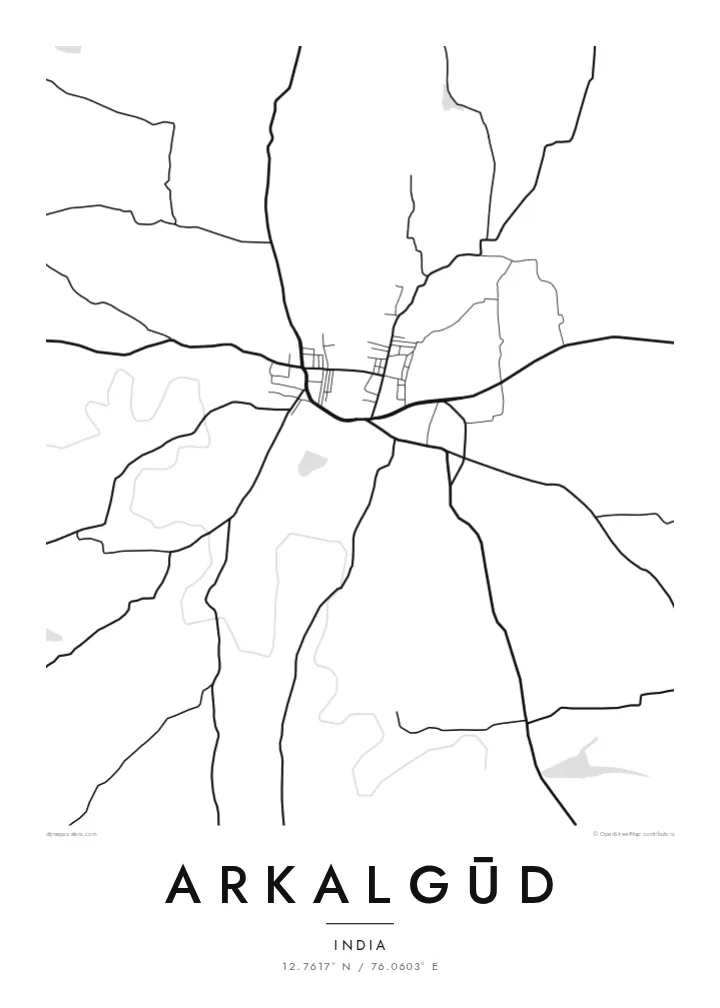
The town itself is small and compact, with a market centre and roads leading out to surrounding villages. One of the most distinctive features of the landscape is the old system of water tanks, a traditional form of irrigation reservoir in southern India. These irregular shapes are scattered across the fields and appear as dark patches in black and white.
An Arkalgūd map poster shows the town among irrigation tanks, fields and village roads. The composition is calm and open, and the tanks add small dark shapes across the frame. It shows a working agricultural landscape in the region between the hills and the Kaveri plains.
Old water tanks are scattered across the countryside. Their irregular shapes form some of the clearest dark marks on the map.
The town centre is compact, with a small cluster of streets from which roads lead outward to villages across the taluk.
Irrigated fields cover much of the land toward the river valley. Their small plots create a fine, even texture throughout the poster.
Prilagodite ga sebi
Dodajte datum, ime ili vlastiti redak teksta, promijenite stil, veličinu ili orijentaciju.
Besplatni pregled je niske rezolucije s vodenim žigom. Tiskani posteri i HD datoteke renderiraju se u 300 DPI, do 7,200 × 10,800 px, bez vodenog žiga.
Zašto Arkalgūd
Families from Hassan district, many of whom now live in Bengaluru or abroad, may want a map of the town they still call home. The tanks and fields give the print a strong character, and it looks good in a study or living room.
You can personalise the title, subtitle and coordinates line, including text in Kannada. There are five styles: Classic black & white, Noir, Paper, Blueprint and Sand. Blueprint makes the tanks and roads especially clear.
Naručite poster Arkalgūd| Veličina otiska | Rezolucija | Datoteke |
|---|---|---|
| 30 × 40 cm (11.8 × 15.7″) | 3,543 × 4,724 px | PNG · PDF |
| 29.7 × 42 cm (A3, 11.7 × 16.5″) | 3,508 × 4,961 px | PNG · PDF |
| 42 × 59.4 cm (A2, 16.5 × 23.4″) | 4,961 × 7,016 px | PNG · PDF |
| 45.7 × 61 cm (18 × 24″) | 5,400 × 7,200 px | PNG · PDF |
| 50 × 70 cm (19.7 × 27.6″) | 5,906 × 8,268 px | PNG · PDF |
| 61 × 91.4 cm (24 × 36″) | 7,200 × 10,800 px | PNG · PDF |
Za usporedbu, besplatni pregled širok je 900 px, ima vodeni žig i namijenjen je zaslonima. HD datoteke imaju do 8× veću rezoluciju u svakom smjeru i čisto se tiskaju u punoj veličini postera.
Odaberite stil na vrhu stranice, a zatim Tiskani poster — veličinu i, ako želite, okvir — ili Digitalne HD datoteke. Naplata traje samo jedan korak, a stranica vaše narudžbe ažurira se čim plaćanje prođe.
Tiska se na premium mat papiru 200 g/m² u jednoj od šest veličina, od 30 × 40 cm do 24 × 36″. Tiskani posteri kreću od {printFrom}, dostava uključena.
Da. Odaberite okvir od masivnog drveta u crnoj, bijeloj, prirodnoj hrastovoj ili tamnoj boji drveta. Dolazi sa staklom otpornim na lom i spreman je za vješanje. Uokvireni posteri kreću od {framedFrom}, dostava uključena.
Dostava je besplatna u cijelom svijetu. Svaki plakat tiska najbliži od naših tiskarskih partnera u više od 30 zemalja, a obično stiže za 3–7 radnih dana. Status i praćenje pošiljke možete pratiti u odjeljku Moje narudžbe. U nekim zemljama dostava traje 2–5 tjedana, a ako još ne dostavljamo u vašu zemlju, stranica će vas na to upozoriti prije plaćanja.
Pošaljite nam fotografiju u roku od 14 dana od dostave i besplatno ćemo ga ponovno tiskati ili vratiti novac.
Da. U uređivaču na ovoj stranici promijenite naslov, podnaslov i redak s koordinatama u što god želite, te odaberite stil i veličinu. Tiskane, uokvirene i digitalne narudžbe koriste točno vaš dizajn.
Za $9 dobivate 300 DPI PNG i PDF datoteke spremne za tisak u svih šest veličina, bez vodenog žiga, za ispis bilo gdje. Niste sigurni? Prvo preuzmite besplatan pregled s vodenim žigom.
U blizini
