River Lagan bridges
The Lagan winds through the city before widening into the lough. A row of bridges stitches its east and west banks together across the poster.
Minimalistički poster s kartom · Ujedinjeno Kraljevstvo
54.5968° N / 5.9254° W
A city spread around the head of Belfast Lough, split by the River Lagan and framed by dark hills


Jedan grad, pet ugođaja
Dodirnite stil da ga vidite na zidu. Svi stilovi koštaju isto — tiskani, uokvireni ili kao HD datoteke.
 Stvarni pikseli · print datoteka 24 × 36″
Oštro za tisak
Ovo je 100% izrezak stvarne print datoteke. Svaki poster — tiskani, uokvireni ili preuzet — renderira se na našim serverima u 300 DPI, do 7,200 × 10,800 piksela, tako da čak i najsitnije linije ostanu oštre na ispisu 24 × 36″.
Na zidu


Karta
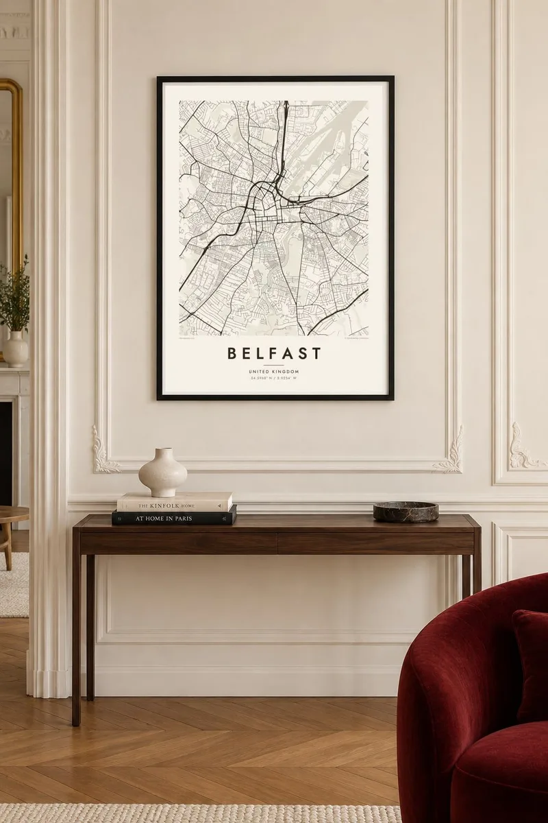
Belfast sits where the River Lagan flows into Belfast Lough. On the map, the lough opens out to the northeast, docks and shipyards fill the land beside it, and the city centre gathers around City Hall and Donegall Square. To the north and west the streets climb toward a line of hills, with the distinctive outline of Cave Hill looking down over everything.
The city's industrial history is written into its shape. Harland & Wolff's shipyard built the Titanic, and the reclaimed land where the ship was launched is now the Titanic Quarter, home to a large museum. South of the centre, Queen's University and the Botanic Gardens anchor a quieter district of terraces.
A Belfast map poster carries all of these layers: the curving Lagan with its bridges, the long straight quays, the tight terraced streets of the inner neighbourhoods and the broad docklands opening onto the lough. It is a city whose water and industry still determine how it looks from above.
The Lagan winds through the city before widening into the lough. A row of bridges stitches its east and west banks together across the poster.
The former shipyard land on Queen's Island, where the Titanic was built, makes a large open area. The shapes of old slipways and docks stand out against the lough.
To the north the streets stop at the slopes of Cave Hill. The built area gives way to parkland and steep ground at the top of the composition.
Prilagodite ga sebi
Dodajte datum, ime ili vlastiti redak teksta, promijenite stil, veličinu ili orijentaciju.
Besplatni pregled je niske rezolucije s vodenim žigom. Tiskani posteri i HD datoteke renderiraju se u 300 DPI, do 7,200 × 10,800 px, bez vodenog žiga.
Zašto Belfast
Belfast has a large diaspora, and a map of the city makes a fitting gift for anyone who grew up there, studied at Queen's or still keeps family ties. It also appeals to anyone interested in the city's maritime and industrial past.
Personalise the title, subtitle and coordinates line to mark an address, a graduation or a wedding. Then choose from five styles: Classic black & white, Noir, Paper, Blueprint or Sand. Blueprint suits the shipbuilding heritage particularly well.
Naručite poster Belfast| Veličina otiska | Rezolucija | Datoteke |
|---|---|---|
| 30 × 40 cm (11.8 × 15.7″) | 3,543 × 4,724 px | PNG · PDF |
| 29.7 × 42 cm (A3, 11.7 × 16.5″) | 3,508 × 4,961 px | PNG · PDF |
| 42 × 59.4 cm (A2, 16.5 × 23.4″) | 4,961 × 7,016 px | PNG · PDF |
| 45.7 × 61 cm (18 × 24″) | 5,400 × 7,200 px | PNG · PDF |
| 50 × 70 cm (19.7 × 27.6″) | 5,906 × 8,268 px | PNG · PDF |
| 61 × 91.4 cm (24 × 36″) | 7,200 × 10,800 px | PNG · PDF |
Za usporedbu, besplatni pregled širok je 900 px, ima vodeni žig i namijenjen je zaslonima. HD datoteke imaju do 8× veću rezoluciju u svakom smjeru i čisto se tiskaju u punoj veličini postera.
Odaberite stil na vrhu stranice, a zatim Tiskani poster — veličinu i, ako želite, okvir — ili Digitalne HD datoteke. Naplata traje samo jedan korak, a stranica vaše narudžbe ažurira se čim plaćanje prođe.
Tiska se na premium mat papiru 200 g/m² u jednoj od šest veličina, od 30 × 40 cm do 24 × 36″. Tiskani posteri kreću od $39, dostava uključena.
Da. Odaberite okvir od masivnog drveta u crnoj, bijeloj, prirodnoj hrastovoj ili tamnoj boji drveta. Dolazi sa staklom otpornim na lom i spreman je za vješanje. Uokvireni posteri kreću od $99, dostava uključena.
Dostava je besplatna u cijelom svijetu. Svaki plakat tiska najbliži od naših tiskarskih partnera u više od 30 zemalja, a obično stiže za 3–7 radnih dana. Status i praćenje pošiljke možete pratiti u odjeljku Moje narudžbe. U nekim zemljama dostava traje 2–5 tjedana, a ako još ne dostavljamo u vašu zemlju, stranica će vas na to upozoriti prije plaćanja.
Pošaljite nam fotografiju u roku od 14 dana od dostave i besplatno ćemo ga ponovno tiskati ili vratiti novac.
Da. U uređivaču na ovoj stranici promijenite naslov, podnaslov i redak s koordinatama u što god želite, te odaberite stil i veličinu. Tiskane, uokvirene i digitalne narudžbe koriste točno vaš dizajn.
Za $9 dobivate 300 DPI PNG i PDF datoteke spremne za tisak u svih šest veličina, bez vodenog žiga, za ispis bilo gdje. Niste sigurni? Prvo preuzmite besplatan pregled s vodenim žigom.
U blizini
