Panel block geometry
Large residential blocks are grouped in repeating patterns along the avenues. They give the map a rhythmic, graphic quality that suits a minimalist poster.
Minimalistički poster s kartom · Slovačka
48.1233° N / 17.1287° E
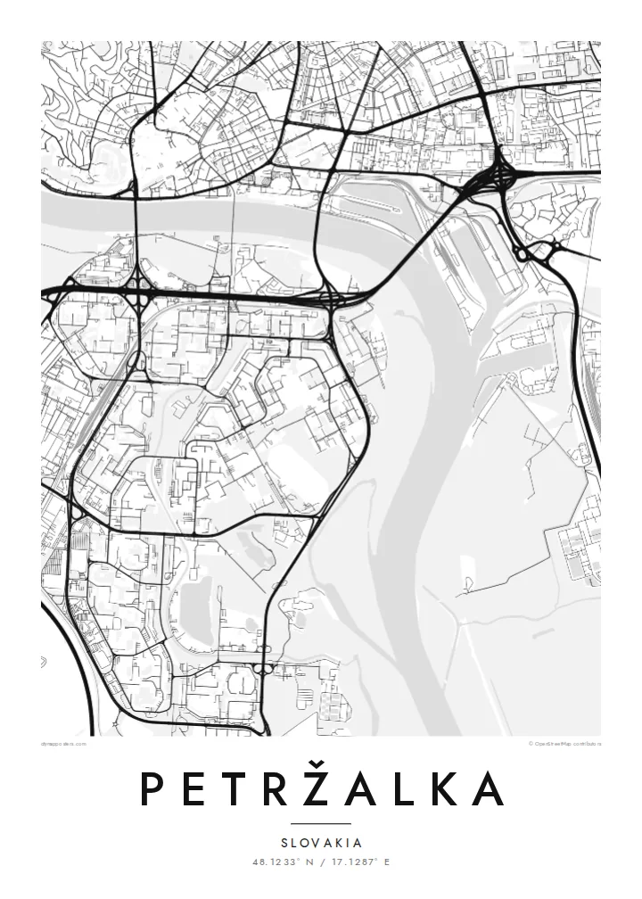
A vast housing estate on the right bank of the Danube, facing Bratislava's old town across the water


Jedan grad, pet ugođaja
Dodirnite stil da ga vidite na zidu. Svi stilovi koštaju isto — tiskani, uokvireni ili kao HD datoteke.
 Stvarni pikseli · print datoteka 24 × 36″
Oštro za tisak
Ovo je 100% izrezak stvarne print datoteke. Svaki poster — tiskani, uokvireni ili preuzet — renderira se na našim serverima u 300 DPI, do 7,200 × 10,800 piksela, tako da čak i najsitnije linije ostanu oštre na ispisu 24 × 36″.
Na zidu


Karta
Petržalka is the Bratislava borough on the south bank of the Danube, opposite the old town and the castle hill. On a map it looks quite unlike the historic city. It is a huge field of large prefabricated residential blocks, arranged in geometric groups along wide avenues, with lakes and green strips between them.
The Danube forms its northern edge, crossed by several bridges, among them the SNP Bridge with its disc-shaped tower. Along the riverbank lies Sad Janka Kráľa, often described as one of the oldest public parks in Central Europe. To the south and west the district reaches the Austrian border.
A Petržalka map poster depicts one of the largest panel housing estates in Central Europe, a clear example of late twentieth-century urban planning. In black and white, its repeated shapes, curving avenues and the broad river create a strong, almost abstract image.
Large residential blocks are grouped in repeating patterns along the avenues. They give the map a rhythmic, graphic quality that suits a minimalist poster.
Several bridges connect the district with the old town across the river. The SNP Bridge is the best known, recognisable by its round tower.
Sad Janka Kráľa lines the Danube bank with trees and paths. It is a soft green band between the river and the estates.
Prilagodite ga sebi
Dodajte datum, ime ili vlastiti redak teksta, promijenite stil, veličinu ili orijentaciju.
Besplatni pregled je niske rezolucije s vodenim žigom. Tiskani posteri i HD datoteke renderiraju se u 300 DPI, do 7,200 × 10,800 px, bez vodenog žiga.
Zašto Petržalka
Many Bratislava residents grew up in Petržalka or started their adult life there. A map of the district shows the blocks, lakes and river that shaped everyday routines, with an honesty that suits the place.
The title, subtitle and coordinates can be personalised, for example with a street address or the year you moved in. Choose Classic black and white, Noir, Paper, Blueprint or Sand, with Blueprint especially fitting for a planned district.
Naručite poster Petržalka| Veličina otiska | Rezolucija | Datoteke |
|---|---|---|
| 30 × 40 cm11.8 × 15.7″ | 3,543 × 4,724 px | PNG · PDF |
| 29.7 × 42 cm (A3)11.7 × 16.5″ | 3,508 × 4,961 px | PNG · PDF |
| 42 × 59.4 cm (A2)16.5 × 23.4″ | 4,961 × 7,016 px | PNG · PDF |
| 45.7 × 61 cm18 × 24″ | 5,400 × 7,200 px | PNG · PDF |
| 50 × 70 cm19.7 × 27.6″ | 5,906 × 8,268 px | PNG · PDF |
| 61 × 91.4 cm24 × 36″ | 7,200 × 10,800 px | PNG · PDF |
Za usporedbu, besplatni pregled širok je 900 px, ima vodeni žig i namijenjen je zaslonima. HD datoteke imaju do 8× veću rezoluciju u svakom smjeru i čisto se tiskaju u punoj veličini postera.
Odaberite stil na vrhu stranice, a zatim Tiskani poster — veličinu i, ako želite, okvir — ili Digitalne HD datoteke. Naplata traje samo jedan korak, a stranica vaše narudžbe ažurira se čim plaćanje prođe.
Tiska se na premium mat papiru 200 g/m² u jednoj od šest veličina, od 30 × 40 cm do 24 × 36″. Tiskani posteri kreću od $39, dostava uključena.
Da. Odaberite okvir od masivnog drveta u crnoj, bijeloj, prirodnoj hrastovoj ili tamnoj boji drveta. Dolazi sa staklom otpornim na lom i spreman je za vješanje. Uokvireni posteri kreću od $99, dostava uključena.
Dostava je besplatna u 60+ zemalja. Svaki poster tiska najbliži od naših partnera za tisak u 30+ zemalja, a obično stiže za 3–7 radnih dana. Status i praćenje pošiljke možete pratiti u odjeljku Moje narudžbe. Za nekoliko zemalja dostava traje 2–5 tjedana, a ako još ne dostavljamo u vašu zemlju, stranica će vas na to upozoriti prije plaćanja.
Pošaljite nam fotografiju u roku od 14 dana od dostave i besplatno ćemo ga ponovno tiskati ili vratiti novac.
Da. U uređivaču na ovoj stranici promijenite naslov, podnaslov i redak s koordinatama u što god želite, te odaberite stil i veličinu. Tiskane, uokvirene i digitalne narudžbe koriste točno vaš dizajn.
Za $9 dobivate 300 DPI PNG i PDF datoteke spremne za tisak u svih šest veličina, bez vodenog žiga, za ispis bilo gdje. Niste sigurni? Prvo preuzmite besplatan pregled s vodenim žigom.
