Cliff-bound coastline
The shoreline is mostly steep rock, with only a few inlets where boats can approach. On the poster the edge of the island appears sharp and irregular, giving the landmass a clear, almost sculpted outline.
Minimalista térképposzter · Görögország
35.8644° N / 23.2989° E
A small, steep-sided island between Kythera and Crete, its rocky outline broken by a few coves and a single harbour.


Egy város, öt hangulat
Koppints egy stílusra, hogy lásd a falon. Minden stílus ugyanannyiba kerül — nyomtatva, kerettel vagy HD fájlként.
 Valódi pixelek · 24 × 36″ nyomtatási fájl
Nyomtatásban is éles
Ez a valódi nyomtatási fájl 100%-os kivágata. Minden poszter — nyomtatva, kerettel vagy letöltve — szervereinken 300 DPI-vel, akár 7,200 × 10,800 pixel felbontásban készül, így a legkisebb utcák is élesek maradnak egy 24 × 36″-os nyomaton is.
A falon


A térkép
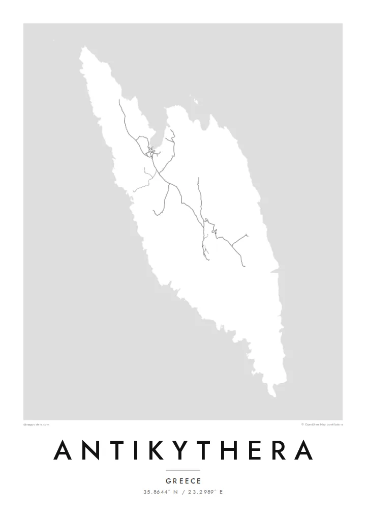
Antikythera sits alone in the strait between Kythera and Crete, a compact wedge of limestone with very little flat ground. From above, the island reads as a rough, elongated shape fringed by cliffs, with a handful of tracks threading between a small harbour settlement and scattered hamlets. The sea takes up most of the frame, and the land becomes a single pale form surrounded by open water.
The island is known worldwide for what was found just offshore. At the start of the twentieth century, sponge divers came across an ancient shipwreck here, and among its cargo was the Antikythera mechanism, a geared bronze device often described as the oldest known analogue computer. The object is now kept in the National Archaeological Museum in Athens, but its name will always point back to this coastline.
An Antikythera map poster is an exercise in restraint. There is no dense grid to fill the paper, only a coastline, a thin network of roads and the contour of the island against a wide field of white or black. The result is quiet and graphic, a shape that people who know the island tend to recognise at once, and that others find simply striking.
The shoreline is mostly steep rock, with only a few inlets where boats can approach. On the poster the edge of the island appears sharp and irregular, giving the landmass a clear, almost sculpted outline.
A small sheltered cove on the northern side serves as the island's port and its link to the ferries. It is where the few roads converge, which makes it the natural focal point of the map.
The waters off the island hold the wreck that yielded the famous mechanism. Nothing marks the spot on a street map, yet the empty sea around the coast carries that story for anyone who knows it.
Tedd a sajátoddá
Adj hozzá dátumot, nevet vagy saját szöveget, válts stílust, méretet vagy tájolást.
Az ingyenes előnézet alacsony felbontású és vízjeles. A nyomatok és a HD fájlok 300 DPI-vel, akár 7,200 × 10,800 px felbontásban készülnek, vízjel nélkül.
Miért Antikythera?
Antikythera appeals to people who care about the history of science, to divers and sailors, and to anyone who has made the long ferry crossing to reach it. The poster is less about streets than about one island standing alone in open sea, a small object with an outsized story.
You can add your own title and subtitle, such as the date of a visit or a line about the mechanism, and adjust the coordinates line. Choose from Classic black & white, Noir, Paper, Blueprint or Sand; Blueprint suits the scientific theme particularly well. Download HD files for $9 or order a printed poster.
Antikythera poszter megrendelése| Nyomtatási méret | Felbontás | Fájlok |
|---|---|---|
| 30 × 40 cm11.8 × 15.7″ | 3,543 × 4,724 px | PNG · PDF |
| 29.7 × 42 cm (A3)11.7 × 16.5″ | 3,508 × 4,961 px | PNG · PDF |
| 42 × 59.4 cm (A2)16.5 × 23.4″ | 4,961 × 7,016 px | PNG · PDF |
| 45.7 × 61 cm18 × 24″ | 5,400 × 7,200 px | PNG · PDF |
| 50 × 70 cm19.7 × 27.6″ | 5,906 × 8,268 px | PNG · PDF |
| 61 × 91.4 cm24 × 36″ | 7,200 × 10,800 px | PNG · PDF |
Összehasonlításképp: az ingyenes előnézet 900 px széles, vízjeles, és képernyőn való megtekintésre készült. A HD fájlok mindkét irányban akár 8× nagyobb felbontásúak, és teljes poszterméretben is tisztán nyomtathatók.
Válassz egy stílust az oldal tetején, majd válaszd a Nyomtatott poszter opciót — méretet és, ha szeretnéd, keretet is — vagy a Digitális HD fájlokat. A fizetés egy lépésből áll, és a rendelési oldalad azonnal frissül, amint a fizetés megtörtént.
Prémium, 200 g/m²-es matt papírra nyomtatjuk, hat méretben, 30 × 40 cm-től 24 × 36″-ig. A nyomtatott poszterek ára $39-tól indul, szállítással együtt.
Igen. Válassz tömör fa keretet fekete, fehér, natúr tölgy vagy sötét fa színben. Törésálló üvegezéssel érkezik, azonnal felakasztható. A keretezett poszterek ára $99-tól indul, szállítással együtt.
A szállítás 60+ országba ingyenes. Minden plakátot a hozzánk legközelebbi nyomdai partnerünk nyomtat ki, több mint 30 országban, és általában 3–7 munkanap alatt érkezik meg. Az állapotot és a követést a Rendeléseim menüpontban követheted nyomon. Néhány országba 2–5 hétig tart a szállítás, és ahová még nem szállítunk, ott az oldal fizetés előtt jelzi.
Küldj nekünk egy fotót a kézbesítéstől számított 14 napon belül, és ingyen újranyomtatjuk, vagy visszatérítjük az összeget.
Igen. Az oldalon található szerkesztőben tetszés szerint módosíthatod a címet, az alcímet és a koordináták sorát, majd válassz stílust és méretet. A nyomtatott, keretezett és digitális rendelések is pontosan a te tervedet használják.
$9-ért 300 DPI-s PNG és nyomtatásra kész PDF fájlokat kapsz mind a hat méretben, vízjel nélkül, bárhol kinyomtathatod. Még nem vagy biztos benne? Töltsd le először az ingyenes, vízjeles előnézetet.
A közelben
