Baie des Anges
Nice's wide bay follows a smooth arc lined by the Promenade des Anglais, with the old town and the port tucked behind the castle hill at its eastern end.
Minimalista térképposzter · Franciaország
43.9525° N / 7.5436° E
A curving shoreline of bays and rocky capes, with Cannes, Antibes, Nice and Monaco strung between the mountains and the sea


Egy város, öt hangulat
Koppints egy stílusra, hogy lásd a falon. Minden stílus ugyanannyiba kerül — nyomtatva, kerettel vagy HD fájlként.
 Valódi pixelek · 24 × 36″ nyomtatási fájl
Nyomtatásban is éles
Ez a valódi nyomtatási fájl 100%-os kivágata. Minden poszter — nyomtatva, kerettel vagy letöltve — szervereinken 300 DPI-vel, akár 7,200 × 10,800 pixel felbontásban készül, így a legkisebb utcák is élesek maradnak egy 24 × 36″-os nyomaton is.
A falon


A térkép
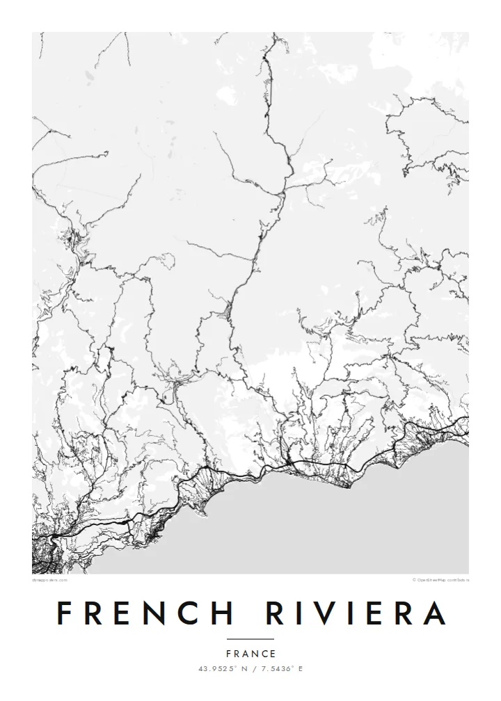
The French Riviera, or Côte d'Azur, runs along the Mediterranean in the far southeast of France, up to the Italian border. From above it is a series of wide bays separated by rocky capes: the Baie des Anges at Nice, Cap d'Antibes, Cap Ferrat and Cap Martin. Behind them the land rises quickly into the foothills of the Alps, which push the towns down toward the water.
The coast became a winter resort for wealthy British and Russian visitors in the nineteenth century, which is why the seafront at Nice is still called the Promenade des Anglais. Cannes holds its international film festival along the Croisette, and the principality of Monaco fills a tight pocket of coast between Nice and Menton.
A French Riviera map poster shows three distinct layers: the long curve of the seafront promenades, the dense street networks of the cities, and the corniche roads cut higher up the slope. East of Nice, the Basse, Moyenne and Grande Corniche run roughly parallel one above another, while west of Cannes the red rocks of the Estérel give the shore a jagged edge.
Nice's wide bay follows a smooth arc lined by the Promenade des Anglais, with the old town and the port tucked behind the castle hill at its eastern end.
Between Nice and Menton three roads run at different heights along the slope, and their near-parallel lines stack up one above another over the coast.
Cap d'Antibes and Cap Ferrat push into the sea as rounded peninsulas, their quiet villa roads contrasting with the denser cities on either side.
Tedd a sajátoddá
Adj hozzá dátumot, nevet vagy saját szöveget, válts stílust, méretet vagy tájolást.
Az ingyenes előnézet alacsony felbontású és vízjeles. A nyomatok és a HD fájlok 300 DPI-vel, akár 7,200 × 10,800 px felbontásban készülnek, vízjel nélkül.
Miért French Riviera?
It suits anyone who has lived on the coast, spent summers there or remembers one particular town. Set the title to Nice, Côte d'Azur or a place of your own, add a date in the subtitle, and move the coordinates to the spot that matters.
Noir gives the Mediterranean a night-time depth, while Sand suits the warm light of the coast. Classic black & white, Paper and Blueprint complete the five styles. Printed posters come on matte paper and ship from partners in more than 30 countries.
French Riviera poszter megrendelése| Nyomtatási méret | Felbontás | Fájlok |
|---|---|---|
| 30 × 40 cm11.8 × 15.7″ | 3,543 × 4,724 px | PNG · PDF |
| 29.7 × 42 cm (A3)11.7 × 16.5″ | 3,508 × 4,961 px | PNG · PDF |
| 42 × 59.4 cm (A2)16.5 × 23.4″ | 4,961 × 7,016 px | PNG · PDF |
| 45.7 × 61 cm18 × 24″ | 5,400 × 7,200 px | PNG · PDF |
| 50 × 70 cm19.7 × 27.6″ | 5,906 × 8,268 px | PNG · PDF |
| 61 × 91.4 cm24 × 36″ | 7,200 × 10,800 px | PNG · PDF |
Összehasonlításképp: az ingyenes előnézet 900 px széles, vízjeles, és képernyőn való megtekintésre készült. A HD fájlok mindkét irányban akár 8× nagyobb felbontásúak, és teljes poszterméretben is tisztán nyomtathatók.
Válassz egy stílust az oldal tetején, majd válaszd a Nyomtatott poszter opciót — méretet és, ha szeretnéd, keretet is — vagy a Digitális HD fájlokat. A fizetés egy lépésből áll, és a rendelési oldalad azonnal frissül, amint a fizetés megtörtént.
Prémium, 200 g/m²-es matt papírra nyomtatjuk, hat méretben, 30 × 40 cm-től 24 × 36″-ig. A nyomtatott poszterek ára $39-tól indul, szállítással együtt.
Igen. Válassz tömör fa keretet fekete, fehér, natúr tölgy vagy sötét fa színben. Törésálló üvegezéssel érkezik, azonnal felakasztható. A keretezett poszterek ára $99-tól indul, szállítással együtt.
A szállítás 60+ országba ingyenes. Minden plakátot a hozzánk legközelebbi nyomdai partnerünk nyomtat ki, több mint 30 országban, és általában 3–7 munkanap alatt érkezik meg. Az állapotot és a követést a Rendeléseim menüpontban követheted nyomon. Néhány országba 2–5 hétig tart a szállítás, és ahová még nem szállítunk, ott az oldal fizetés előtt jelzi.
Küldj nekünk egy fotót a kézbesítéstől számított 14 napon belül, és ingyen újranyomtatjuk, vagy visszatérítjük az összeget.
Igen. Az oldalon található szerkesztőben tetszés szerint módosíthatod a címet, az alcímet és a koordináták sorát, majd válassz stílust és méretet. A nyomtatott, keretezett és digitális rendelések is pontosan a te tervedet használják.
$9-ért 300 DPI-s PNG és nyomtatásra kész PDF fájlokat kapsz mind a hat méretben, vízjel nélkül, bárhol kinyomtathatod. Még nem vagy biztos benne? Töltsd le először az ingyenes, vízjeles előnézetet.
A közelben
