Johana old town
Narrow streets on rising ground around Zentoku-ji form the historic core. Their tight, regular pattern stands out sharply against the open fields around the town.
Minimalista térképposzter · Japán
36.5127° N / 136.8935° E
Johana's temple-town streets and the craft districts of central Nanto, set where the Toyama plain meets the mountains.


Egy város, öt hangulat
Koppints egy stílusra, hogy lásd a falon. Minden stílus ugyanannyiba kerül — nyomtatva, kerettel vagy HD fájlként.
 Valódi pixelek · 24 × 36″ nyomtatási fájl
Nyomtatásban is éles
Ez a valódi nyomtatási fájl 100%-os kivágata. Minden poszter — nyomtatva, kerettel vagy letöltve — szervereinken 300 DPI-vel, akár 7,200 × 10,800 pixel felbontásban készül, így a legkisebb utcák is élesek maradnak egy 24 × 36″-os nyomaton is.
A falon


A térkép
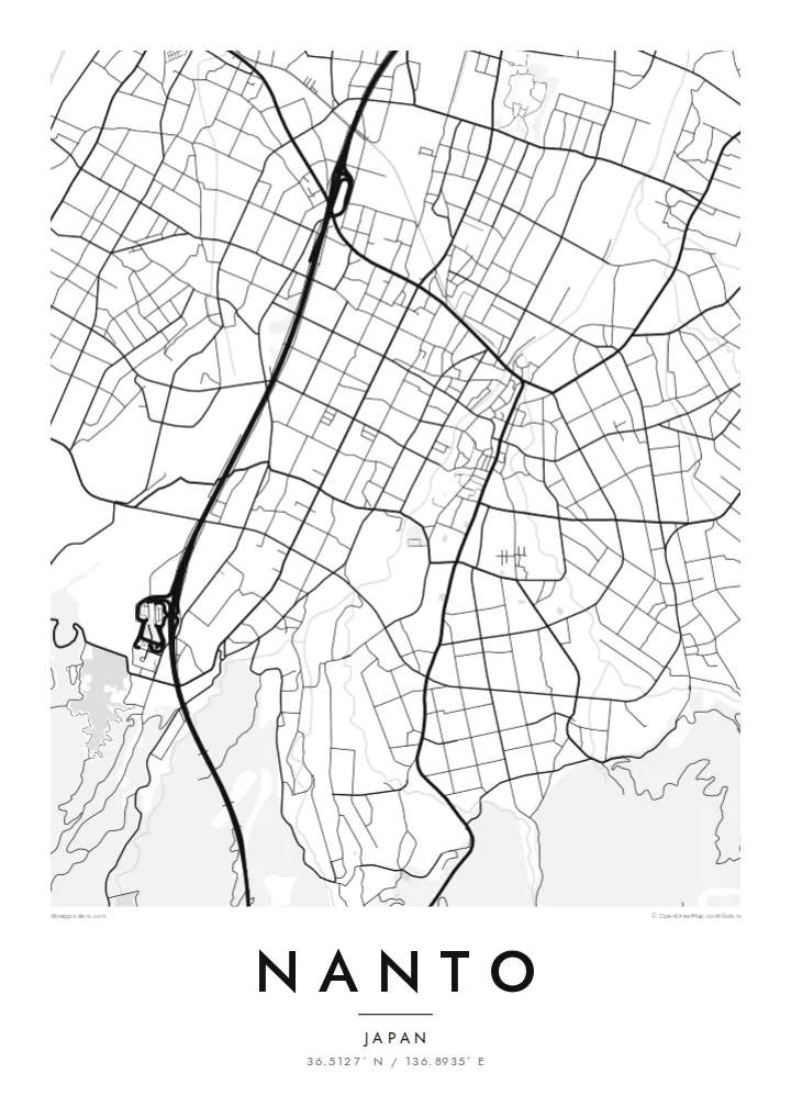
This map centres on the southern districts of Nanto, around the old town of Johana, where the Tonami plain narrows and meets the first ridges of the mountains. Johana grew as a temple town around Zentoku-ji, a large temple of the Jodo Shinshu school. Its centre is a tight grid of narrow streets lined with merchant houses, laid out on rising ground above the river.
Johana is known for its Hikiyama festival each spring, when ornate floats are pulled through the old streets. It is one of the Yama, Hoko, Yatai float festivals that UNESCO lists as intangible cultural heritage. Nearby Inami, also part of Nanto, has a long woodcarving tradition linked to the great Zuisen-ji temple.
A Nanto map poster centred on these districts shows a compact historic centre with small, walkable blocks, surrounded by paddies and the scattered farmsteads of the plain, with forested slopes rising to the south. It is a quieter, more intimate view than a map of the whole city, closer to the scale at which people actually live in Nanto.
Narrow streets on rising ground around Zentoku-ji form the historic core. Their tight, regular pattern stands out sharply against the open fields around the town.
The approach to Zuisen-ji in Inami is lined with woodcarvers' workshops. The craft grew up around the temple's rebuilding and still defines the district.
South of the town, the flat paddies give way to wooded ridges and river valleys, which add a denser, darker texture to the lower edge of the map.
Tedd a sajátoddá
Adj hozzá dátumot, nevet vagy saját szöveget, válts stílust, méretet vagy tájolást.
Az ingyenes előnézet alacsony felbontású és vízjeles. A nyomatok és a HD fájlok 300 DPI-vel, akár 7,200 × 10,800 px felbontásban készülnek, vízjel nélkül.
Miért Nanto?
Travellers who come for the festival, a woodcarving workshop or a trip to Gokayama often pass through these towns, where families have lived for centuries. This map is a precise keepsake of a small Japanese townscape and suits a calm, minimal interior.
Add a title such as Johana or Inami, a subtitle with a date, and the coordinates line. Choose Classic black & white, Noir, Paper, Blueprint or Sand, then download all six print sizes or order a matte print with an optional wooden frame.
Nanto poszter megrendelése| Nyomtatási méret | Felbontás | Fájlok |
|---|---|---|
| 30 × 40 cm11.8 × 15.7″ | 3,543 × 4,724 px | PNG · PDF |
| 29.7 × 42 cm (A3)11.7 × 16.5″ | 3,508 × 4,961 px | PNG · PDF |
| 42 × 59.4 cm (A2)16.5 × 23.4″ | 4,961 × 7,016 px | PNG · PDF |
| 45.7 × 61 cm18 × 24″ | 5,400 × 7,200 px | PNG · PDF |
| 50 × 70 cm19.7 × 27.6″ | 5,906 × 8,268 px | PNG · PDF |
| 61 × 91.4 cm24 × 36″ | 7,200 × 10,800 px | PNG · PDF |
Összehasonlításképp: az ingyenes előnézet 900 px széles, vízjeles, és képernyőn való megtekintésre készült. A HD fájlok mindkét irányban akár 8× nagyobb felbontásúak, és teljes poszterméretben is tisztán nyomtathatók.
Válassz egy stílust az oldal tetején, majd válaszd a Nyomtatott poszter opciót — méretet és, ha szeretnéd, keretet is — vagy a Digitális HD fájlokat. A fizetés egy lépésből áll, és a rendelési oldalad azonnal frissül, amint a fizetés megtörtént.
Prémium, 200 g/m²-es matt papírra nyomtatjuk, hat méretben, 30 × 40 cm-től 24 × 36″-ig. A nyomtatott poszterek ára $39-tól indul, szállítással együtt.
Igen. Válassz tömör fa keretet fekete, fehér, natúr tölgy vagy sötét fa színben. Törésálló üvegezéssel érkezik, azonnal felakasztható. A keretezett poszterek ára $99-tól indul, szállítással együtt.
A szállítás 60+ országba ingyenes. Minden plakátot a hozzánk legközelebbi nyomdai partnerünk nyomtat ki, több mint 30 országban, és általában 3–7 munkanap alatt érkezik meg. Az állapotot és a követést a Rendeléseim menüpontban követheted nyomon. Néhány országba 2–5 hétig tart a szállítás, és ahová még nem szállítunk, ott az oldal fizetés előtt jelzi.
Küldj nekünk egy fotót a kézbesítéstől számított 14 napon belül, és ingyen újranyomtatjuk, vagy visszatérítjük az összeget.
Igen. Az oldalon található szerkesztőben tetszés szerint módosíthatod a címet, az alcímet és a koordináták sorát, majd válassz stílust és méretet. A nyomtatott, keretezett és digitális rendelések is pontosan a te tervedet használják.
$9-ért 300 DPI-s PNG és nyomtatásra kész PDF fájlokat kapsz mind a hat méretben, vízjel nélkül, bárhol kinyomtathatod. Még nem vagy biztos benne? Töltsd le először az ingyenes, vízjeles előnézetet.
A közelben
