İstiklal Avenue
The pedestrian avenue from Taksim to Tünel follows the ridge in a long, slightly curving line. It is the clearest single stroke on the map.
Մինիմալիստական քարտեզ-պաստառ · Թուրքիա
41.0428° N / 28.9674° E
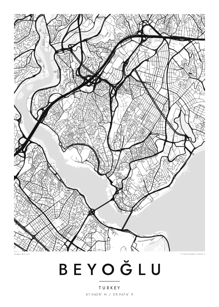
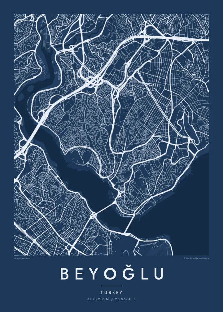
A hilly district above the Golden Horn and Bosphorus, with a pedestrian avenue running along the ridge from Taksim to Galata



Մեկ քաղաք, հինգ տրամադրություն
Հպեք ոճին՝ պատին տեսնելու համար։ Բոլոր ոճերն արժեն նույնը՝ տպված, շրջանակված կամ որպես HD ֆայլեր։
 Իրական պիքսելներ · 24 × 36″ տպագրական ֆայլ
Տպագրական հստակություն
Սա իրական տպագրական ֆայլի 100% հատվածն է։ Յուրաքանչյուր պաստառ՝ տպված, շրջանակված կամ ներբեռնված, մեր սերվերներում մշակվում է 300 DPI որակով, մինչև 7,200 × 10,800 պիքսել, այնպես որ նույնիսկ ամենանուրբ գծերը մնում են հստակ 24 × 36″ տպագրության վրա։
Պատին


Քարտեզը
Beyoğlu covers the high ground north of the Golden Horn, where the land rises steeply from the water to a long ridge. The streets follow that terrain. Short, steep lanes and stairways drop down towards Karaköy and the Bosphorus shore, while the main avenue runs along the top. On the map, the district looks like a spine with ribs.
That spine is İstiklal Avenue, a pedestrian street about a kilometre and a half long. It links Taksim Square at the northern end to Tünel near the Galata Tower. A red heritage tram runs along it. At the southern end, the Tünel funicular, opened in 1875, carries passengers down the slope to Karaköy and is one of the oldest underground railways in the world.
Once known as Pera, the district was home to embassies, merchants and a large non-Muslim population in the late Ottoman period. Many of its apartment buildings and arcades date from that time. A Beyoğlu map poster shows how steep ground, a single strong avenue and two bodies of water shaped one of Istanbul's most distinctive districts.
The pedestrian avenue from Taksim to Tünel follows the ridge in a long, slightly curving line. It is the clearest single stroke on the map.
The medieval stone tower stands on the southern slope above Karaköy. It marks the point where the district begins its descent to the Golden Horn.
Short, steep streets and flights of steps connect the ridge to the waterfront, giving the map a dense, fine-grained texture on its southern and eastern edges.
Դարձրեք այն ձերը
Ավելացրեք ամսաթիվ, անուն կամ ձեր սեփական տողը, փոխեք ոճը, չափսը կամ դիրքը։
Անվճար նախադիտումն ունի ցածր որակ և ջրանիշ։ Տպագրություններն ու HD ֆայլերը մշակվում են 300 DPI որակով, մինչև 7,200 × 10,800 px, առանց ջրանիշի։
Ինչու՝ Beyoğlu
Beyoğlu is where many people lived their Istanbul years, whether as students, new arrivals or night owls. A map of its ridge and slopes holds those streets together more faithfully than any photograph.
Personalise the title and subtitle with a date, an address or a line of your own. Choose one of five styles. Noir suits the district's late evenings, while Paper gives it the look of an old city plan.
Պատվիրել Beyoğlu պաստառը| Տպագրության չափս | Լուծաչափ | Ֆայլեր |
|---|---|---|
| 30 × 40 cm (11.8 × 15.7″) | 3,543 × 4,724 px | PNG · PDF |
| 29.7 × 42 cm (A3, 11.7 × 16.5″) | 3,508 × 4,961 px | PNG · PDF |
| 42 × 59.4 cm (A2, 16.5 × 23.4″) | 4,961 × 7,016 px | PNG · PDF |
| 45.7 × 61 cm (18 × 24″) | 5,400 × 7,200 px | PNG · PDF |
| 50 × 70 cm (19.7 × 27.6″) | 5,906 × 8,268 px | PNG · PDF |
| 61 × 91.4 cm (24 × 36″) | 7,200 × 10,800 px | PNG · PDF |
Համեմատության համար՝ անվճար նախադիտումը 900 px լայնությամբ է, ջրանիշով և նախատեսված է էկրանների համար։ HD ֆայլերն ունեն մինչև 8 անգամ ավելի բարձր լուծաչափ յուրաքանչյուր ուղղությամբ և մաքուր են տպվում պաստառի ամբողջ չափով։
Ընտրեք ոճը էջի վերևում, ապա ընտրեք Տպված պաստառ՝ չափս և, ցանկության դեպքում, շրջանակ, կամ Թվային HD ֆայլեր։ Վճարումը կատարվում է մեկ քայլով, և ձեր պատվերի էջը թարմացվում է հենց վճարումն ավարտվելուն պես։
Այն տպվում է պրեմիում 200 գ/մ² մատ թղթի վրա՝ վեց չափսերից մեկով, 30 × 40 սմ-ից մինչև 24 × 36″։ Տպված պաստառների գինը սկսվում է {printFrom}-ից՝ առաքումը ներառված է։
Այո։ Ընտրեք զանգվածեղեն փայտից շրջանակ՝ սև, սպիտակ, բնական կաղնի կամ մուգ փայտի գույնով։ Այն ունի հարվածակայուն ապակի և պատրաստ է կախման համար։ Շրջանակված պաստառների գինը սկսվում է {framedFrom}-ից՝ առաքումը ներառված է։
Առաքումն անվճար է ամբողջ աշխարհում։ Յուրաքանչյուր պաստառ տպվում է 30+ երկրներում գտնվող մեր տպագրական գործընկերներից ամենամոտով և սովորաբար հասնում է 3–7 աշխատանքային օրում։ Կարգավիճակն ու հետագծումը կարող եք տեսնել Իմ պատվերներ բաժնում։
Ուղարկեք մեզ լուսանկար առաքումից հետո 14 օրվա ընթացքում, և մենք անվճար կրկին կտպենք կամ գումարը կվերադարձնենք։
Այո։ Այս էջի խմբագրիչում փոխեք վերնագիրը, ենթավերնագիրը և կոորդինատների տողը ձեր ցանկությամբ, և ընտրեք ոճն ու չափսը։ Տպված, շրջանակված և թվային պատվերներն օգտագործում են ճիշտ ձեր դիզայնը։
$9-ով ստանում եք 300 DPI որակի PNG և տպագրության համար պատրաստ PDF ֆայլեր բոլոր վեց չափսերով, առանց ջրանիշի, ցանկացած վայրում տպելու համար։ Դեռ վստահ չե՞ք։ Նախ ներբեռնեք անվճար ջրանիշով նախադիտումը։
Մոտակայքում
