Køge Bay shoreline
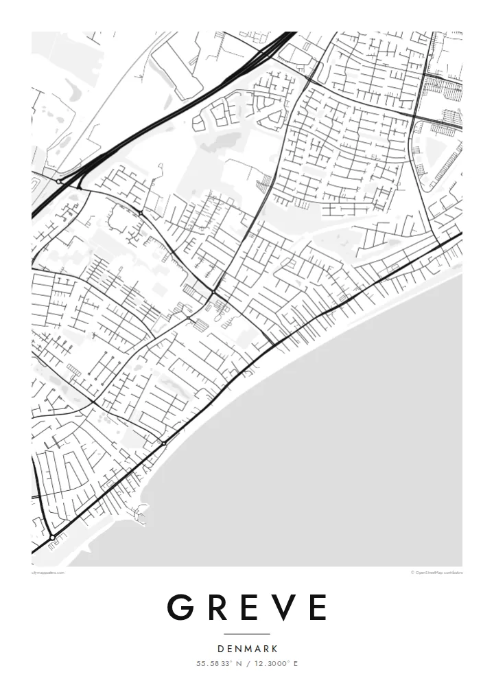
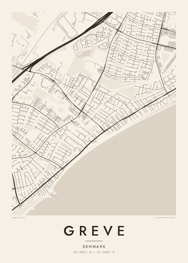
The eastern edge of the map is one long, gently curving coastline. The open water of Køge Bay takes up the side of the frame and gives the composition a calm, horizontal weight.
Մինիմալիստական քարտեզ-պաստառ · Դանիա
55.5833° N / 12.3000° E
A long, straight shoreline on Køge Bay, with a railway and a motorway running beside it and low suburban streets filling the land between



Մեկ քաղաք, հինգ տրամադրություն
Հպեք ոճին՝ պատին տեսնելու համար։ Բոլոր ոճերն արժեն նույնը՝ տպված, շրջանակված կամ որպես HD ֆայլեր։
 Իրական պիքսելներ · 24 × 36″ տպագրական ֆայլ
Տպագրական հստակություն
Սա իրական տպագրական ֆայլի 100% հատվածն է։ Յուրաքանչյուր պաստառ՝ տպված, շրջանակված կամ ներբեռնված, մեր սերվերներում մշակվում է 300 DPI որակով, մինչև 7,200 × 10,800 պիքսել, այնպես որ նույնիսկ ամենանուրբ գծերը մնում են հստակ 24 × 36″ տպագրության վրա։
Պատին


Քարտեզը
Seen from above, Greve is shaped by lines that run side by side. The coast of Køge Bay runs roughly north to south along its eastern edge. Just inland, a railway follows the same direction, and further west a motorway does too. Between these parallel strokes, the town fills in with residential streets, cul-de-sacs and small green pockets. The result is a pattern that is long and narrow and clearly tied to the water.
Much of Greve's shoreline is part of Køge Bugt Strandpark, a man-made beach park built along the bay in the late twentieth century. It brought sand, dunes and sheltered lagoons to a coast that had been flat and marshy. On the map, this shows up as a smooth outer edge of beach with a thin band of enclosed water behind it. It is one of the most distinctive shapes around Copenhagen's southern suburbs.
A Greve map poster shows how the town grew up as a coastal suburb of the capital. Denser pieces of street pattern gather around the stations. Older village cores sit a little further inland, and newer housing spreads in loops and branches between them. Printed in plain black and white, the drawing reads like a cross-section of Zealand's east coast, running from open water through beach and rail to farmland at the far edge.
The eastern edge of the map is one long, gently curving coastline. The open water of Køge Bay takes up the side of the frame and gives the composition a calm, horizontal weight.
Behind the reshaped beach, narrow lagoons and dunes form a second, inner line parallel to the sea. This double edge is easy to spot and sets Greve apart from neighbouring stretches of coast.
A suburban railway and a major motorway both run north to south through the municipality. They divide the town into long bands, with residential streets tucked between them and bridges or underpasses stitching the sides together.
Դարձրեք այն ձերը
Ավելացրեք ամսաթիվ, անուն կամ ձեր սեփական տողը, փոխեք ոճը, չափսը կամ դիրքը։
Անվճար նախադիտումն ունի ցածր որակ և ջրանիշ։ Տպագրություններն ու HD ֆայլերը մշակվում են 300 DPI որակով, մինչև 7,200 × 10,800 px, առանց ջրանիշի։
Ինչու՝ Greve
Greve is where many people have their first home outside Copenhagen, or their summer mornings on the beach. For them, this map is a quiet reminder of walks along the bay and train rides into the city. It also marks the part of the coast they still think of as theirs.
You can personalise the title, subtitle and coordinates line with a street name, a date or a family name. Then choose one of five styles: Classic black & white, Noir, Paper, Blueprint or Sand. Download the HD files for $9, or order a printed poster with an optional wooden frame.
Պատվիրել Greve պաստառը| Տպագրության չափս | Լուծաչափ | Ֆայլեր |
|---|---|---|
| 30 × 40 cm11.8 × 15.7″ | 3,543 × 4,724 px | PNG · PDF |
| 29.7 × 42 cm (A3)11.7 × 16.5″ | 3,508 × 4,961 px | PNG · PDF |
| 42 × 59.4 cm (A2)16.5 × 23.4″ | 4,961 × 7,016 px | PNG · PDF |
| 45.7 × 61 cm18 × 24″ | 5,400 × 7,200 px | PNG · PDF |
| 50 × 70 cm19.7 × 27.6″ | 5,906 × 8,268 px | PNG · PDF |
| 61 × 91.4 cm24 × 36″ | 7,200 × 10,800 px | PNG · PDF |
Համեմատության համար՝ անվճար նախադիտումը 900 px լայնությամբ է, ջրանիշով և նախատեսված է էկրանների համար։ HD ֆայլերն ունեն մինչև 8 անգամ ավելի բարձր լուծաչափ յուրաքանչյուր ուղղությամբ և մաքուր են տպվում պաստառի ամբողջ չափով։
Ընտրեք ոճը էջի վերևում, ապա ընտրեք Տպված պաստառ՝ չափս և, ցանկության դեպքում, շրջանակ, կամ Թվային HD ֆայլեր։ Վճարումը կատարվում է մեկ քայլով, և ձեր պատվերի էջը թարմացվում է հենց վճարումն ավարտվելուն պես։
Այն տպվում է պրեմիում 200 գ/մ² մատ թղթի վրա՝ վեց չափսերից մեկով, 30 × 40 սմ-ից մինչև 24 × 36″։ Տպված պաստառների գինը սկսվում է $39-ից՝ առաքումը ներառված է։
Այո։ Ընտրեք զանգվածեղեն փայտից շրջանակ՝ սև, սպիտակ, բնական կաղնի կամ մուգ փայտի գույնով։ Այն ունի հարվածակայուն ապակի և պատրաստ է կախման համար։ Շրջանակված պաստառների գինը սկսվում է $99-ից՝ առաքումը ներառված է։
Առաքումն ամբողջ աշխարհում անվճար է։ Յուրաքանչյուր պոստեր տպվում է մեր տպագրական գործընկերներից ամենամոտի մոտ՝ 30+ երկրներում, և սովորաբար հասնում է 3–7 աշխատանքային օրում։ Կարգավիճակն ու հետևման համարը կարող եք տեսնել «Իմ պատվերները» բաժնում։ Մի քանի երկրներ 2–5 շաբաթ են պահանջում, իսկ եթե դեռ չենք առաքում, կայքը դրա մասին կասի մինչև վճարելը։
Ուղարկեք մեզ լուսանկար առաքումից հետո 14 օրվա ընթացքում, և մենք անվճար կրկին կտպենք կամ գումարը կվերադարձնենք։
Այո։ Այս էջի խմբագրիչում փոխեք վերնագիրը, ենթավերնագիրը և կոորդինատների տողը ձեր ցանկությամբ, և ընտրեք ոճն ու չափսը։ Տպված, շրջանակված և թվային պատվերներն օգտագործում են ճիշտ ձեր դիզայնը։
$9-ով ստանում եք 300 DPI որակի PNG և տպագրության համար պատրաստ PDF ֆայլեր բոլոր վեց չափսերով, առանց ջրանիշի, ցանկացած վայրում տպելու համար։ Դեռ վստահ չե՞ք։ Նախ ներբեռնեք անվճար ջրանիշով նախադիտումը։
Մոտակայքում
