Galata Bridge
The lowest crossing near the mouth links Eminönü with Karaköy. It is the busiest point on the water, and its outline marks the entrance to the inlet.
ミニマルなマップポスター · トルコ
41.0412° N / 28.9551° E
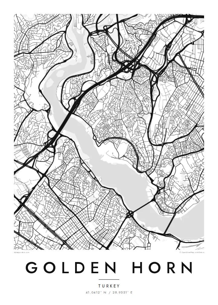
A long, curved estuary cutting into Istanbul's European side, crossed by bridges and lined on both banks with old quarters


ひとつの街、5つの表情
スタイルをタップすると、壁に飾ったイメージを確認できます。どのスタイルも料金は同じです — プリント、フレーム付き、HDファイルのいずれでも。
 実寸ピクセル・24 × 36″ 印刷ファイル
印刷でもくっきり
これは実際の印刷ファイルを100%の解像度で切り出したものです。プリント、フレーム付き、ダウンロードのいずれのポスターも、サーバー上で300 DPI・最大7,200 × 10,800ピクセルでレンダリングされるため、24 × 36″の印刷でも細かい道まで鮮明です。
部屋に飾ると


この地図について
The Golden Horn is a narrow inlet that curves north-west from the Bosphorus for several kilometres. It separates Istanbul's historic peninsula from Galata and Beyoğlu on the far shore. On a map, its shape explains the name: a slender, horn-like body of water, wide at the mouth and tapering inland, where two streams feed into it.
For centuries this was one of the finest natural harbours in the Mediterranean world. In Byzantine times, a great chain was stretched across its mouth to keep enemy fleets out. The shores were later lined with shipyards, warehouses and dense neighbourhoods such as Fener and Balat, whose streets still come right down to the water on the southern bank.
Today several bridges cross the inlet, from the Galata Bridge near the mouth to the Atatürk Bridge and the Haliç metro bridge further in. A Golden Horn map poster places water at the centre of the composition. The city presses in from both sides, and the bridges stitch the two halves together in a series of fine lines.
The lowest crossing near the mouth links Eminönü with Karaköy. It is the busiest point on the water, and its outline marks the entrance to the inlet.
The inlet bends gently as it narrows inland. This gives the map a long, sweeping body of water rather than the straight line of a river.
These historic neighbourhoods on the southern bank climb from the waterline in a tight mesh of streets. They show how closely the old city once lived with the harbour.
自分だけの一枚に
日付や名前、好きな言葉を入れたり、スタイル・サイズ・向きを変えたりできます。
無料プレビューは低解像度で透かし入りです。プリントとHDファイルは300 DPI・最大7,200 × 10,800pxでレンダリングされ、透かしはありません。
Golden Hornを選ぶ理由
Anyone who has crossed the Galata Bridge at dusk or taken a ferry up the inlet knows how much of Istanbul is defined by water. This map puts the Golden Horn at the centre, just as the city does.
You can change the title, subtitle and coordinates line to mark a trip, a move or a family story. Pick one of five styles. Blueprint emphasises the water as a clean field, while Noir makes the shorelines glow against a dark ground.
Golden Hornのポスターを注文する| 印刷サイズ | 解像度 | ファイル |
|---|---|---|
| 30 × 40 cm11.8 × 15.7″ | 3,543 × 4,724 px | PNG · PDF |
| 29.7 × 42 cm (A3)11.7 × 16.5″ | 3,508 × 4,961 px | PNG · PDF |
| 42 × 59.4 cm (A2)16.5 × 23.4″ | 4,961 × 7,016 px | PNG · PDF |
| 45.7 × 61 cm18 × 24″ | 5,400 × 7,200 px | PNG · PDF |
| 50 × 70 cm19.7 × 27.6″ | 5,906 × 8,268 px | PNG · PDF |
| 61 × 91.4 cm24 × 36″ | 7,200 × 10,800 px | PNG · PDF |
比較すると、無料プレビューは幅900 pxで透かし入り、画面表示用です。HDデータは縦横それぞれ最大8倍の解像度で、ポスターサイズでもきれいに印刷できます。
ページ上部でスタイルを選び、プリントポスター(サイズとお好みでフレーム)またはデジタルHDファイルをお選びください。お会計は1ステップで完了し、お支払いが確認され次第、注文ページが更新されます。
高級200gsmマット紙に印刷され、30 × 40cmから24 × 36″まで6種類のサイズからお選びいただけます。プリントポスターは送料込みで$39からとなります。
はい。ブラック、ホワイト、ナチュラルオーク、ダークウッドの無垢材フレームからお選びいただけます。割れにくい素材のガラスパネル付きで、届いたらすぐに飾れます。フレーム付きポスターは送料込みで$99からとなります。
60か国以上へ送料無料でお届けします。ポスターは、30か国以上にある提携プリントパートナーのうち最寄りの拠点で印刷され、通常は3〜7営業日で届きます。配送状況と追跡情報は「ご注文履歴」からご確認いただけます。一部の国では2〜5週間かかります。まだ配送に対応していない国の場合は、お支払い前にサイト上でお知らせします。
お届けから14日以内に写真をお送りいただければ、無料で再印刷または返金いたします。
はい。このページのエディターでタイトル、サブタイトル、座標の行をお好きに変更し、スタイルとサイズをお選びください。プリント、フレーム付き、デジタルのいずれの注文にも、そのままお客様のデザインが使用されます。
$9で、6種類全サイズの300 DPI PNGと印刷用PDFファイルを、透かしなしでお届けします。どこでも印刷可能です。迷っている場合は、まず無料の透かし入りプレビューをダウンロードしてお試しください。
