Citadel hill
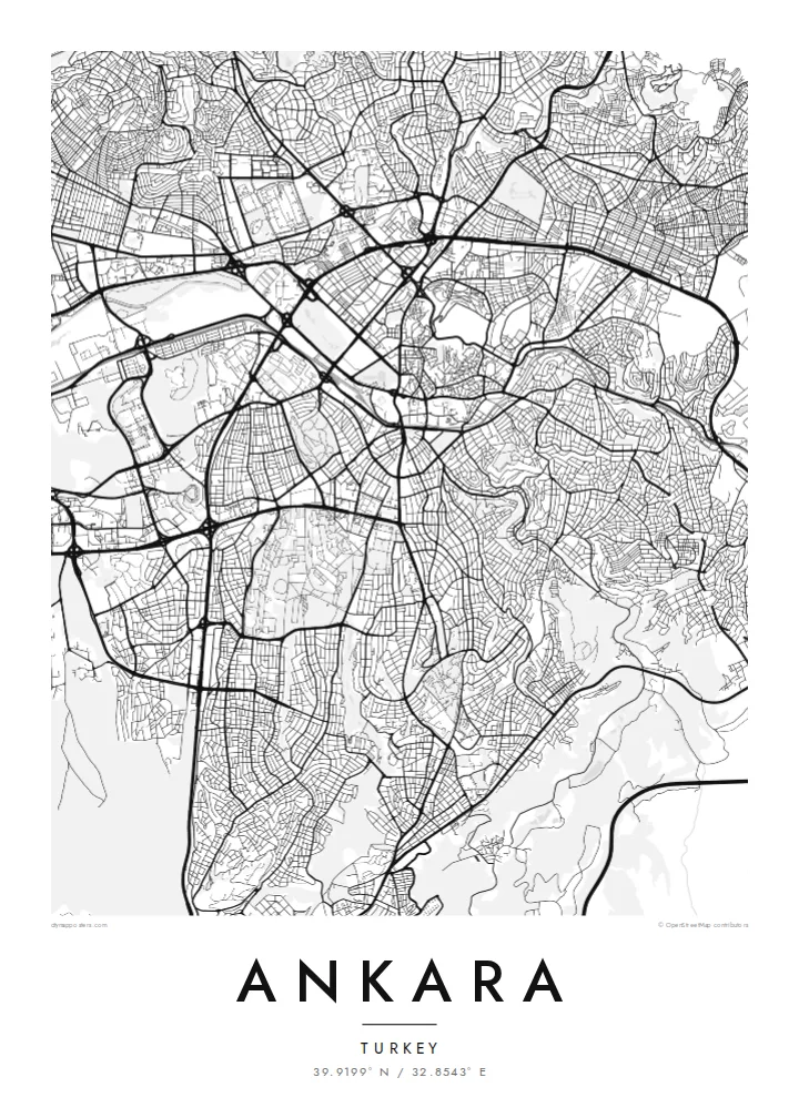
The walled citadel rises above Ulus, north-east of the centre. Its irregular ring of fortifications and tight inner lanes form the densest and oldest street pattern in the city.
Минималистік карта постері · Түркия
39.9199° N / 32.8543° E
A plateau capital spreading from a citadel hill, cut through by a long boulevard running south toward the ministries and Çankaya.

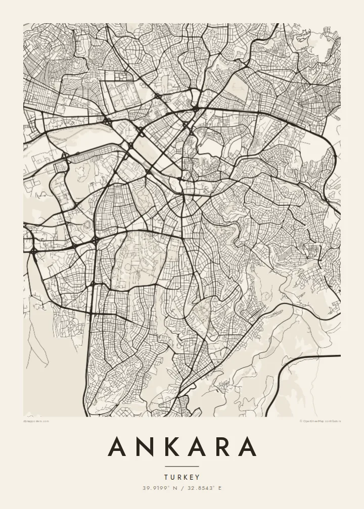


Бір қала, бес көңіл-күй
Стильді басып, оны қабырғада қалай көрінетінін көріңіз. Барлық стильдің бағасы бірдей — басып шығарылған, жақтауланған немесе HD файл түрінде.
 Нақты пиксельдер · 24 × 36″ баспа файлы
Баспада айқын
Бұл нақты баспа файлының 100% кесіндісі. Әрбір постер — басып шығарылған, жақтауланған немесе жүктелген — біздің серверлерде 300 DPI ажыратымдылықпен, 7,200 × 10,800 пикселге дейін өңделеді, сондықтан 24 × 36″ баспада ең кішкентай көшелер де анық көрінеді.
Қабырғада


Карта
Ankara sits on the Anatolian plateau at more than 900 metres, and from above its oldest layer is easy to find: the citadel on its rocky hill north-east of the centre, wrapped in a tight knot of lanes that ignore any grid. Everything newer radiates away from that point. Over the twentieth century the city was pushed outward as a small provincial town became the seat of a republic.
Ankara became the capital in 1923, and the plan drawn up for it in the late 1920s by the German planner Hermann Jansen still shows in the map. Atatürk Boulevard runs as a long spine from Ulus through Kızılay to the government quarter. Gençlik Park is pressed against the old centre, and Anıtkabir, Atatürk's mausoleum, occupies its own hill to the west within a broad ceremonial park.
Further out, the city loses its early order and breaks into large residential districts, ring roads and campuses. The wooded grounds of the Middle East Technical University form one of the largest green shapes on the south-western edge, with the lakes of Eymir and Mogan beyond them. An Ankara map poster captures both the deliberately planned capital and the much larger city that grew around it.
The walled citadel rises above Ulus, north-east of the centre. Its irregular ring of fortifications and tight inner lanes form the densest and oldest street pattern in the city.
A straight north–south axis linking Ulus, Kızılay and Çankaya. On the map it reads as the city's backbone, with ministries, parks and embassies lined up along it.
Atatürk's mausoleum stands on a hilltop west of Kızılay, surrounded by a broad area of green and ceremonial ground that stands out clearly against the housing blocks around it.
Өзіңізге бейімдеңіз
Күнді, есімді не өз жолыңызды қосыңыз, стильді, өлшемді не бағдарды ауыстырыңыз.
Тегін алдын ала қарау төмен ажыратымдылықта және су таңбамен беріледі. Баспалар мен HD файлдар 300 DPI ажыратымдылықпен, 7,200 × 10,800 px-ке дейін, су таңбасыз өңделеді.
Неге Ankara
Ankara tends to be personal for the people who hang it: students who spent years at one of its universities, diplomats posted to Çankaya, families who moved to the capital for work. The map holds the route from the citadel down the boulevard, a walk most of them made many times.
You can change the title and subtitle, add a date that matters and adjust the coordinates line. Choose Classic black & white, Noir, Paper, Blueprint or Sand, then download the $9 HD files to print at home, or order a matte print.
Ankara постерін тапсырыс беру| Басу өлшемі | Ажыратымдылық | Файлдар |
|---|---|---|
| 30 × 40 cm (11.8 × 15.7″) | 3,543 × 4,724 px | PNG · PDF |
| 29.7 × 42 cm (A3, 11.7 × 16.5″) | 3,508 × 4,961 px | PNG · PDF |
| 42 × 59.4 cm (A2, 16.5 × 23.4″) | 4,961 × 7,016 px | PNG · PDF |
| 45.7 × 61 cm (18 × 24″) | 5,400 × 7,200 px | PNG · PDF |
| 50 × 70 cm (19.7 × 27.6″) | 5,906 × 8,268 px | PNG · PDF |
| 61 × 91.4 cm (24 × 36″) | 7,200 × 10,800 px | PNG · PDF |
Салыстыру үшін: тегін нұсқаның ені 900 px, су белгісі бар және экранға арналған. HD файлдардың ажыратымдылығы әр бағытта 8 есеге дейін жоғары және толық постер өлшемінде таза басылады.
Беттің жоғарғы жағынан стильді таңдаңыз, содан кейін Басып шығарылған постерді — өлшемі мен қаласаңыз жақтауын — немесе Цифрлық HD файлдарды таңдаңыз. Төлем бір қадамда жасалады, ал тапсырыс беті төлем өткен бойда жаңарады.
Ол премиум сапалы 200 gsm матталы қағазға алты өлшемнің бірінде — 30 × 40 см-ден 24 × 36″-ке дейін — басып шығарылады. Басып шығарылған постерлердің бағасы $39-дан басталады, жеткізу құны кіреді.
Иә. Қара, ақ, табиғи емен немесе қою түсті ағаштан жасалған қатты жақтауды таңдаңыз. Ол сынбайтын шыныммен келеді және ілуге дайын. Жақтаулы постерлердің бағасы $99-дан басталады, жеткізу құны кіреді.
Жеткізу бүкіл әлем бойынша тегін. Әр постерді 30+ елдегі баспа серіктестерімізден ең жақыны басып шығарады, әдетте 3–7 жұмыс күнінде жетеді. Мәртебесі мен трекингті «Тапсырыстарым» бөлімінен қадағалай аласыз. Кейбір елдерге 2–5 апта кетеді, ал әзірге жеткізбейтін жерлер туралы сайт төлемге дейін хабарлайды.
Жеткізілген күннен бастап 14 күн ішінде бізге фотосурет жіберіңіз, біз оны тегін қайта басып шығарамыз немесе ақшаңызды қайтарамыз.
Иә. Осы беттегі редакторда тақырыпты, тақырыпшаны және координаталар жолын қалауыңызша өзгертіп, стиль мен өлшемді таңдаңыз. Басып шығарылған, жақтаулы және цифрлық тапсырыстардың барлығы дәл сіздің дизайныңызды қолданады.
$9 үшін сіз барлық алты өлшемде 300 DPI PNG және баспаға дайын PDF файлдарын су таңбасыз аласыз, оларды кез келген жерде басып шығаруға болады. Әлі шешім қабылдай алмай тұрсыз ба? Алдымен тегін, су таңбасы бар алдын ала қарауды жүктеп алыңыз.
Жақын маңда
