Cliff-bound coastline
The shoreline is mostly steep rock, with only a few inlets where boats can approach. On the poster the edge of the island appears sharp and irregular, giving the landmass a clear, almost sculpted outline.
Минималистік карта постері · Грекия
35.8644° N / 23.2989° E
A small, steep-sided island between Kythera and Crete, its rocky outline broken by a few coves and a single harbour.


Бір қала, бес көңіл-күй
Стильді басып, оны қабырғада қалай көрінетінін көріңіз. Барлық стильдің бағасы бірдей — басып шығарылған, жақтауланған немесе HD файл түрінде.
 Нақты пиксельдер · 24 × 36″ баспа файлы
Баспада айқын
Бұл нақты баспа файлының 100% кесіндісі. Әрбір постер — басып шығарылған, жақтауланған немесе жүктелген — біздің серверлерде 300 DPI ажыратымдылықпен, 7,200 × 10,800 пикселге дейін өңделеді, сондықтан 24 × 36″ баспада ең кішкентай көшелер де анық көрінеді.
Қабырғада


Карта
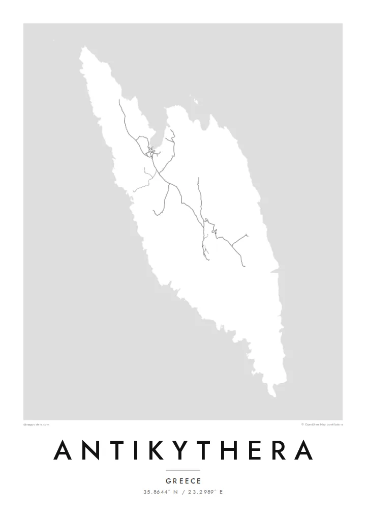
Antikythera sits alone in the strait between Kythera and Crete, a compact wedge of limestone with very little flat ground. From above, the island reads as a rough, elongated shape fringed by cliffs, with a handful of tracks threading between a small harbour settlement and scattered hamlets. The sea takes up most of the frame, and the land becomes a single pale form surrounded by open water.
The island is known worldwide for what was found just offshore. At the start of the twentieth century, sponge divers came across an ancient shipwreck here, and among its cargo was the Antikythera mechanism, a geared bronze device often described as the oldest known analogue computer. The object is now kept in the National Archaeological Museum in Athens, but its name will always point back to this coastline.
An Antikythera map poster is an exercise in restraint. There is no dense grid to fill the paper, only a coastline, a thin network of roads and the contour of the island against a wide field of white or black. The result is quiet and graphic, a shape that people who know the island tend to recognise at once, and that others find simply striking.
The shoreline is mostly steep rock, with only a few inlets where boats can approach. On the poster the edge of the island appears sharp and irregular, giving the landmass a clear, almost sculpted outline.
A small sheltered cove on the northern side serves as the island's port and its link to the ferries. It is where the few roads converge, which makes it the natural focal point of the map.
The waters off the island hold the wreck that yielded the famous mechanism. Nothing marks the spot on a street map, yet the empty sea around the coast carries that story for anyone who knows it.
Өзіңізге бейімдеңіз
Күнді, есімді не өз жолыңызды қосыңыз, стильді, өлшемді не бағдарды ауыстырыңыз.
Тегін алдын ала қарау төмен ажыратымдылықта және су таңбамен беріледі. Баспалар мен HD файлдар 300 DPI ажыратымдылықпен, 7,200 × 10,800 px-ке дейін, су таңбасыз өңделеді.
Неге Antikythera
Antikythera appeals to people who care about the history of science, to divers and sailors, and to anyone who has made the long ferry crossing to reach it. The poster is less about streets than about one island standing alone in open sea, a small object with an outsized story.
You can add your own title and subtitle, such as the date of a visit or a line about the mechanism, and adjust the coordinates line. Choose from Classic black & white, Noir, Paper, Blueprint or Sand; Blueprint suits the scientific theme particularly well. Download HD files for $9 or order a printed poster.
Antikythera постерін тапсырыс беру| Басу өлшемі | Ажыратымдылық | Файлдар |
|---|---|---|
| 30 × 40 cm11.8 × 15.7″ | 3,543 × 4,724 px | PNG · PDF |
| 29.7 × 42 cm (A3)11.7 × 16.5″ | 3,508 × 4,961 px | PNG · PDF |
| 42 × 59.4 cm (A2)16.5 × 23.4″ | 4,961 × 7,016 px | PNG · PDF |
| 45.7 × 61 cm18 × 24″ | 5,400 × 7,200 px | PNG · PDF |
| 50 × 70 cm19.7 × 27.6″ | 5,906 × 8,268 px | PNG · PDF |
| 61 × 91.4 cm24 × 36″ | 7,200 × 10,800 px | PNG · PDF |
Салыстыру үшін: тегін нұсқаның ені 900 px, су белгісі бар және экранға арналған. HD файлдардың ажыратымдылығы әр бағытта 8 есеге дейін жоғары және толық постер өлшемінде таза басылады.
Беттің жоғарғы жағынан стильді таңдаңыз, содан кейін Басып шығарылған постерді — өлшемі мен қаласаңыз жақтауын — немесе Цифрлық HD файлдарды таңдаңыз. Төлем бір қадамда жасалады, ал тапсырыс беті төлем өткен бойда жаңарады.
Ол премиум сапалы 200 gsm матталы қағазға алты өлшемнің бірінде — 30 × 40 см-ден 24 × 36″-ке дейін — басып шығарылады. Басып шығарылған постерлердің бағасы $39-дан басталады, жеткізу құны кіреді.
Иә. Қара, ақ, табиғи емен немесе қою түсті ағаштан жасалған қатты жақтауды таңдаңыз. Ол сынбайтын шыныммен келеді және ілуге дайын. Жақтаулы постерлердің бағасы $99-дан басталады, жеткізу құны кіреді.
60+ елге жеткізу тегін. Әр постер 30+ елдегі баспа серіктестеріміздің ең жақынында басылып, әдетте 3–7 жұмыс күнінде жетеді. Күйі мен трекингті «Менің тапсырыстарым» бөлімінен қадағалай аласыз. Кейбір елдерге 2–5 апта кетеді, ал әзірге жеткізбейтін жерлер туралы сайт төлем алдында хабарлайды.
Жеткізілген күннен бастап 14 күн ішінде бізге фотосурет жіберіңіз, біз оны тегін қайта басып шығарамыз немесе ақшаңызды қайтарамыз.
Иә. Осы беттегі редакторда тақырыпты, тақырыпшаны және координаталар жолын қалауыңызша өзгертіп, стиль мен өлшемді таңдаңыз. Басып шығарылған, жақтаулы және цифрлық тапсырыстардың барлығы дәл сіздің дизайныңызды қолданады.
$9 үшін сіз барлық алты өлшемде 300 DPI PNG және баспаға дайын PDF файлдарын су таңбасыз аласыз, оларды кез келген жерде басып шығаруға болады. Әлі шешім қабылдай алмай тұрсыз ба? Алдымен тегін, су таңбасы бар алдын ала қарауды жүктеп алыңыз.
Жақын маңда
